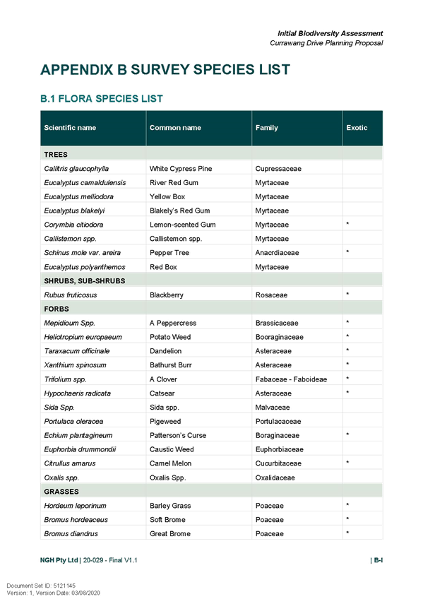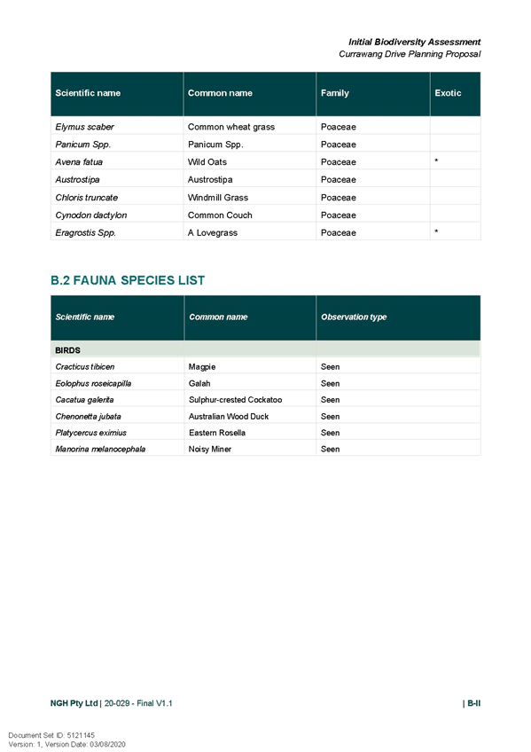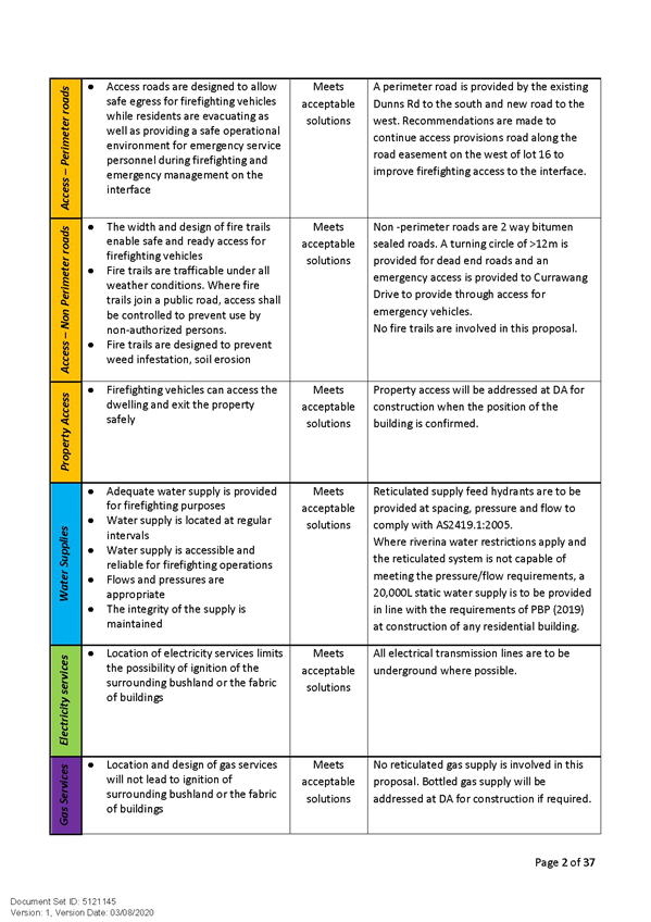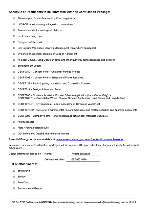
Attachments Provided Under Separate Cover
Ordinary Meeting of Council
11 October 2021
RP-1 - PLANNING PROPOSAL (LEP20/0006) TO AMEND WAGGA WAGGA LOCAL ENVIRONMENTAL PLAN 2010 LAND ZONING AND MINIMUM LOT SIZE FOR LAND LOCATED IN SPRINGVALE
(1) LEP20/0006 - Addendum and Planning Proposal......................................................... 2
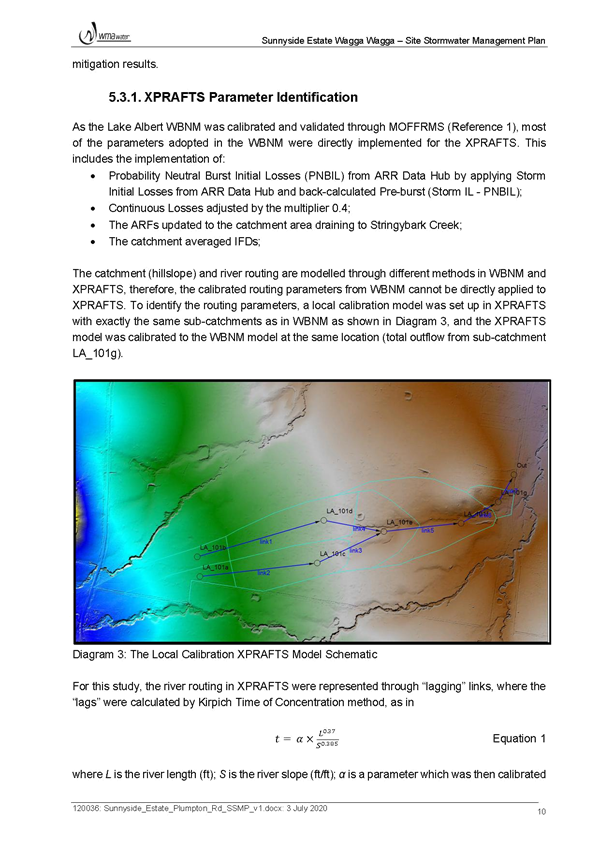
(2) LEP20/0006 - Minutes and Report - 22 March 2021................................................. 221
(3) LEP20/0006 - Gateway Determination....................................................................... 232
(4) LEP20/0006 - Submissions........................................................................................ 234
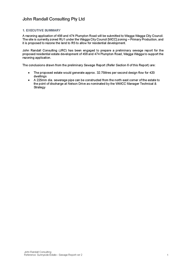
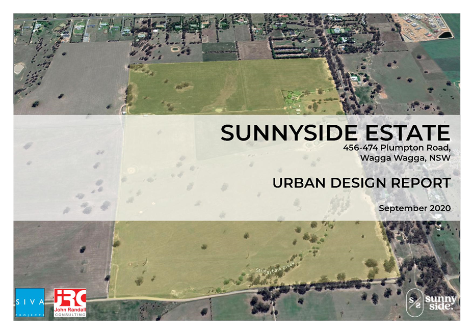
RP-2 - Planning Proposal (LEP21/0001) 456 and 474 Plumpton Road, Rowan - Amendment to land zoning, minimum lot size and urban release area provisions of the Wagga Wagga Local Environmental Plan 2010
(1) LEP21/0001 - Planning Proposal............................................................................... 249
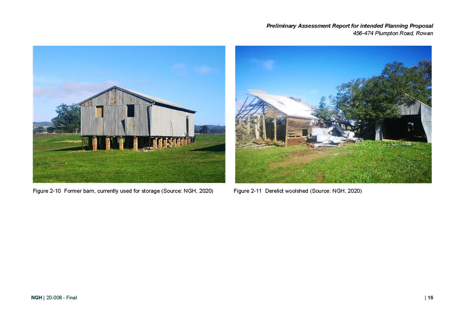
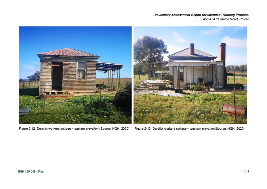
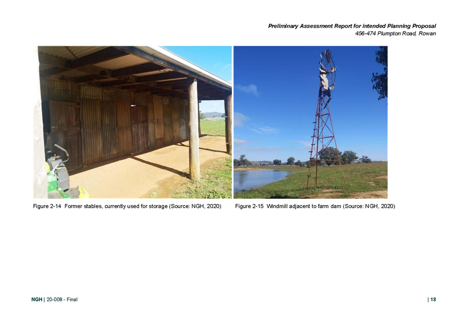
(2) LEP21/0001 - Assessment Report............................................................................. 779
(3) LEP21/0001 - Urban Design Report........................................................................... 792
(4) LEP21/0001 - Preliminary Assessment Report for Intended Planning Proposal...... 862
(5) LEP21/0001 - Stormwater Report.............................................................................. 928
(6) LEP21/0001 - Sewage Report.................................................................................... 984
(7) LEP21/0001 - Traffic Report....................................................................................... 998
(8) LEP21/0001 - Precinct Water Supply Considerations............................................. 1025
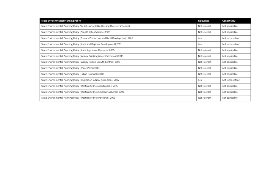
(9) LEP21/0001 - State Environmental Planning Policies............................................. 1033
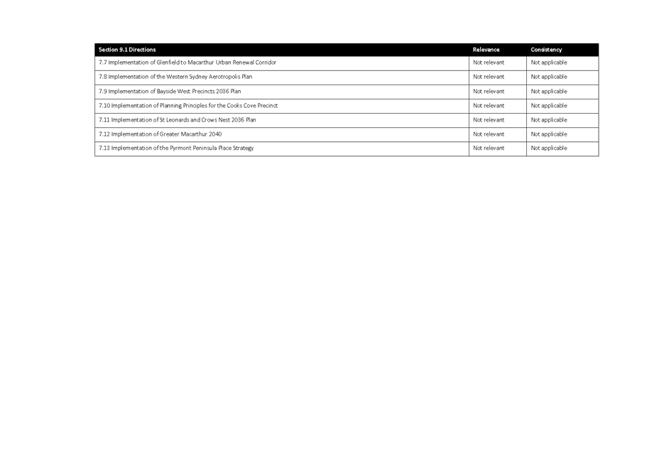
(10) LEP21/0001 - Section 9.1 Directions....................................................................... 1036
(11) LEP21/0001 - Update letter and draft BDAR........................................................... 1040
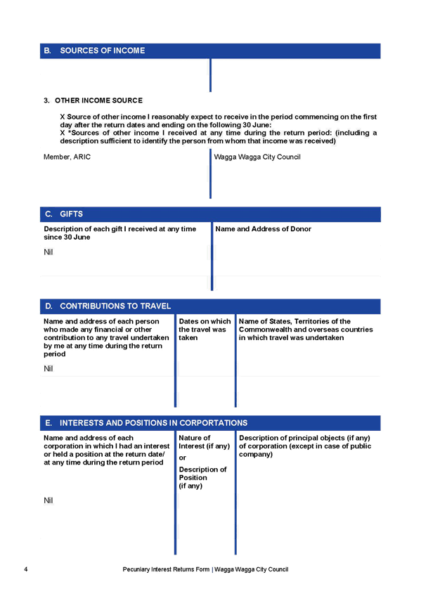
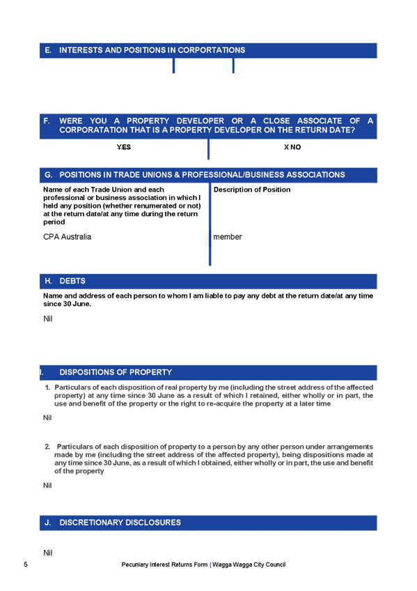
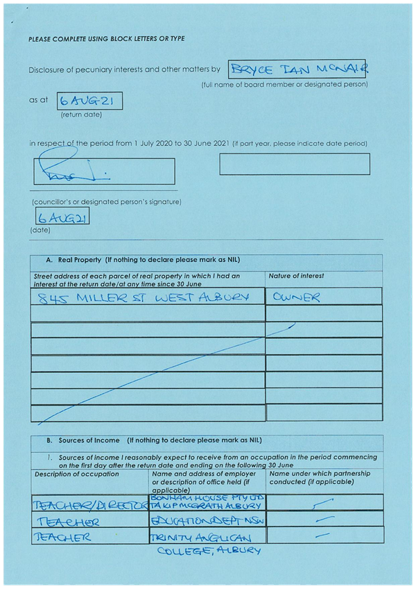
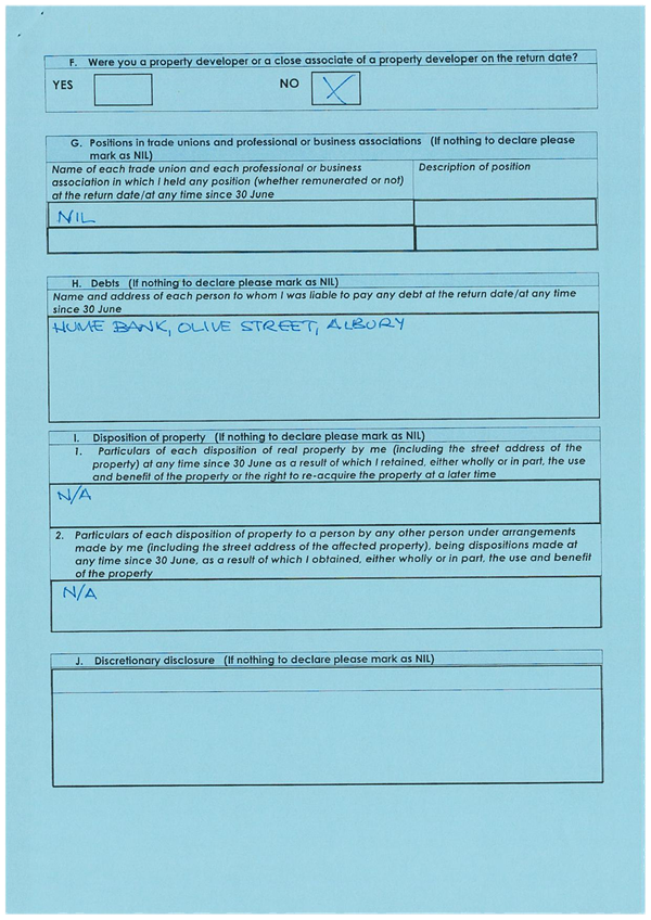
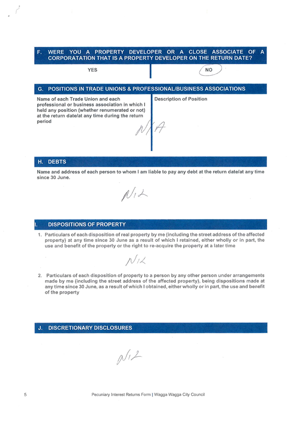
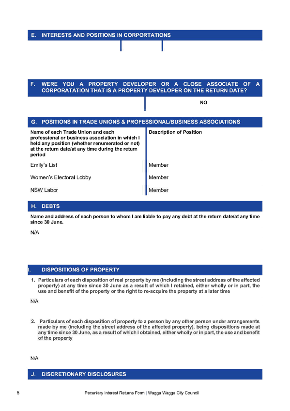
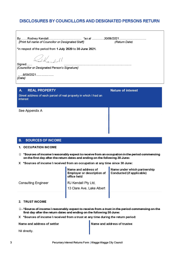
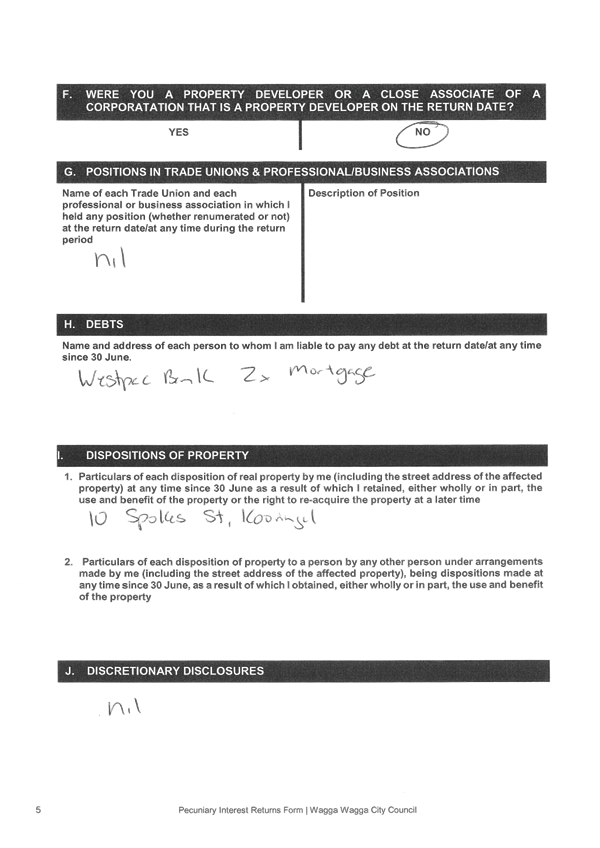
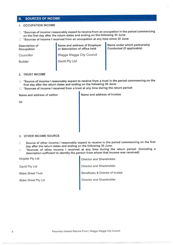
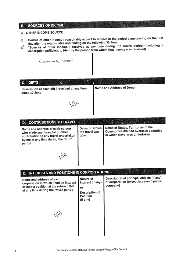
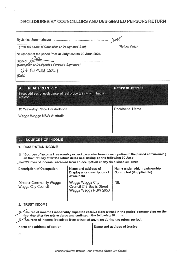
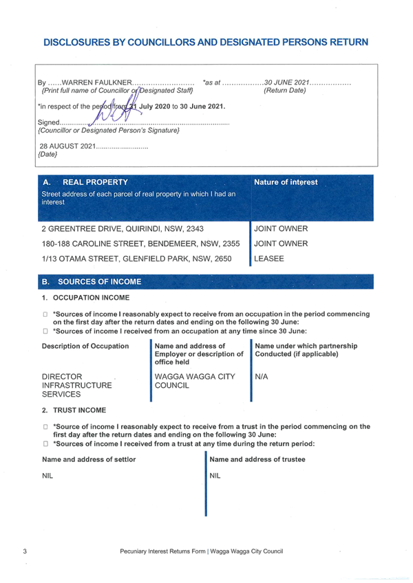
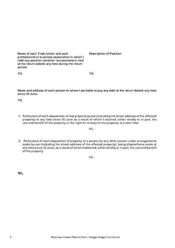
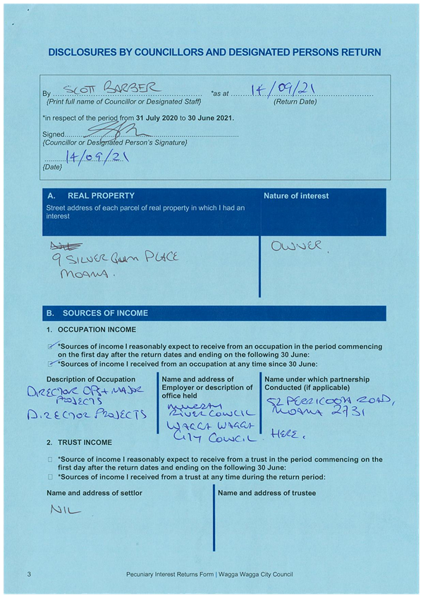
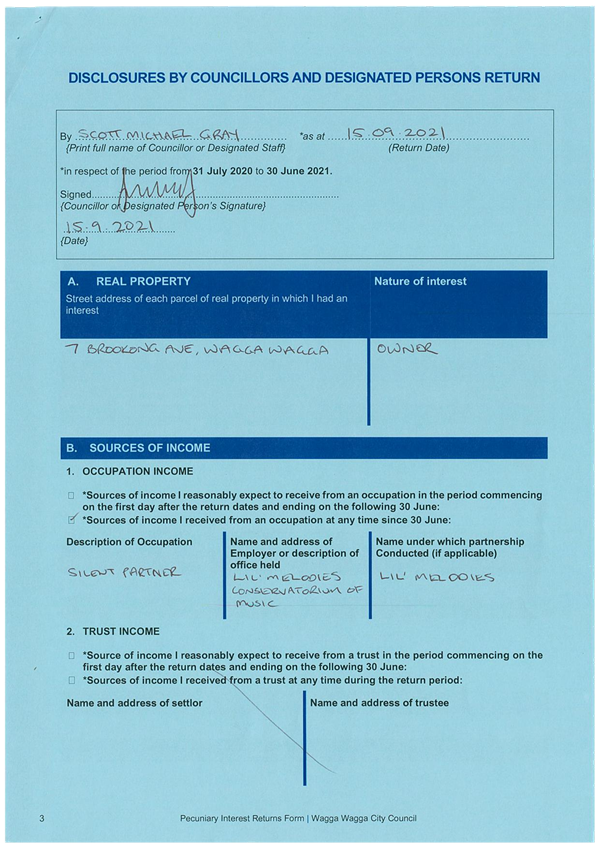
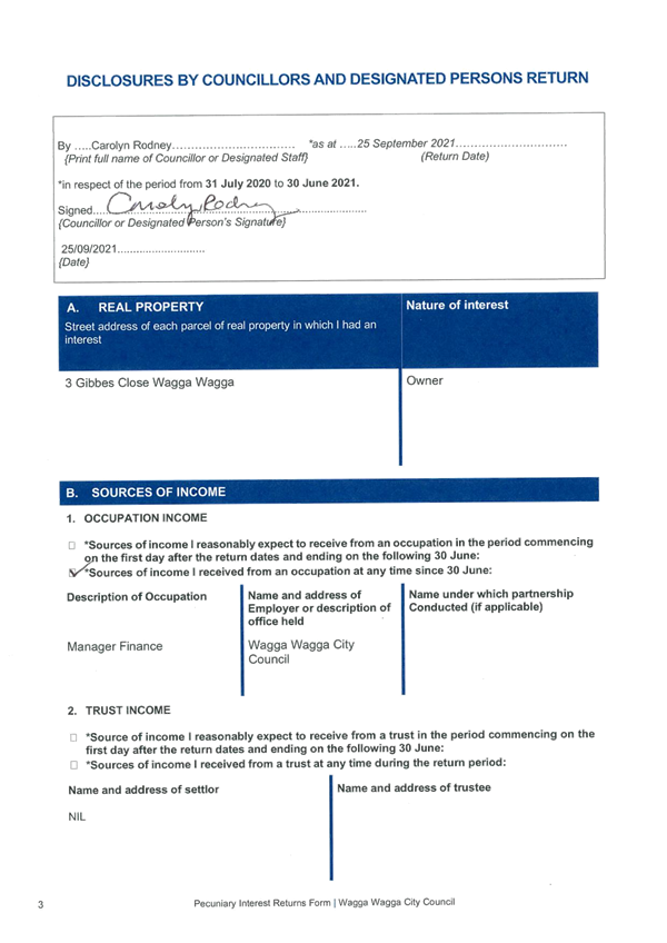
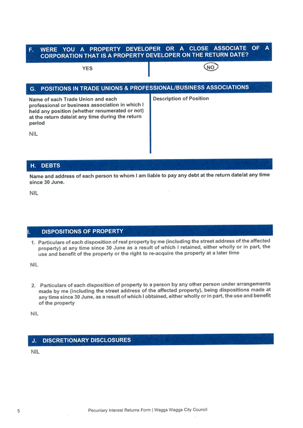
RP-7 - DISCLOSURE OF PECUNIARY INTEREST RETURNS - COUNCILLORS AND DESIGNATED STAFF 2021
(1) Pecuniary Interest Returns 2021 - Committee Members......................................... 1175
(2) Pecuniary Interest Returns 2021 - Councillors......................................................... 1210
(3) Pecuniary Interest Returns 2021 - Designated Persons.......................................... 1254
Attachments
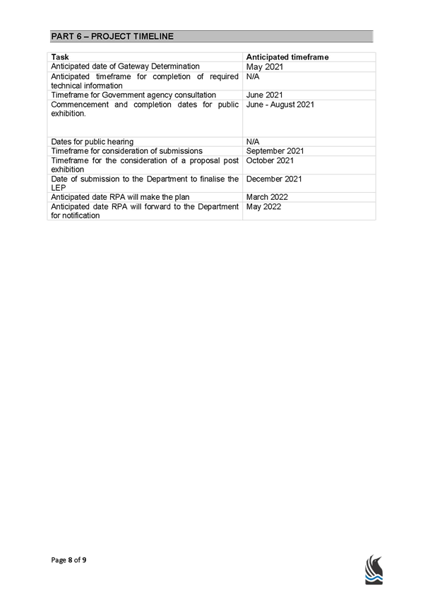
APPLICATION DETAILS
|
Application No: |
LEP21/0001 |
|
Applicant: |
Sunnyside Ventures Pty Ltd |
|
Proposal Summary: |
Land Zoning: Rezoning from RU1 Primary Production to part R5 Large Lot Residential and part RE1 Public Recreation Minimum Lot Size: Reduce minimum lot size from 200 hectares to 1,000m² for land proposed to be zoned R5 Large Lot Residential. Urban Release Area: Introduce Urban Release Area provisions. |
|
Assessment Officer: |
Crystal Atkinson, Senior Strategic Planner |
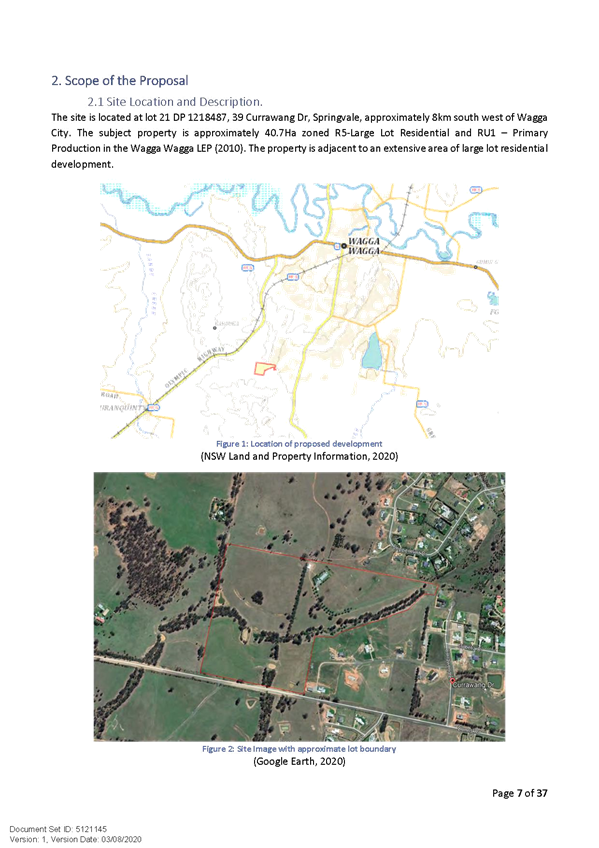
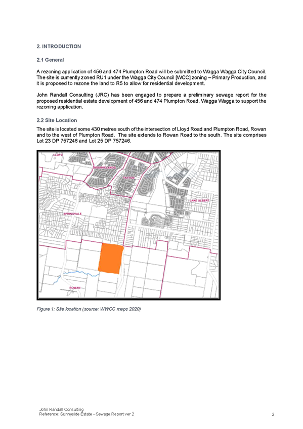
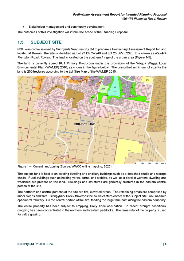
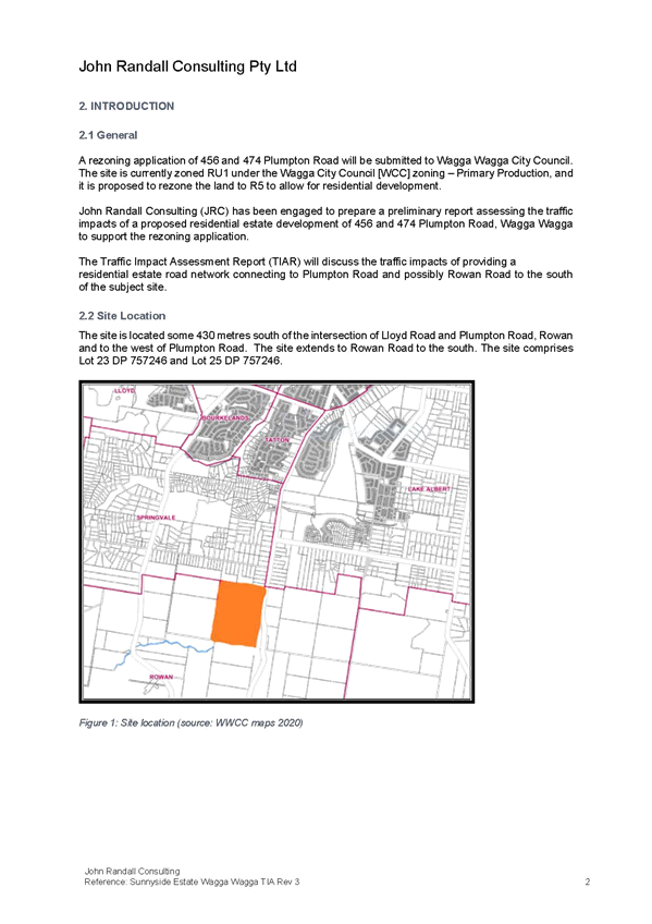
SITE AND LOCATION
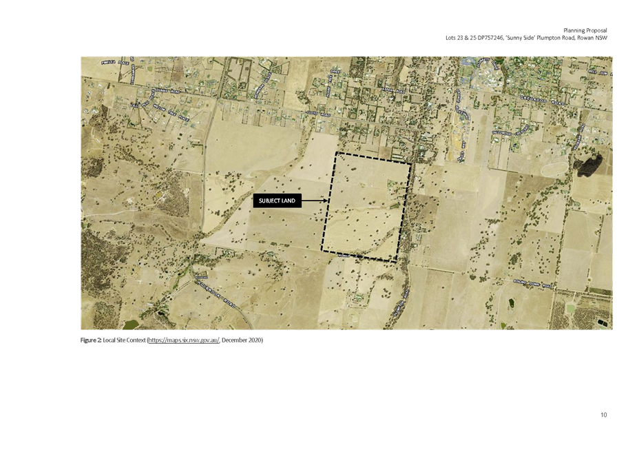
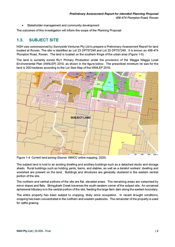
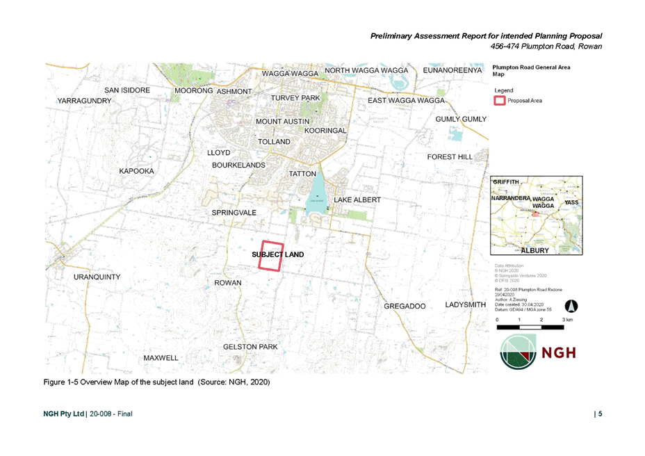
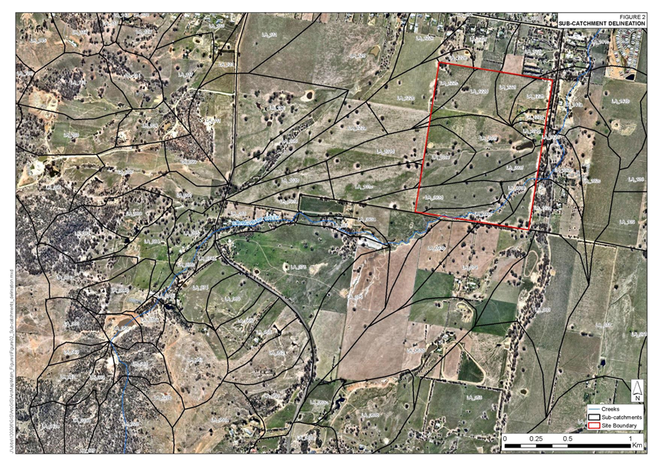
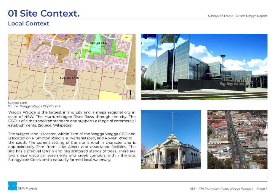
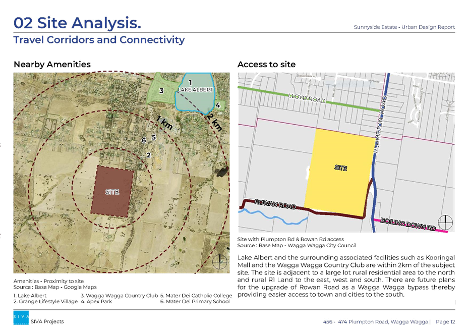
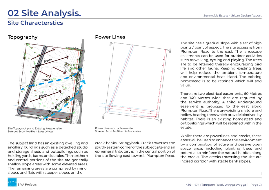
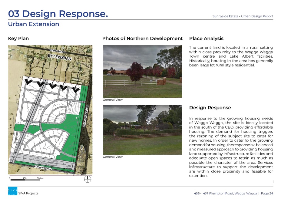
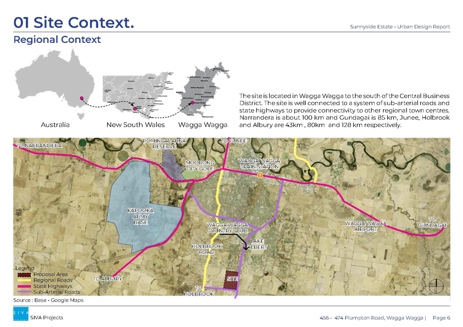
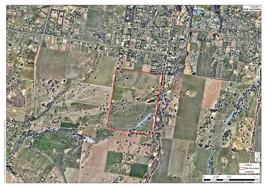
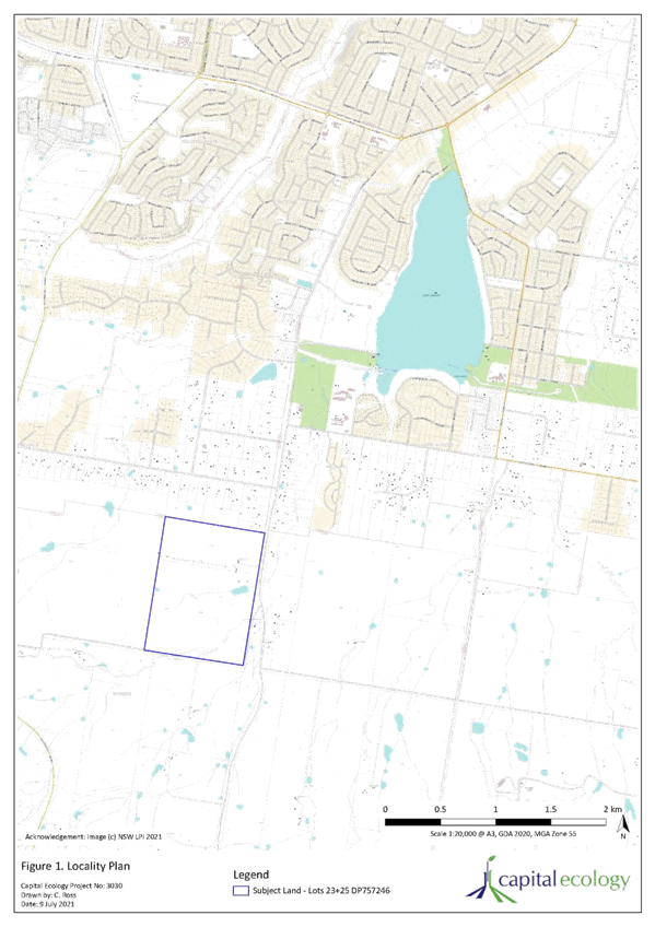
The site is located within the rural area of Rowan, south of the Wagga Wagga CBD. The site is immediately south of the existing large lot residential area located on Lloyd Road, Rowan.
The site has an area of approximately 110 hectares, with frontage to Plumpton Road in the east and Rowan Road in the south.
There is an existing dwelling house and associated sheds within the south-eastern corner of Lot 25, located approximately 200m from Plumpton Road.
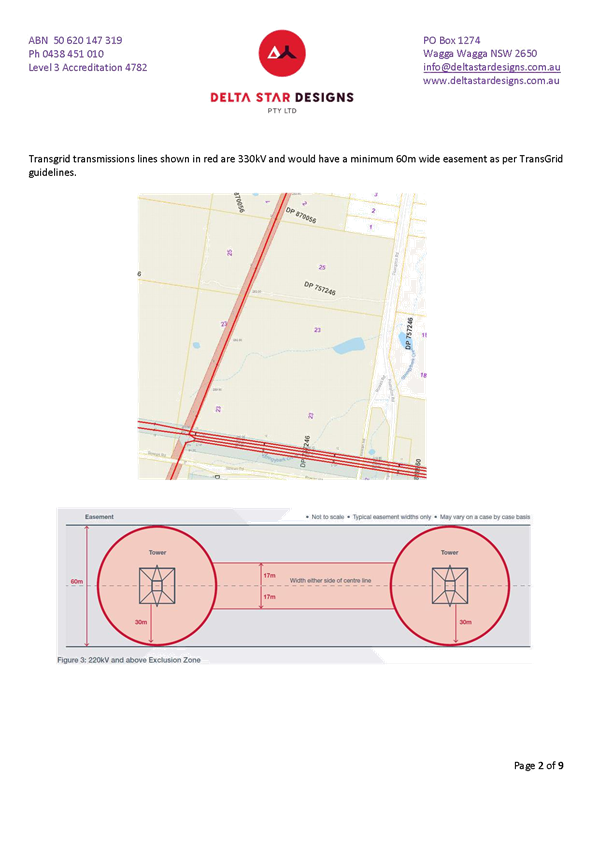
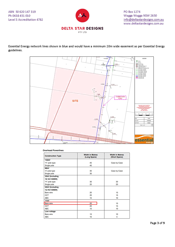
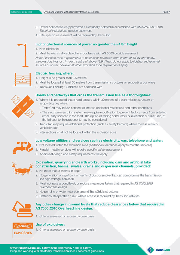
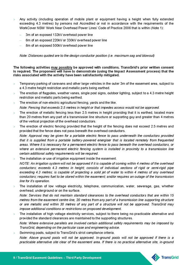
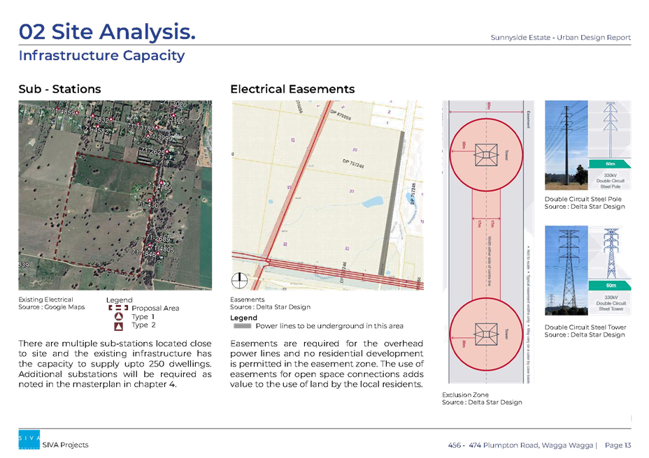
Three easements traverse the site accommodating the following infrastructure:
§ 60m wide overhead telecommunications line extending from the south-west corner of the site in a northerly direction, traversing the two lots.
§ 140m overhead telecommunications line extending in an east-west direction, approximately 50m from the southern boundary.
|
Subject Land: |
456 & 474 Plumpton Road, Rowan NSW 2650 |
|
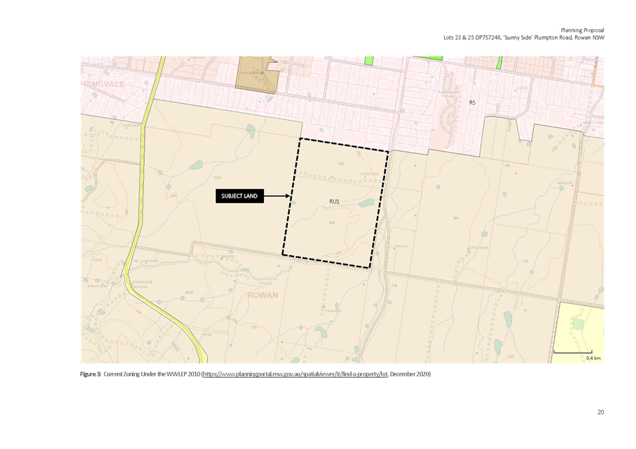
Current LEP Provisions: |
Land Zoning: RU1 Primary Production Minimum lot size: 200 hectares |
|
Current DCP Provisions |
Rural provisions |
|
Existing Character: |
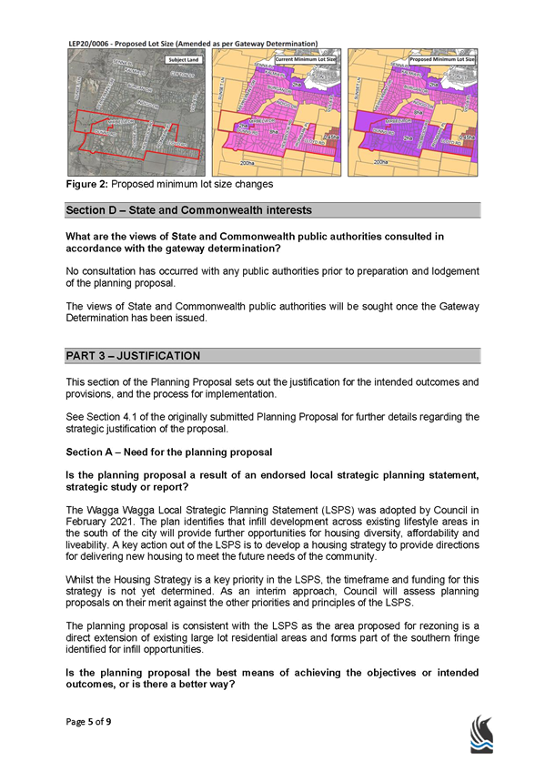
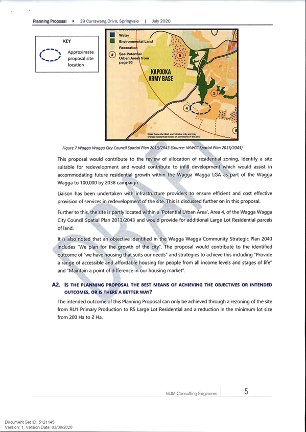
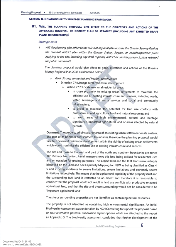
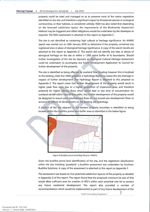
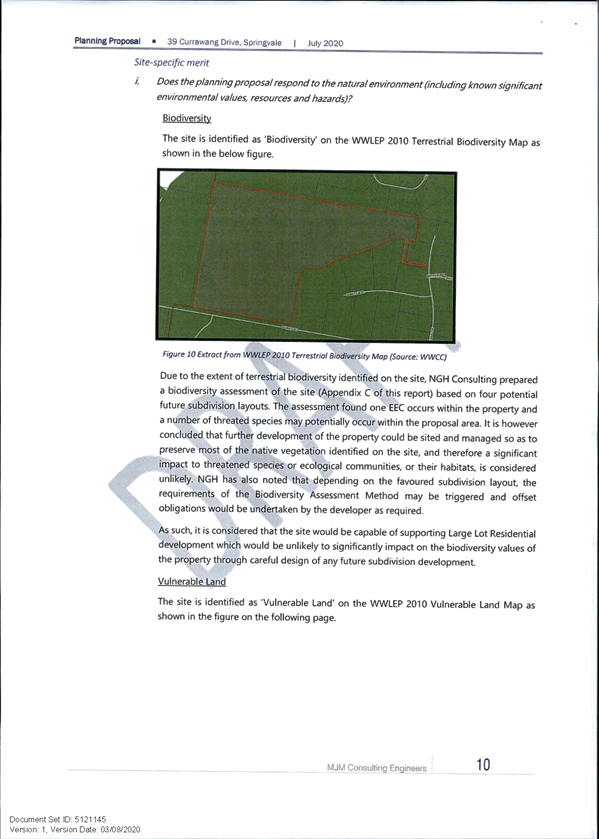
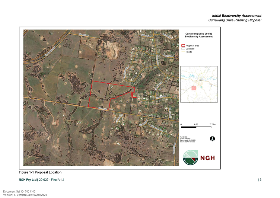
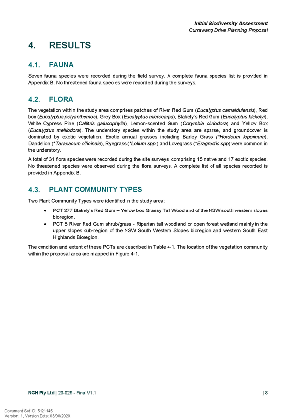
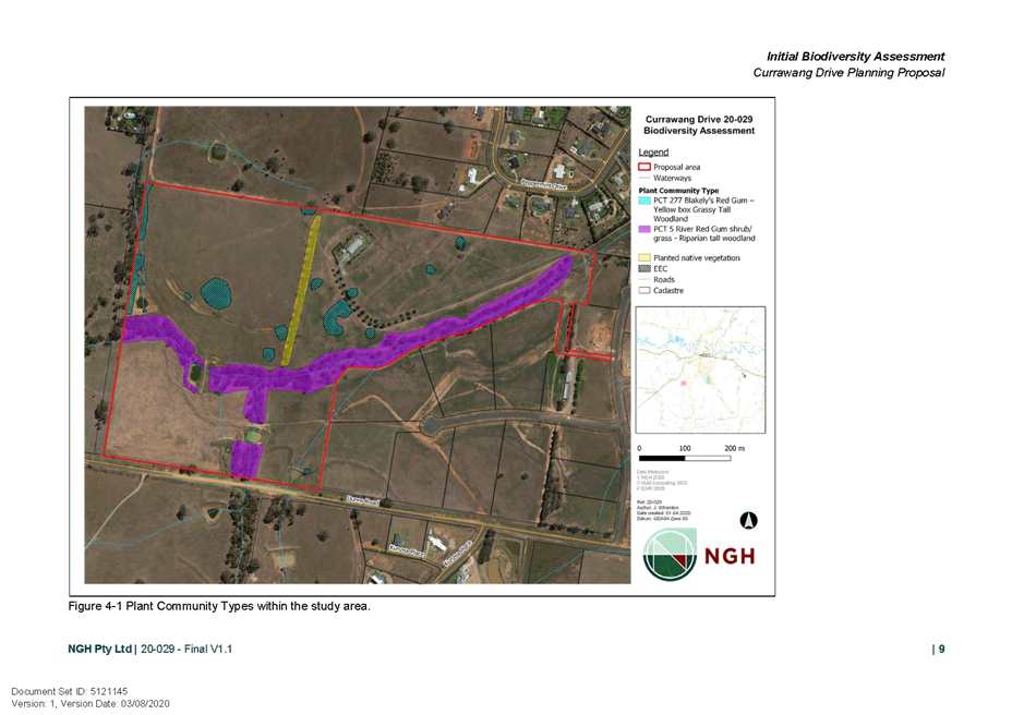
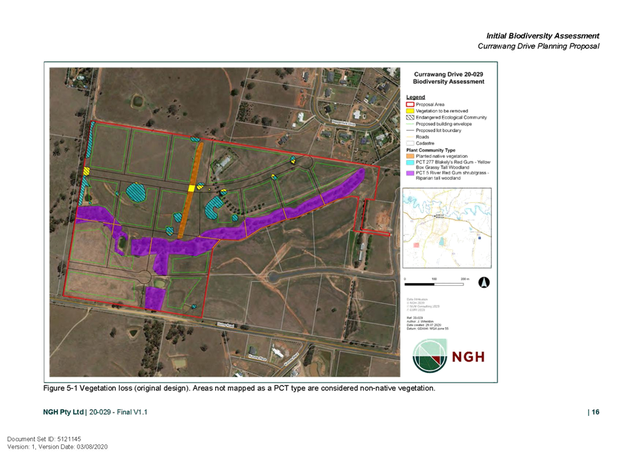
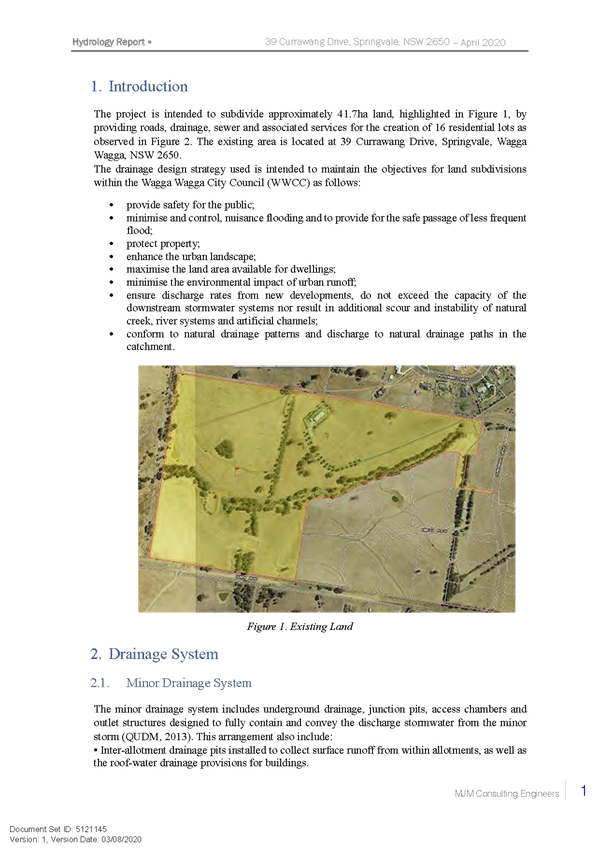
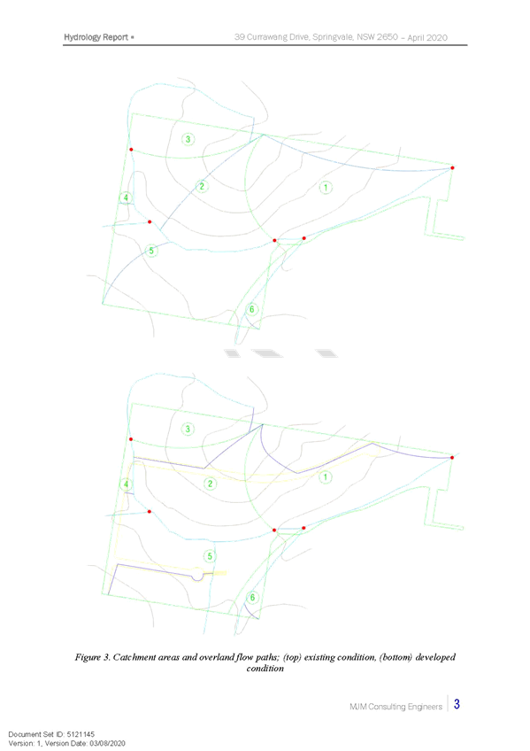
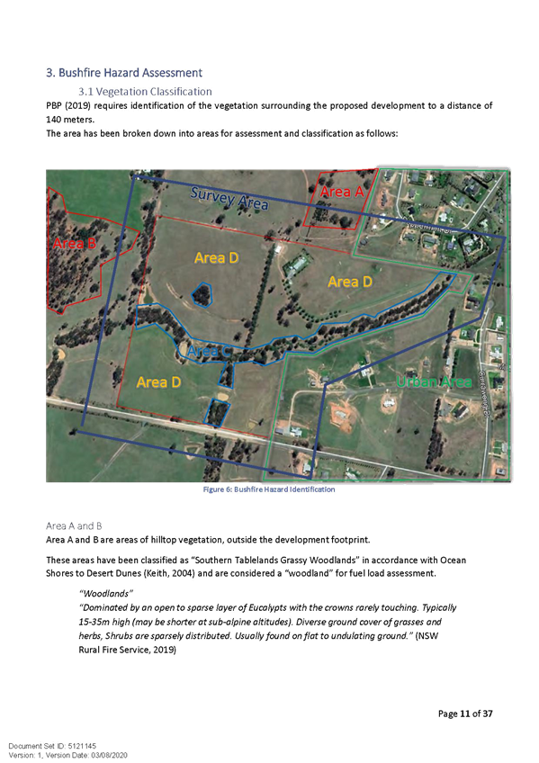
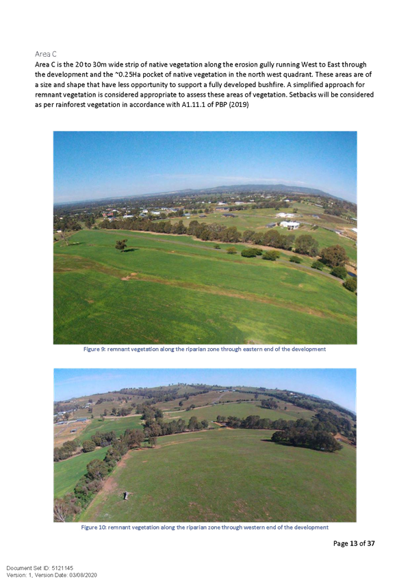
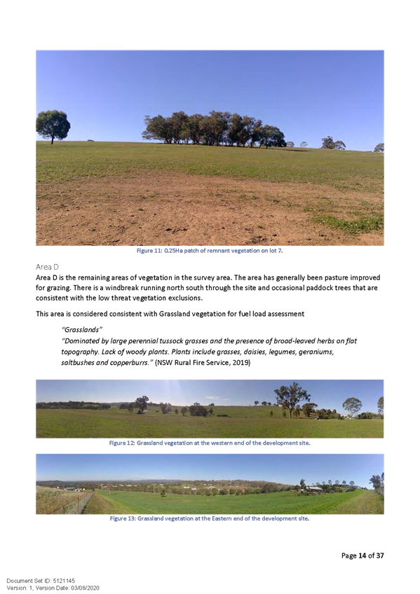
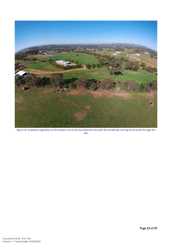
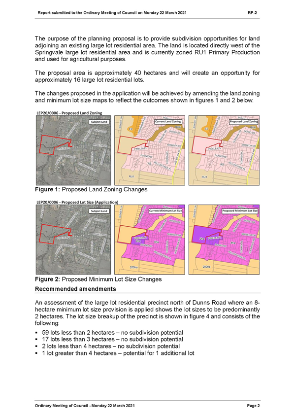
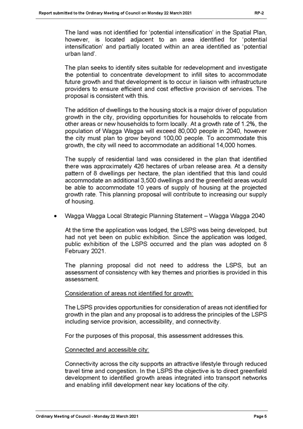
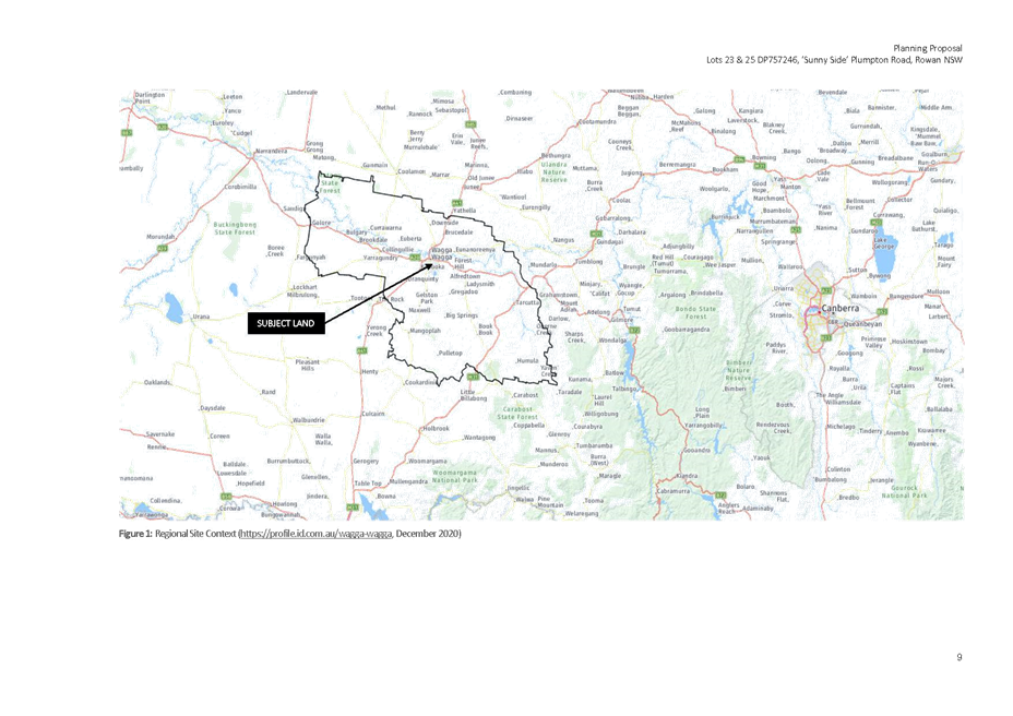
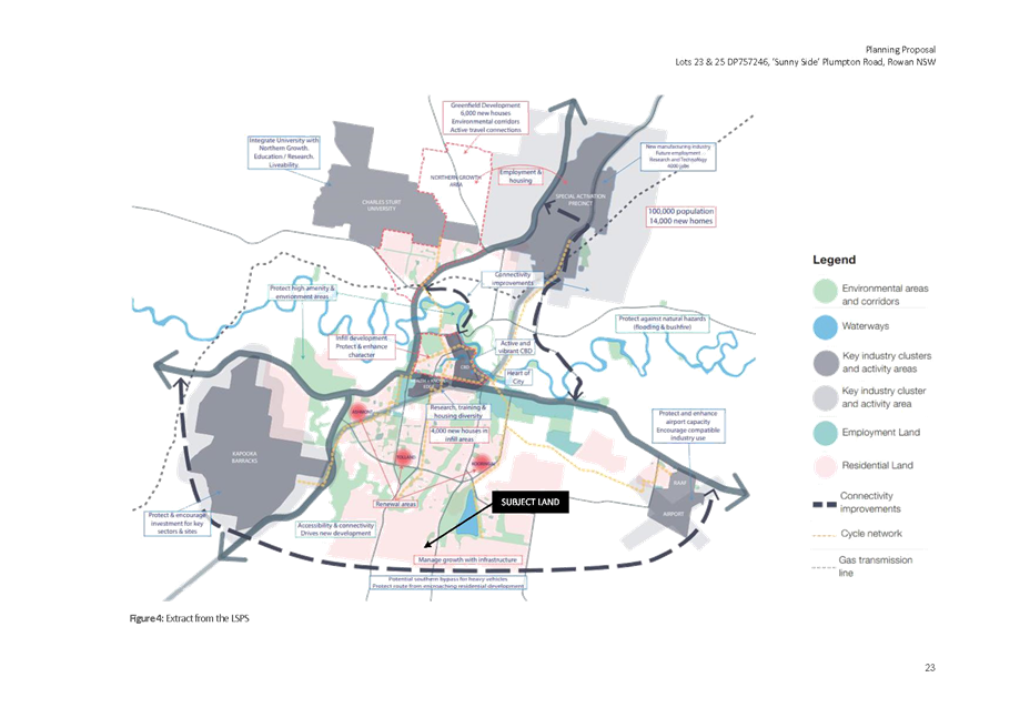
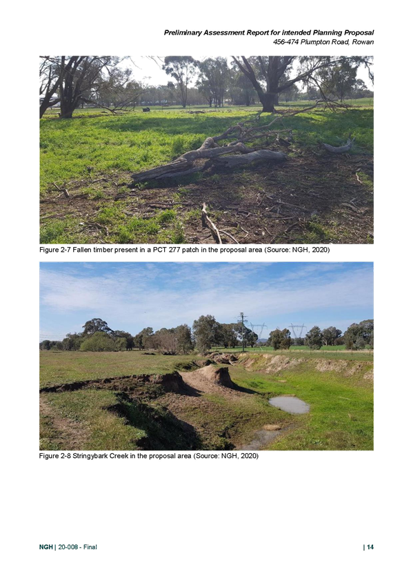
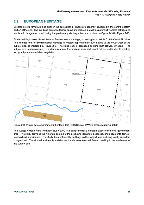
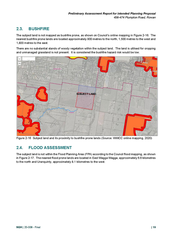
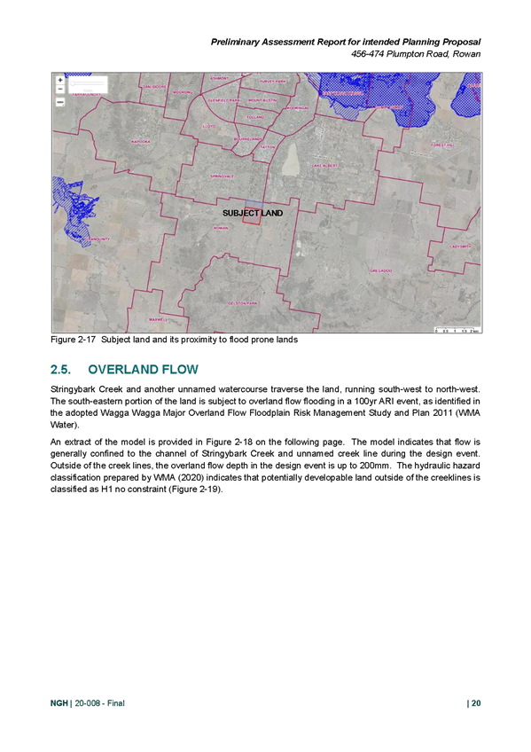
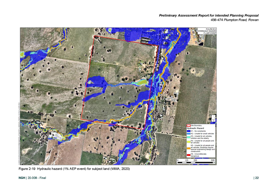
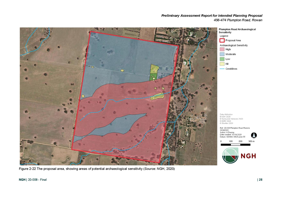
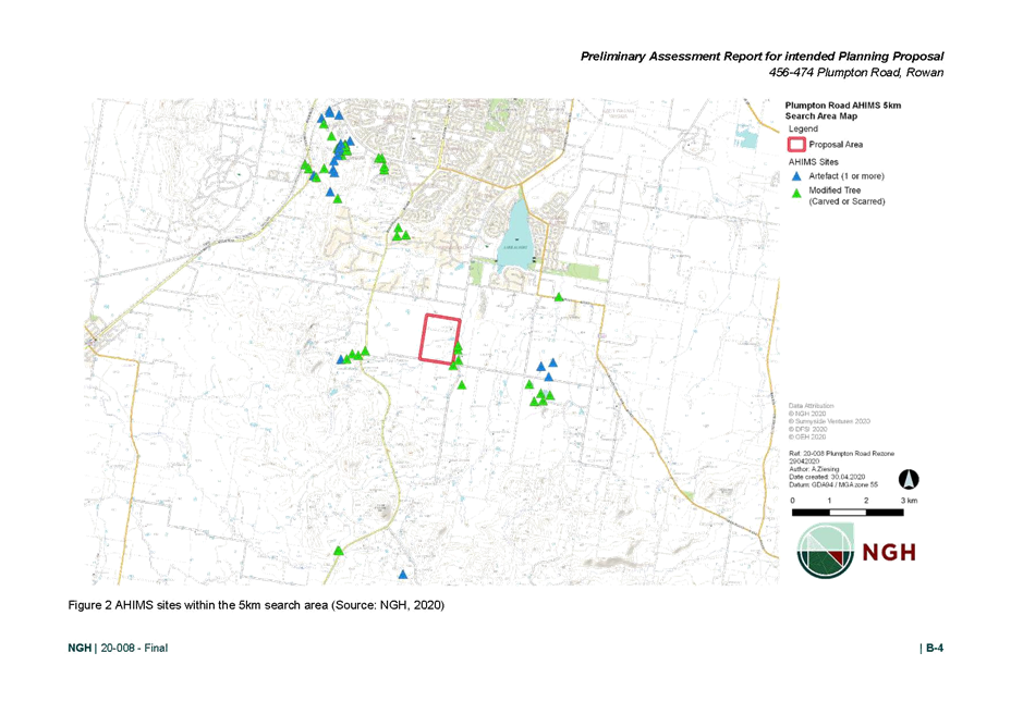
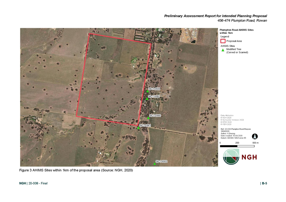
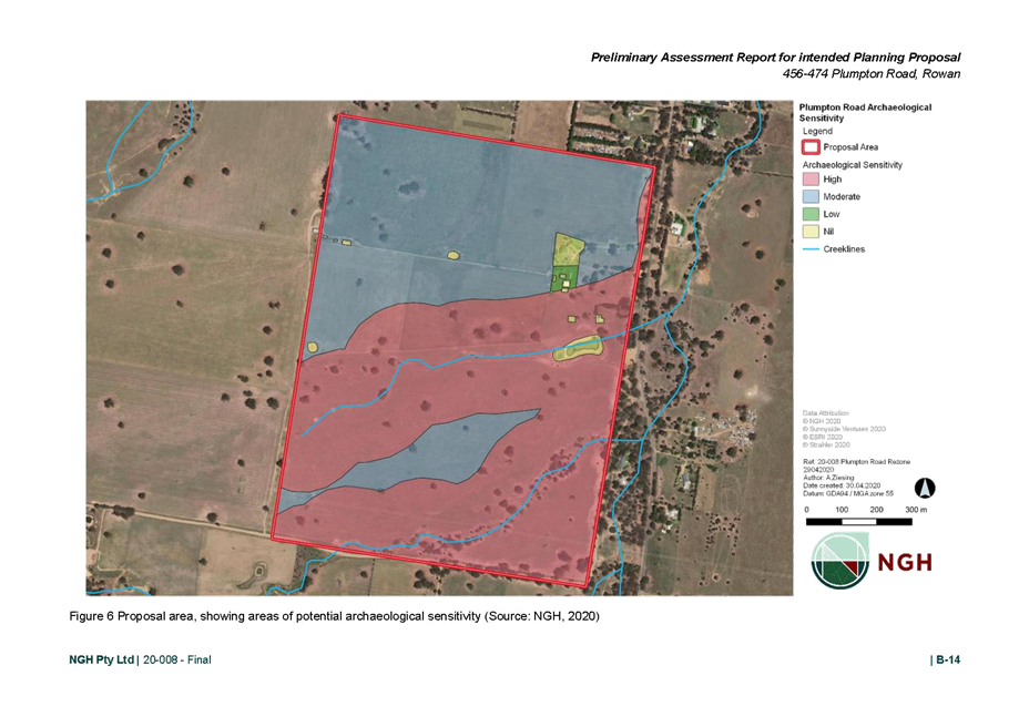
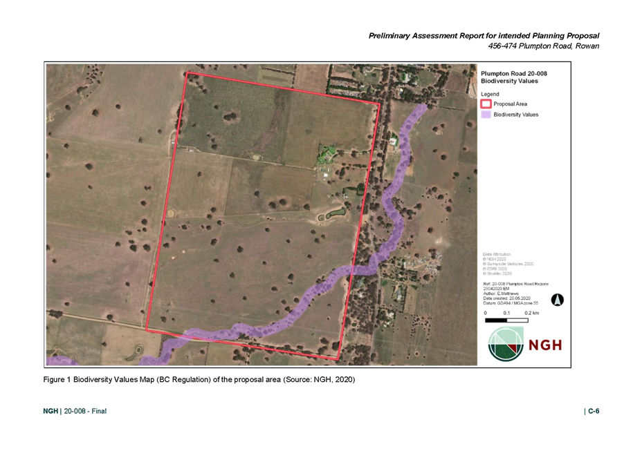
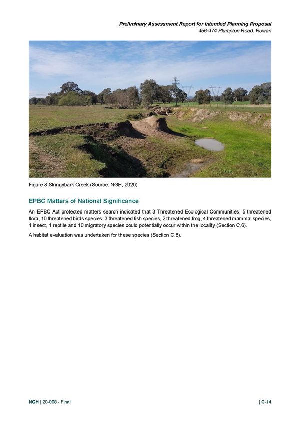
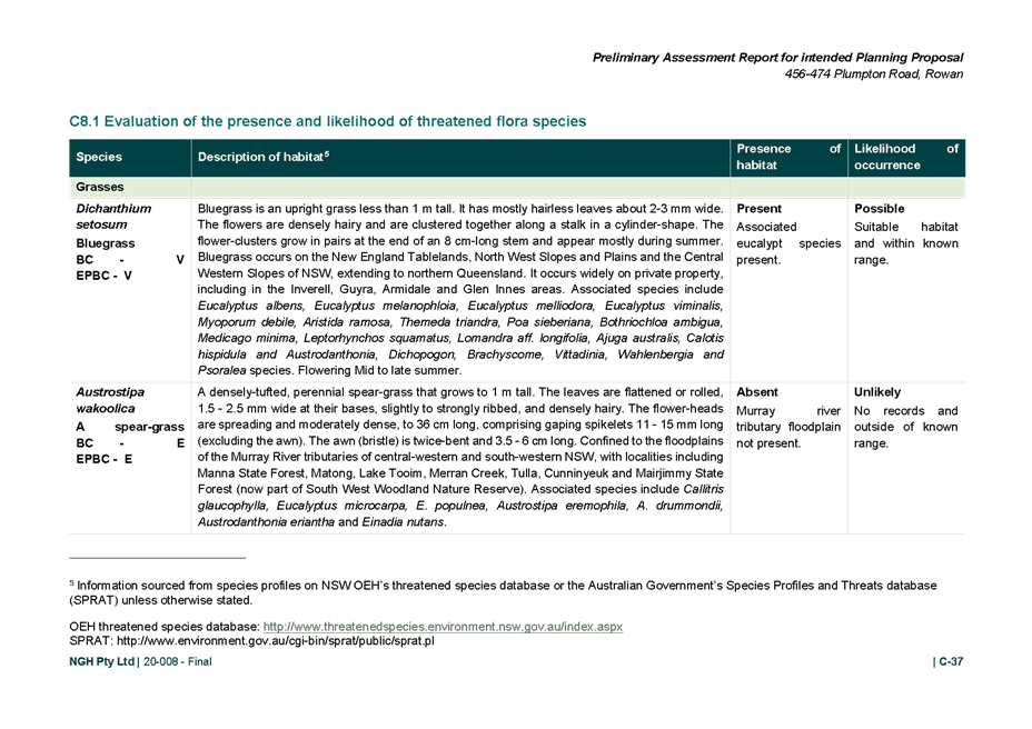
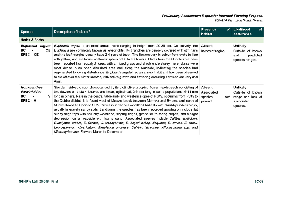
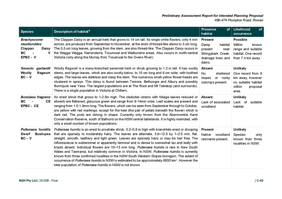
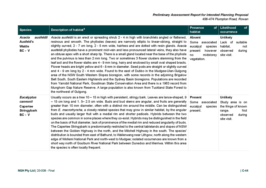
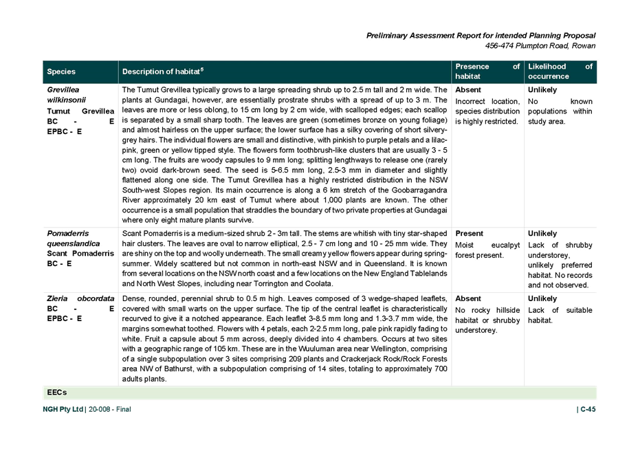
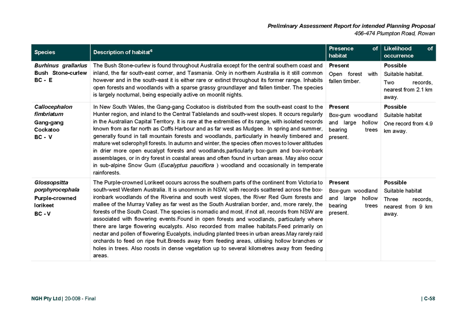
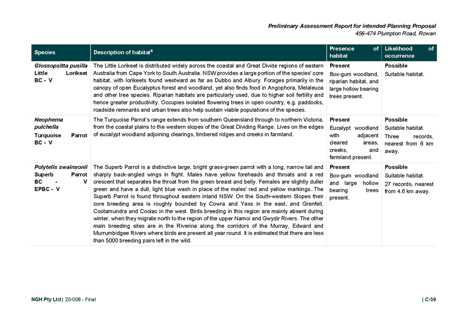
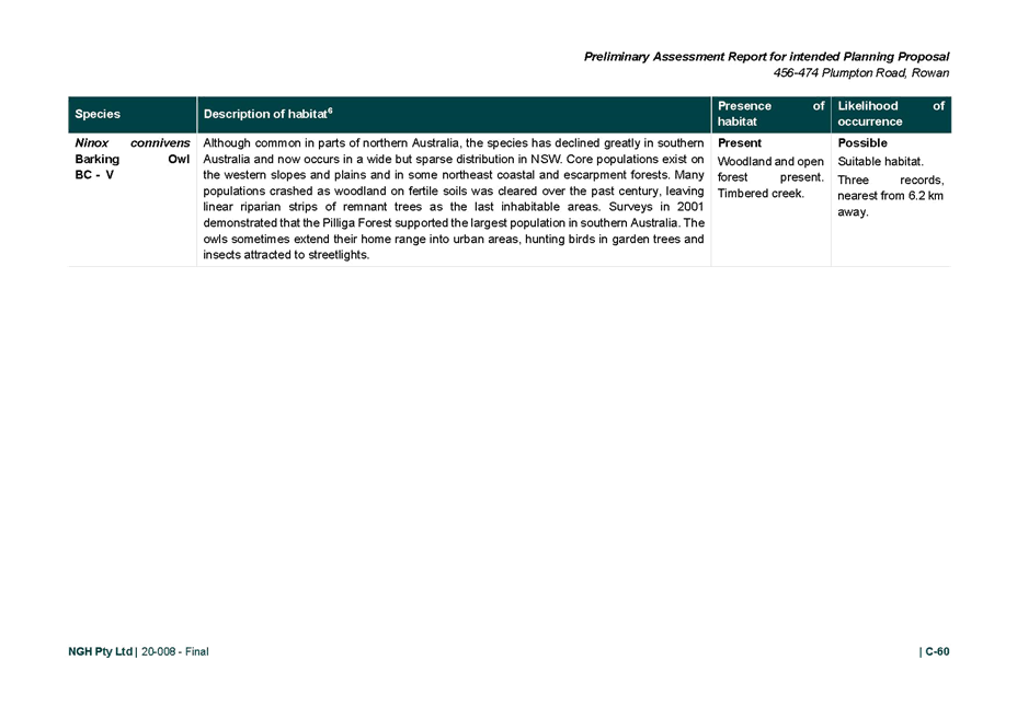
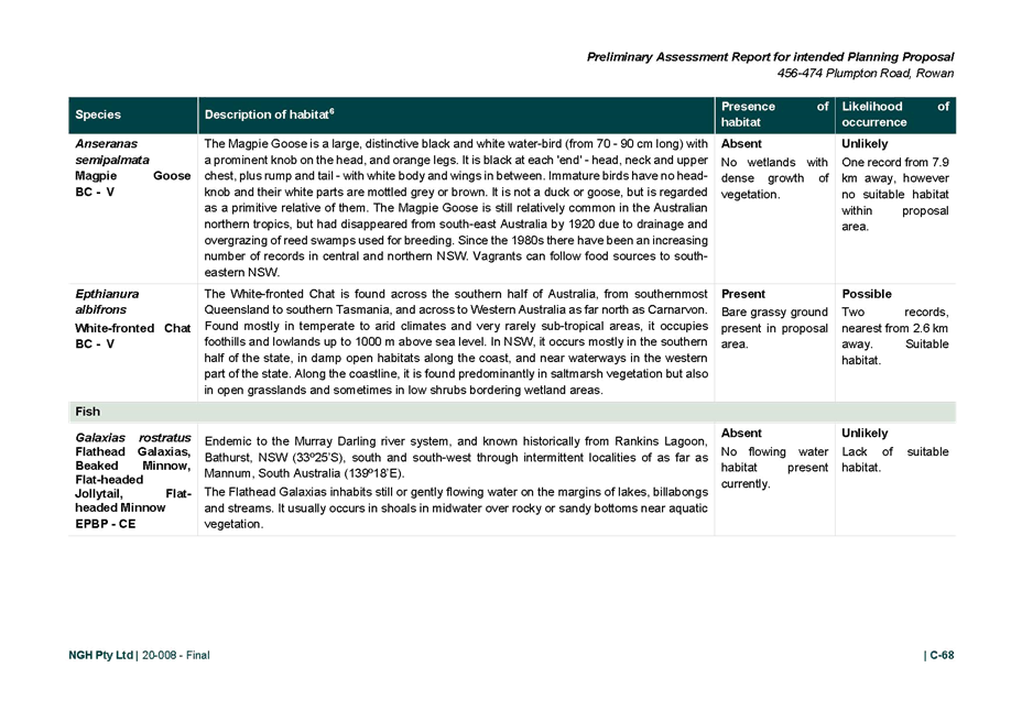
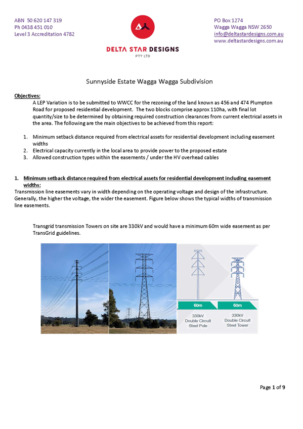
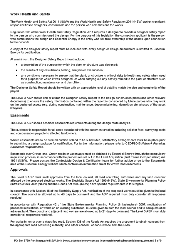
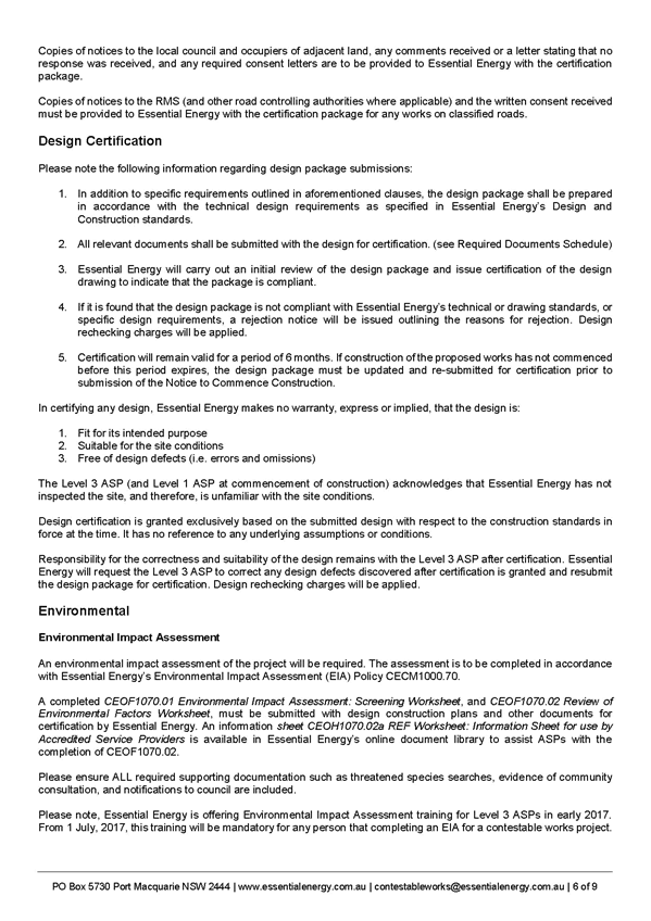
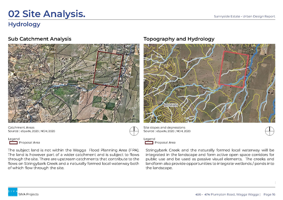
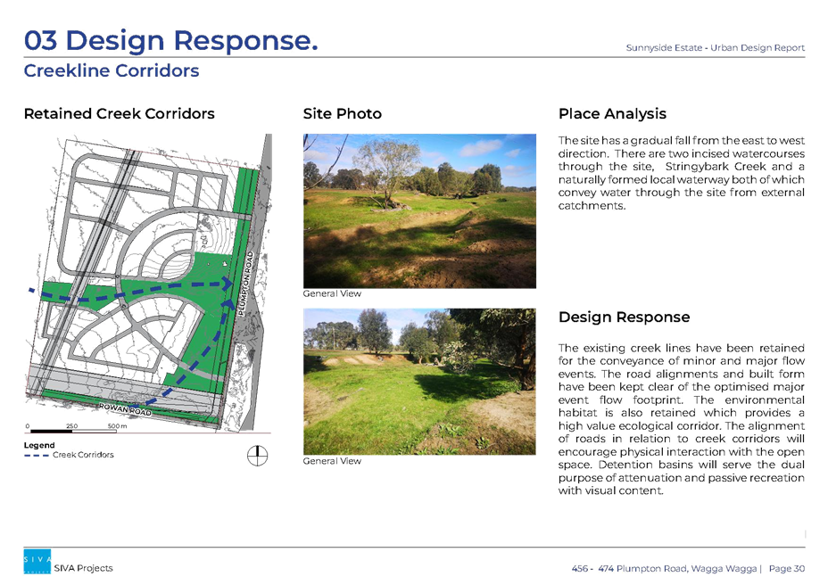
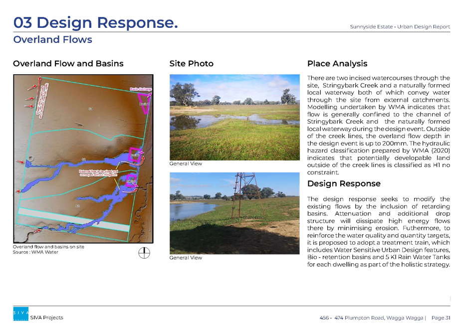
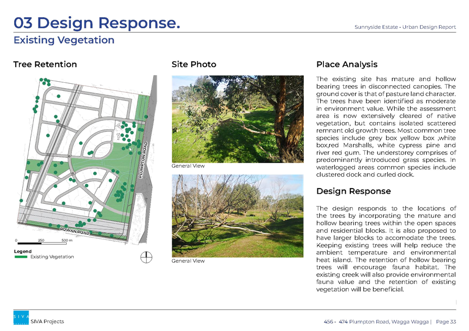
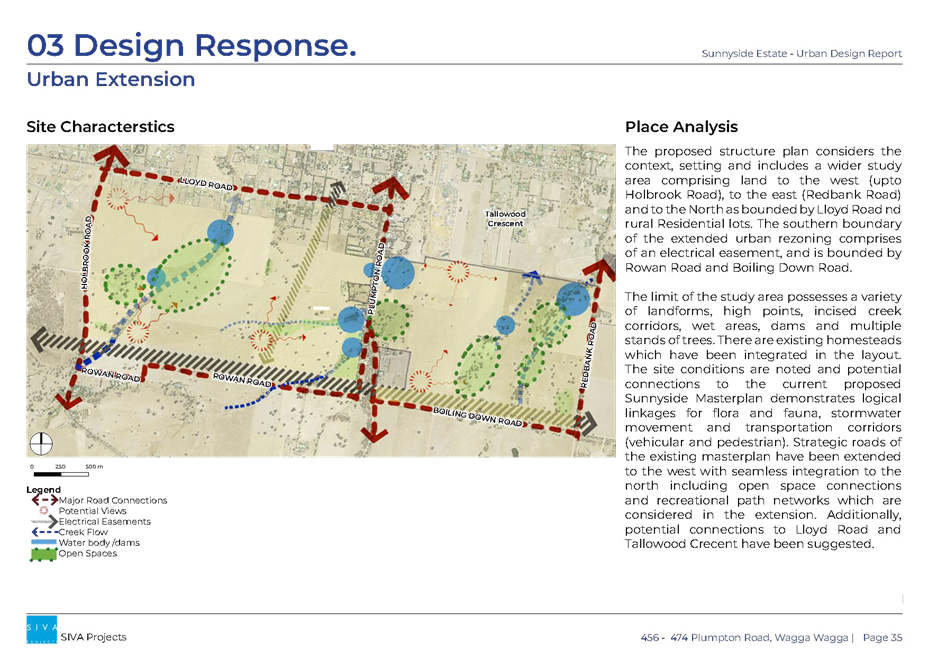
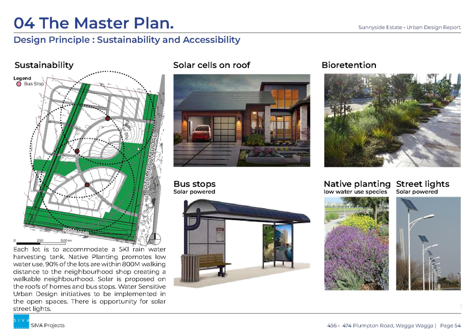
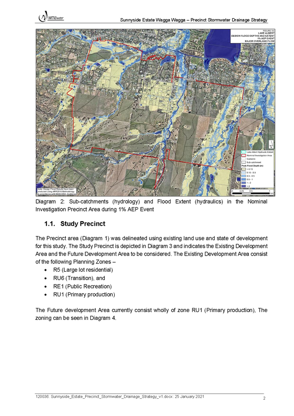
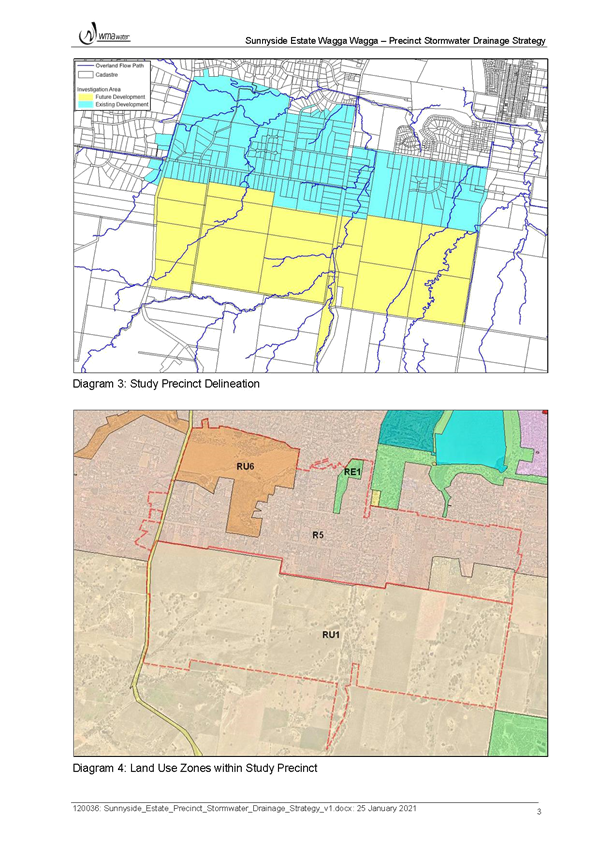
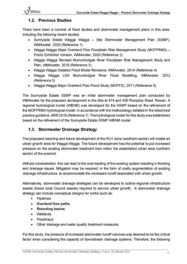
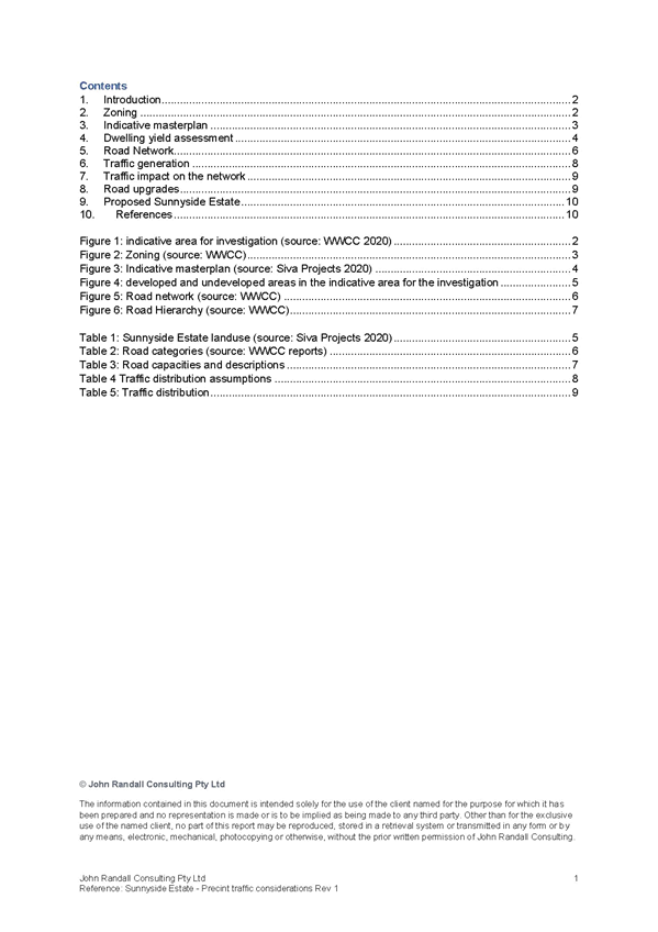
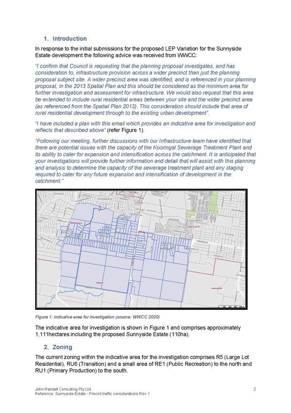
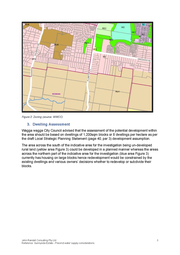
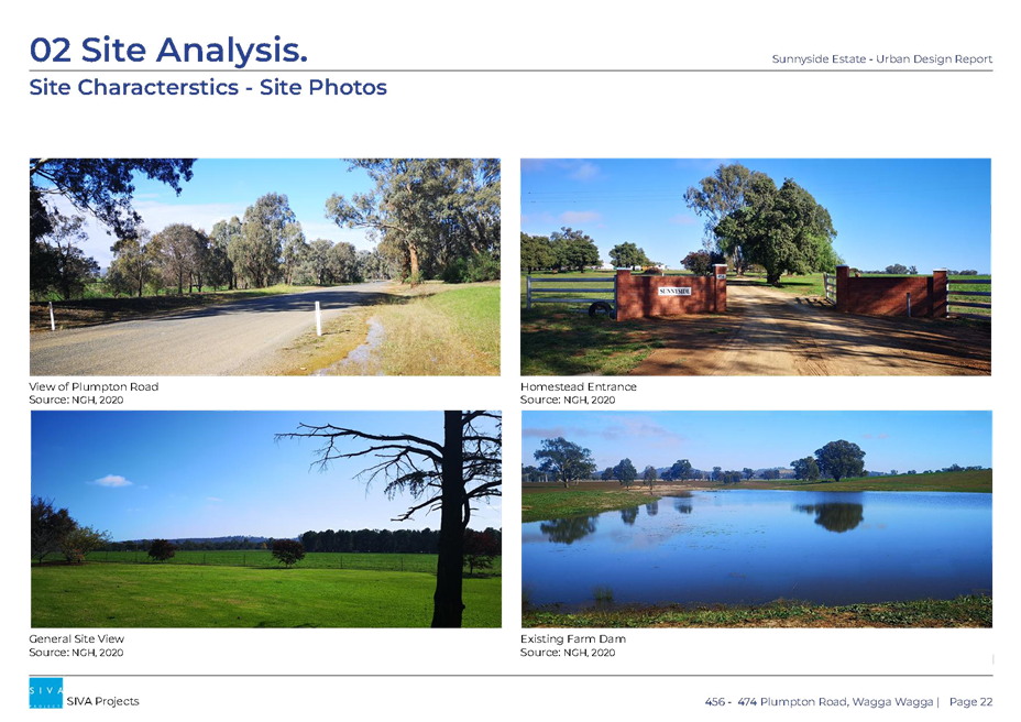
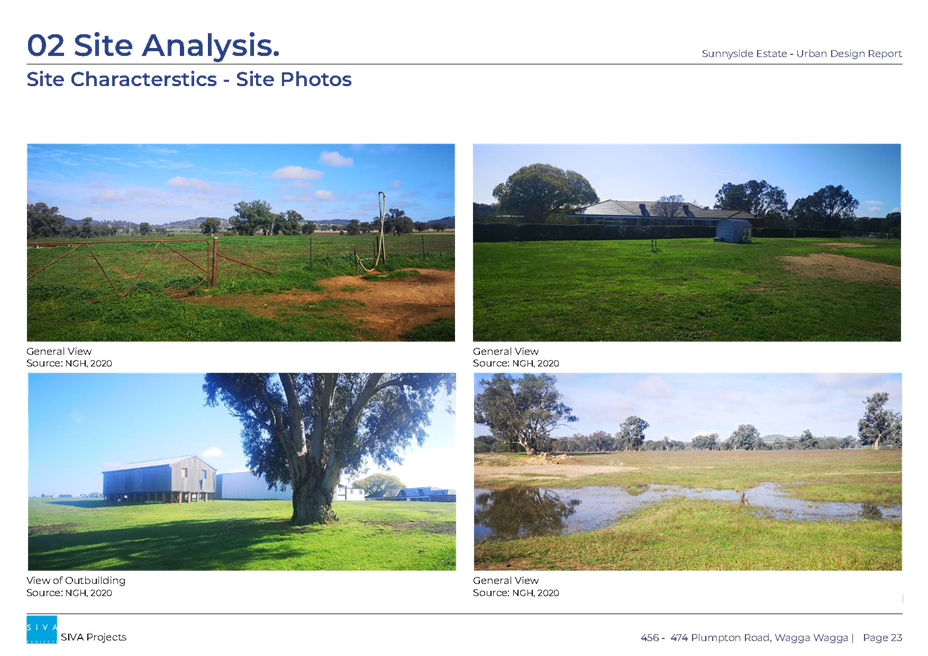
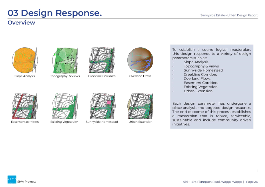
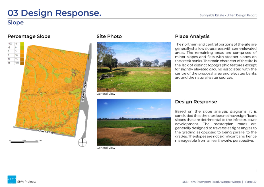
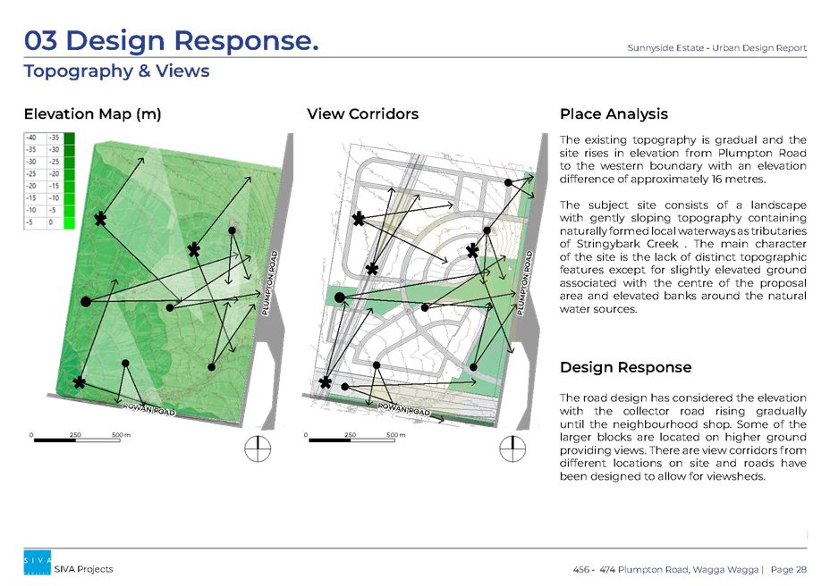
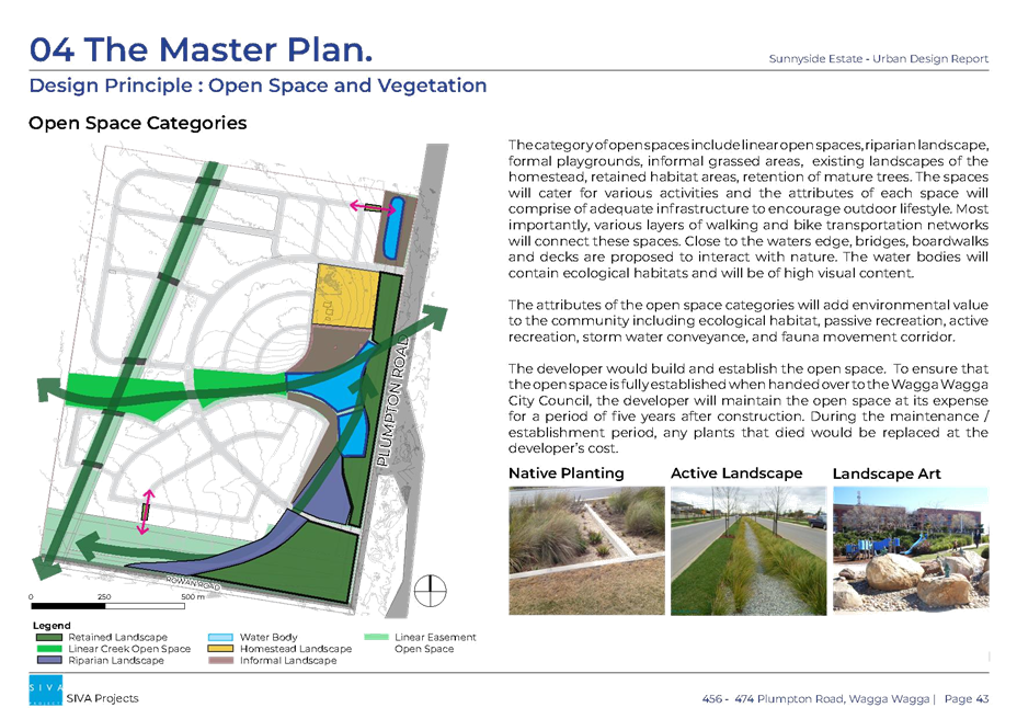
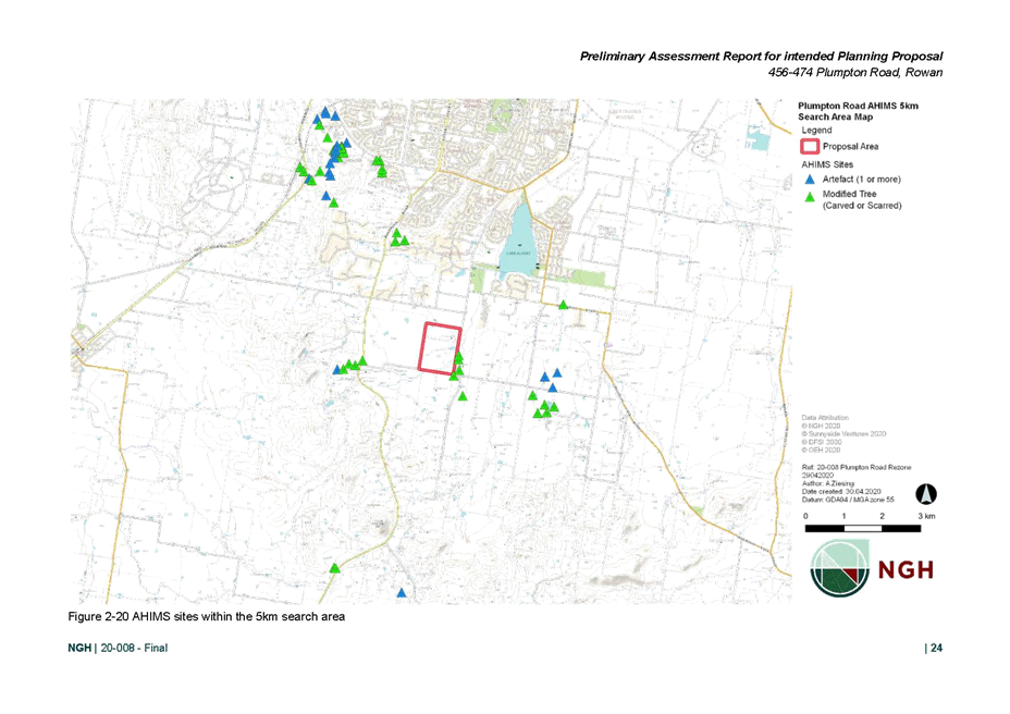
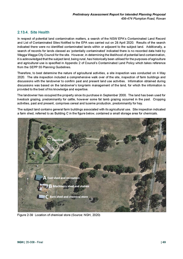
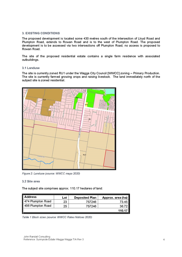
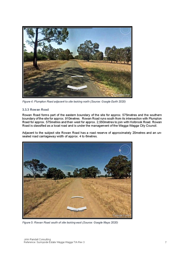
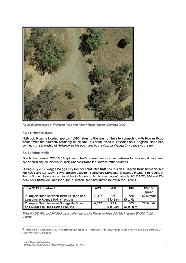
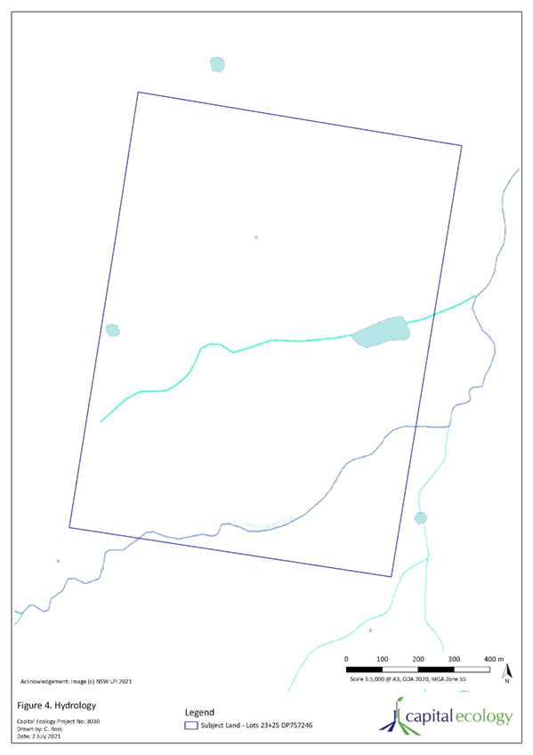
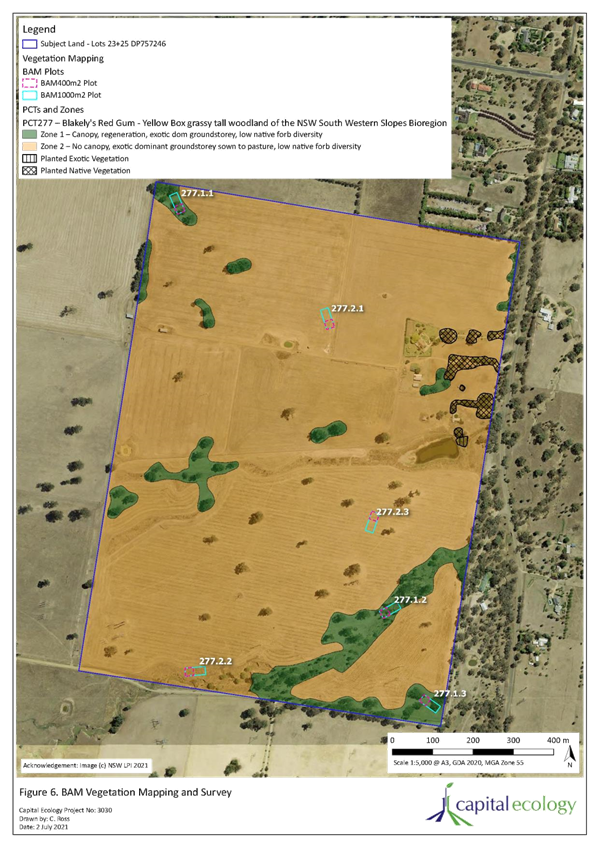
This is characterised as low-quality agricultural grazing land. The site slopes from the south-western corner to the east and north-east. There are two defined watercourses, Stringybark Creek traverses the south eastern corner of the site and an unnamed watercourse traverses the central portion of the site from west to east. There is dispersed vegetation across the site, with higher concentrations adjacent to Stringybark Creek. The electricity transmission corridors traverse the site parallel to the southern boundary and western boundary. Figures 1 and 2 show the site and location in proximity to existing urban areas and adjacent rural lands. |
![]()
![]()
![]()
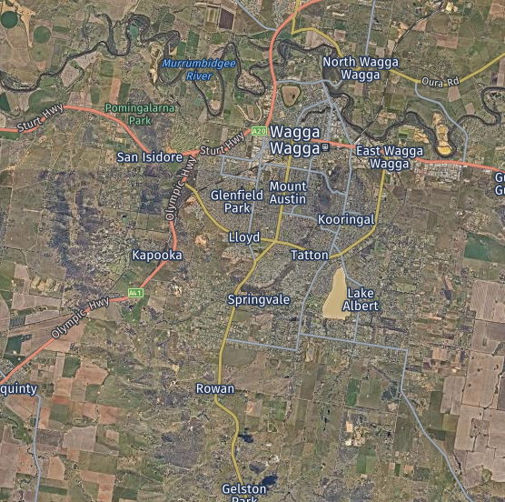
Figure 1: Context map Source: Nearmap
![]()
![]()
![]()
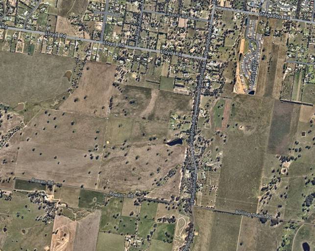
Figure 1: Aerial Image Source: Nearmap
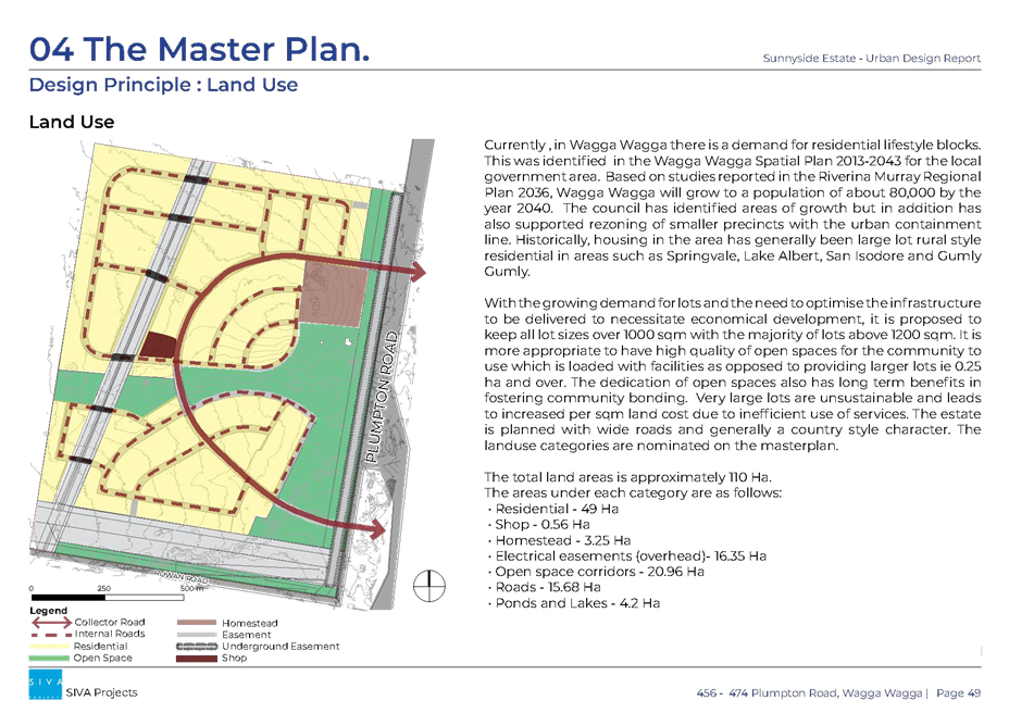
PROPOSAL
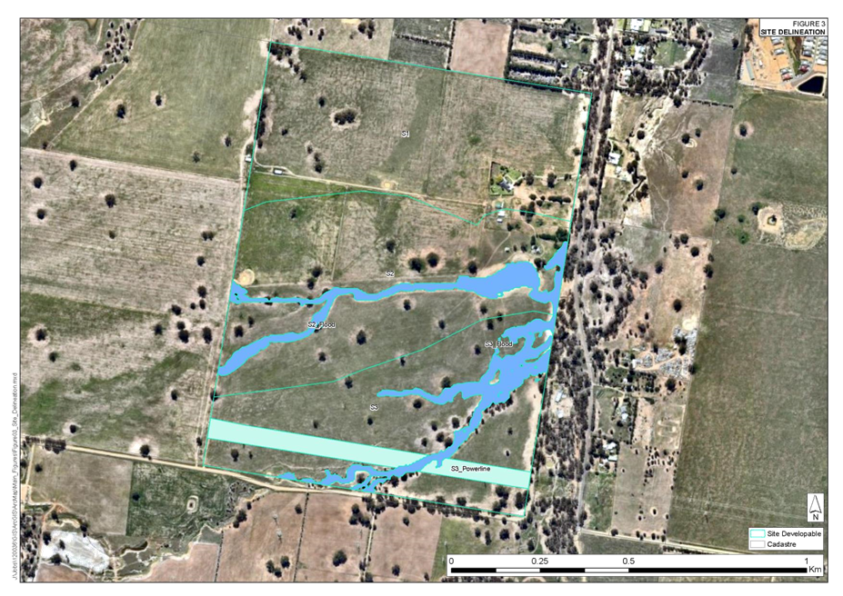
Council is in receipt of a Planning Proposal prepared by Sunnyside Ventures Pty Ltd, relating to land at 456 & 474 Plumpton Road, Rowan.
The planning proposal seeks to amend the Wagga Wagga Local Environmental Plan 2010 (LEP) to achieve the following:
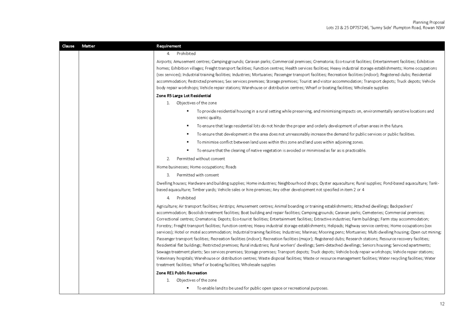
§ Rezone the land from RU1 Primary Production to part R5 Large Lot Residential and part RE1 Public Recreation
§ Reduce the minimum lot size for R5 Large Lot Residential land from 200 hectares to 1,000m².
§ Reduce the minimum lot size for RE1 Public Recreation land from 200 hectares to nil.
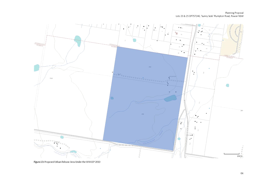
§ Identify the site as an Urban Release Area.
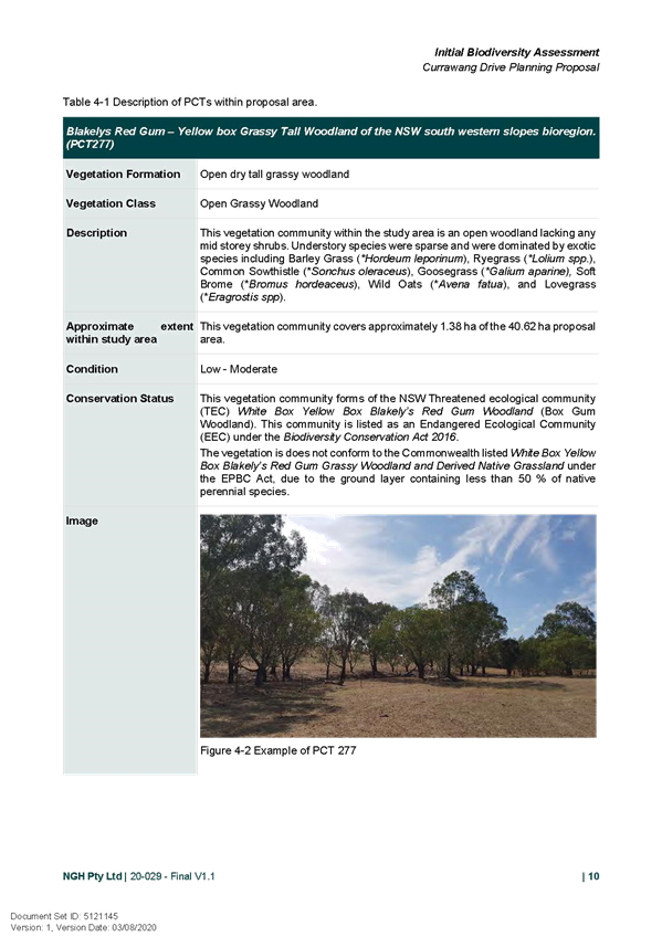
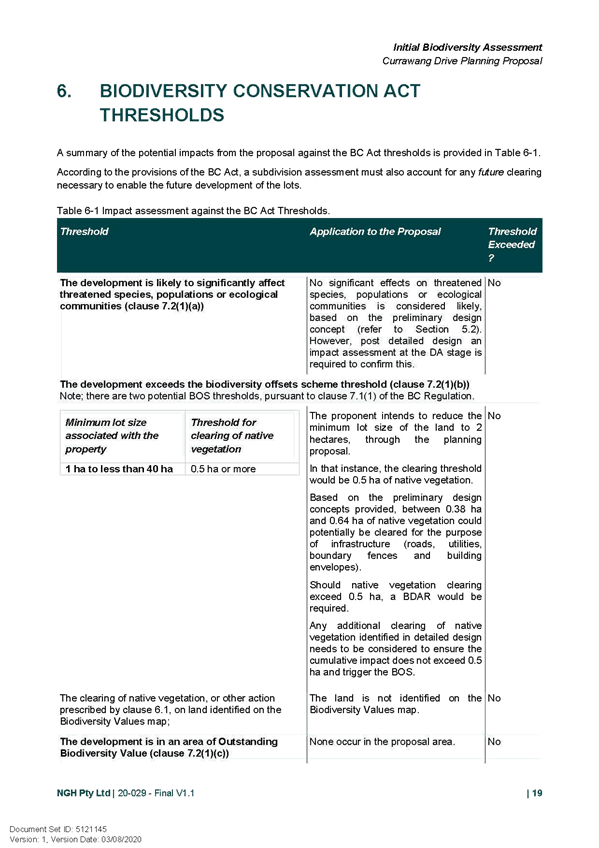
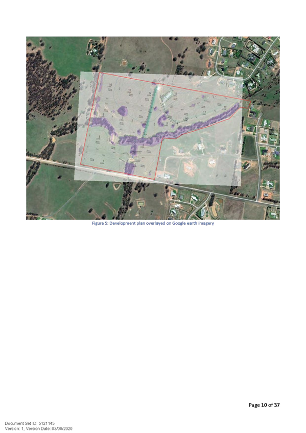
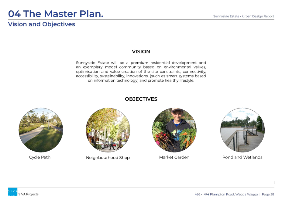
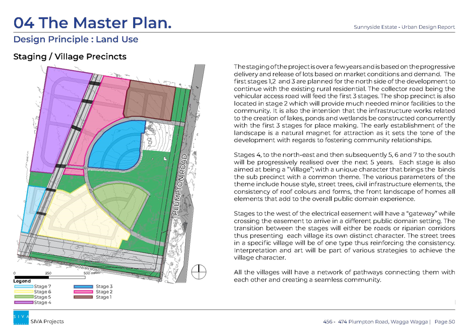
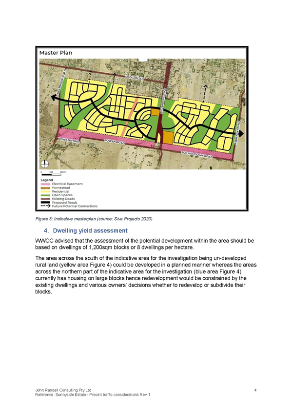
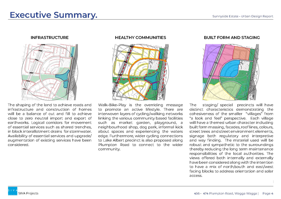
The intended development outcome is to create approximately 490 residential lots and a local centre.
The proponent’s description of the proposal, supporting information and conceptual development plans are provided under a separate cover.
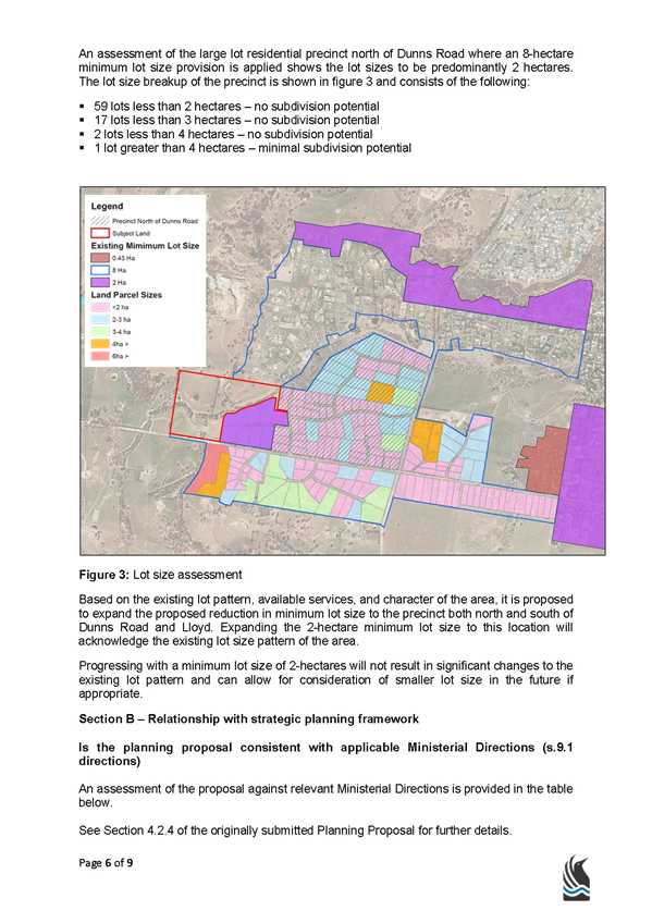
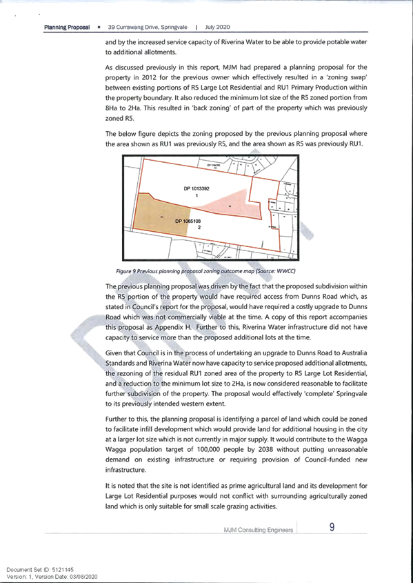
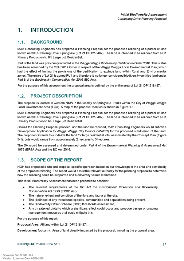
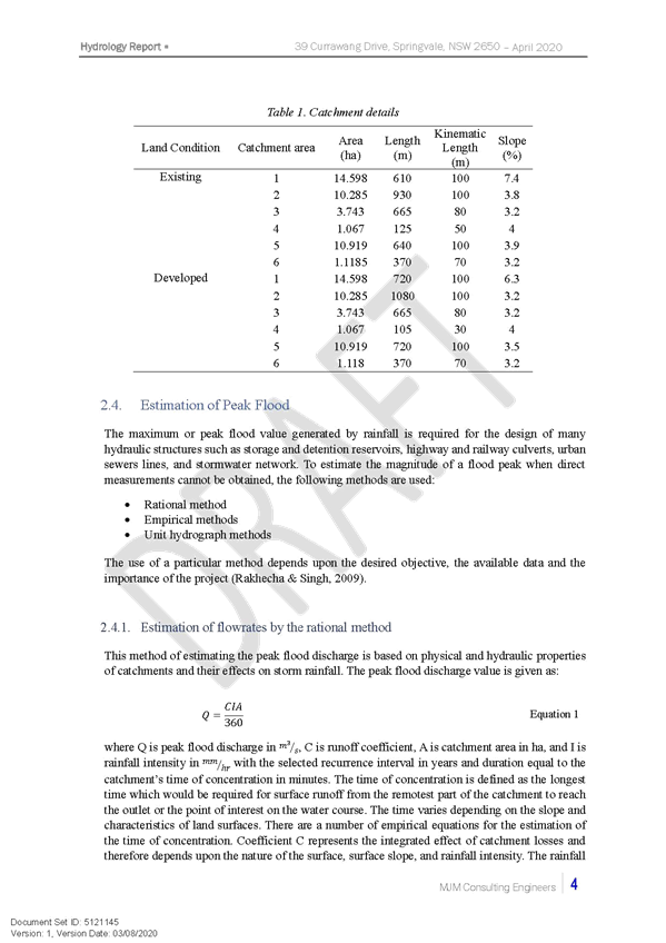
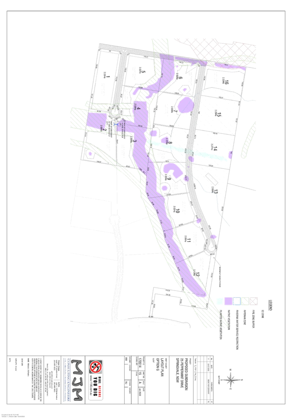
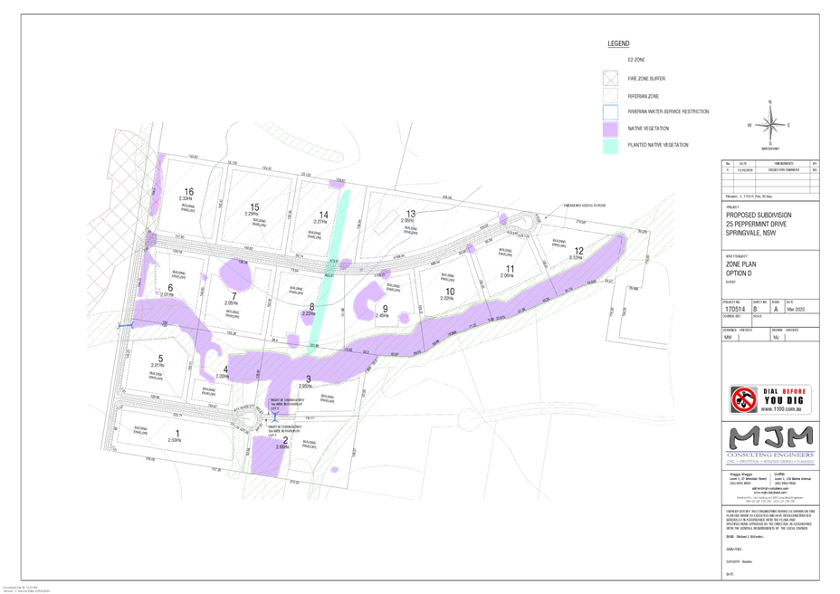
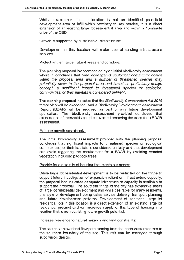
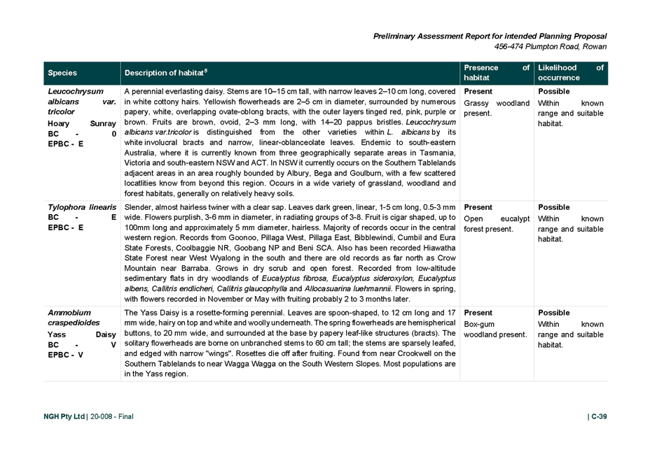
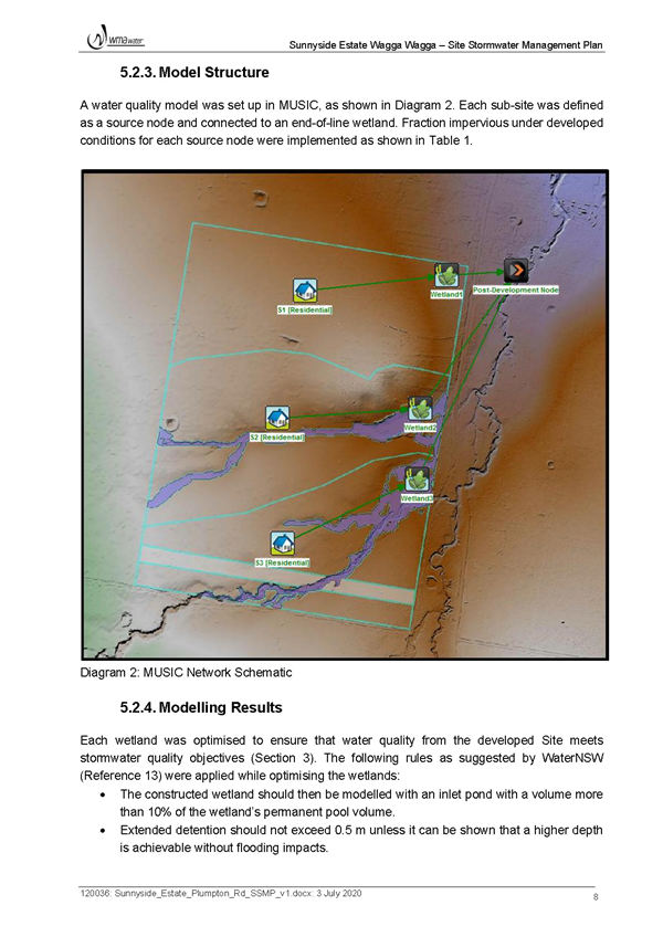
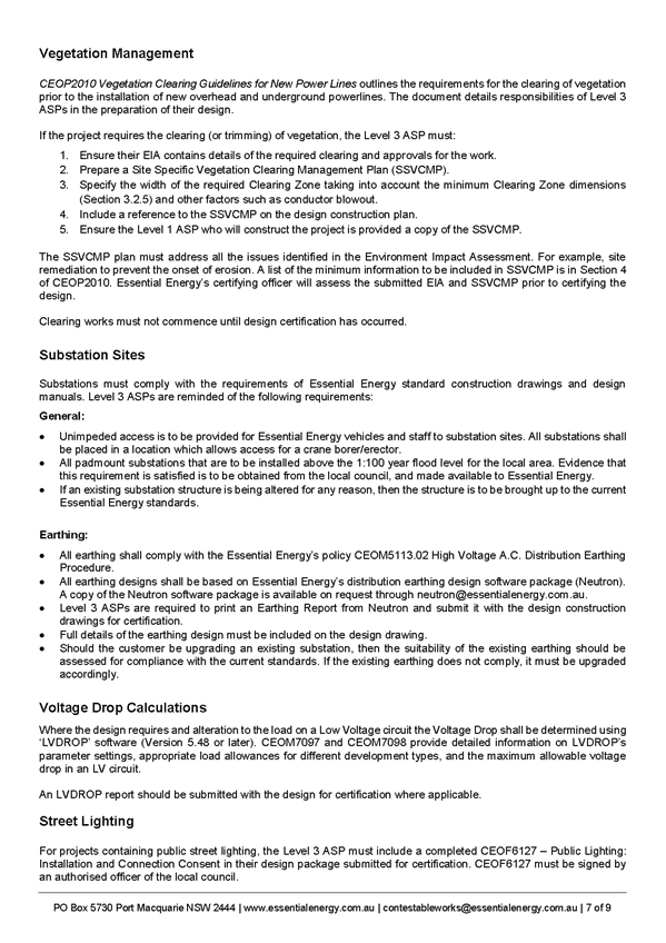
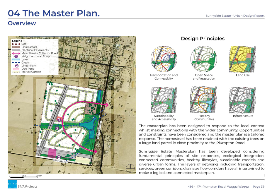
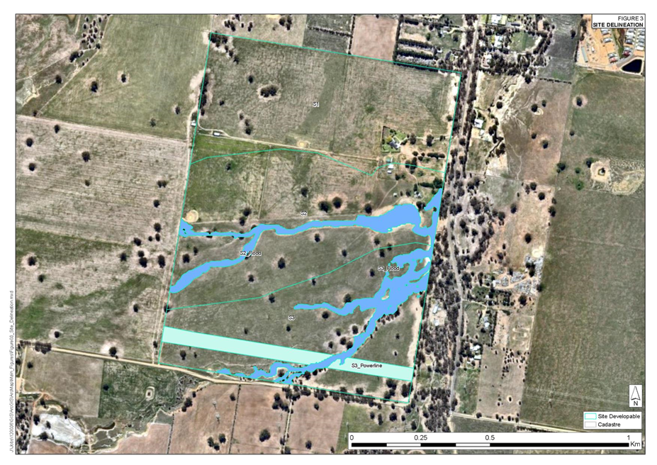
Figure 3 shows the proposed master plan provided with the planning proposal. The master plan will inform site-specific development control plan (DCP) controls.

Figure 3: Proposed Land Use/Masterplan Outcome Source: Application
ASSESSMENT
1. Council’s Vision or Strategic Intent
There is a strong commitment through local and regional policy to find a balance between growth, the natural environment, sustainability, and liveability whilst enabling Wagga Wagga to emerge as the southern capital of NSW.
· Riverina Murray Regional Plan 2036
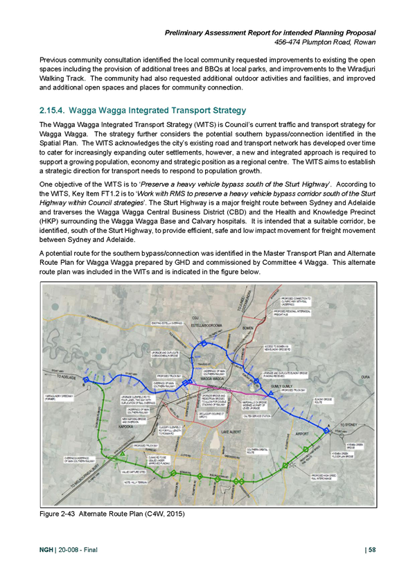
The Riverina Murray Regional Plan 2036 outlines a vision to promote the growth of regional cities and local centres and identifies the significance of aligning infrastructure planning with land release areas. Key actions from the Regional Plan include:
Action 25.3 - Align infrastructure planning with land release areas to provide adequate infrastructure
Council is in the process of revising the infrastructure delivery servicing plan to determine the infrastructure required to service the projected population growth. The site is located outside of the catchment area for the revised servicing plan. The review is anticipated to take 12 months.
Without the revised infrastructure delivery servicing plan in place, the applicant is engaging a consultant to extend on the works Council is currently undertaking for sewer modelling. As part of this process, the applicant will involve Council in the preparation of the brief and review of works.
Action 27.1 – Enable new rural residential development only where is has been identified in a local housing strategy prepared by Council and approved by the Department.
Council has not yet prepared a local housing strategy. Notwithstanding, the LSPS provides an avenue for consideration of growth in areas not identified in the LSPS when infrastructure is available.
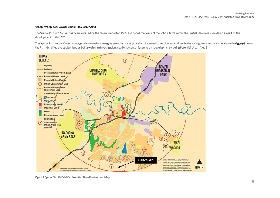
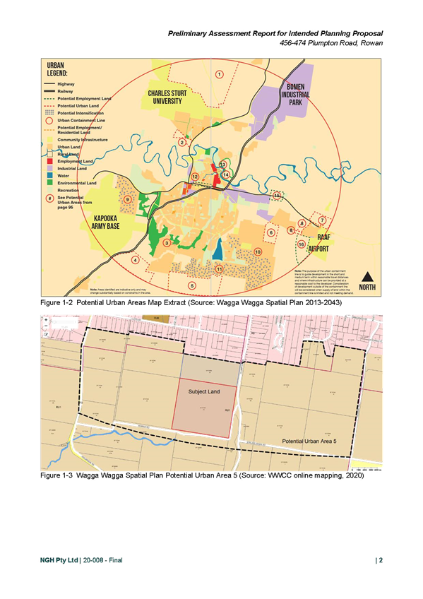
· Wagga Wagga Spatial Plan 2013-2043
Whilst the Planning Proposal refers to, and in part, relies upon, the Spatial Plan, this has been superseded by the LSPS. The LSPS was adopted on 8 February 2021, prior to the lodgement of the Planning Proposal.
Each of the action items identified in the Spatial Plan have been considered in the LSPS. The site was originally identified within Area 5 of the Spatial Plan. The Actions for Area 5 state that “the rezoning of this land should be done in conjunction with the planning and investigation of the identified ‘potential road connection.’…the zone and minimum lot size will be considered after the outcomes of the residential study are known.”
This Action has not been included in the final adopted LSPS. Planning and investigation of the potential road connection have not occurred, and Council are yet to prepare their local housing strategy. The LSPS provides an avenue for consideration of growth.
· Wagga Wagga Local Strategic Planning Statement – Wagga Wagga 2040
The LSPS maps the Northern Growth Area as the area that will be focused on for growth through urban release. The site is located outside of this area; however the plan provides an avenue for consideration of growth outside of the Northern Growth Area.
Principle 1: Protect and enhance natural areas and corridors
The LSPS identifies the benefits that existing vegetation, natural areas, and corridors contribute to the city’s presentation and quality of life. Protecting and preserving environmental assets should be prioritised over development.
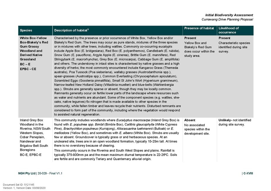
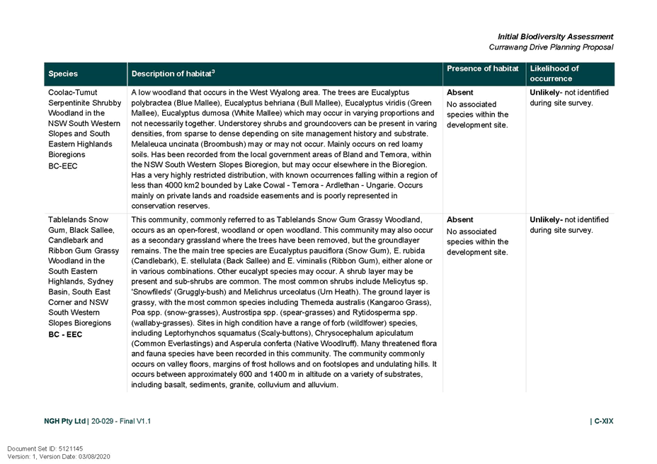
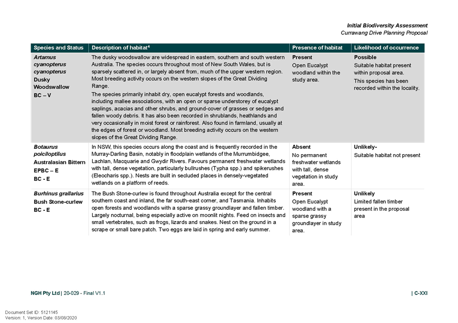
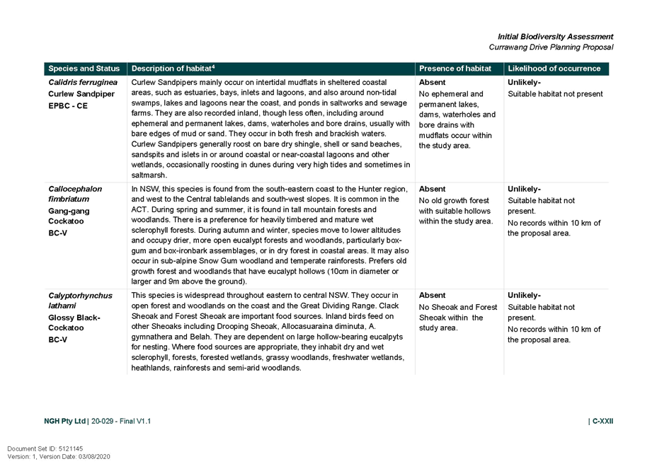
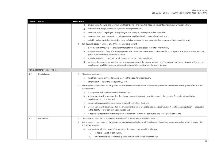
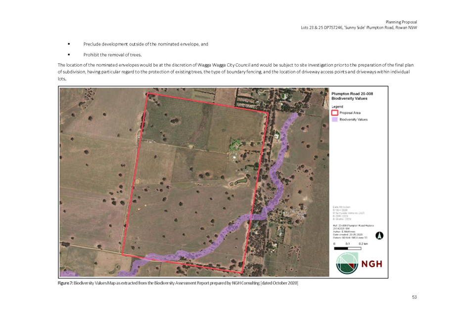
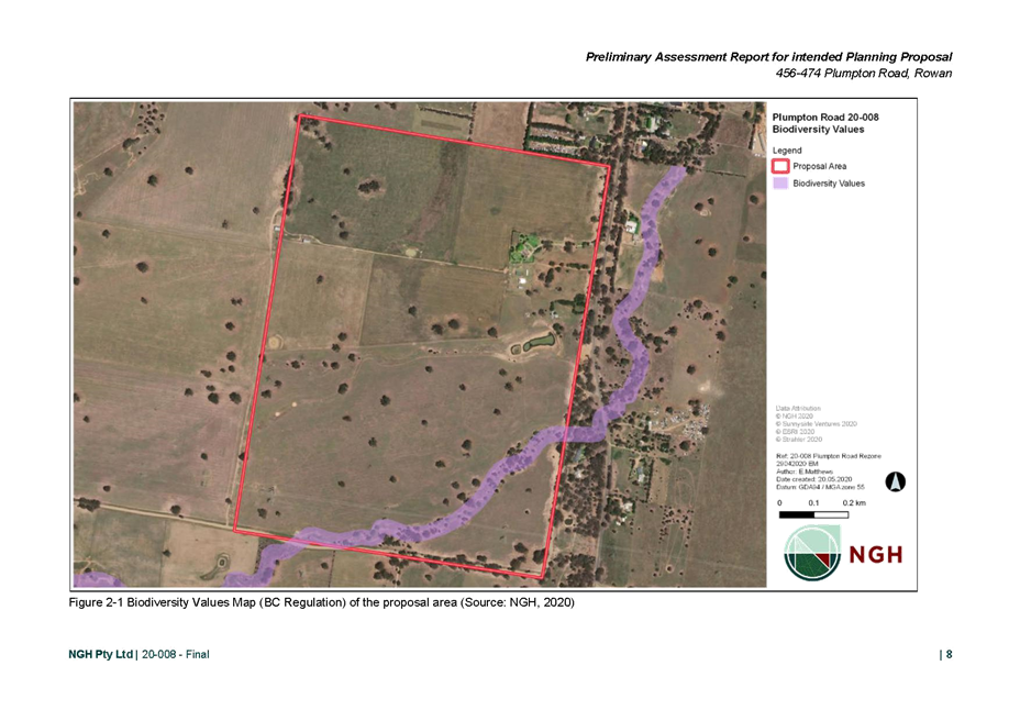
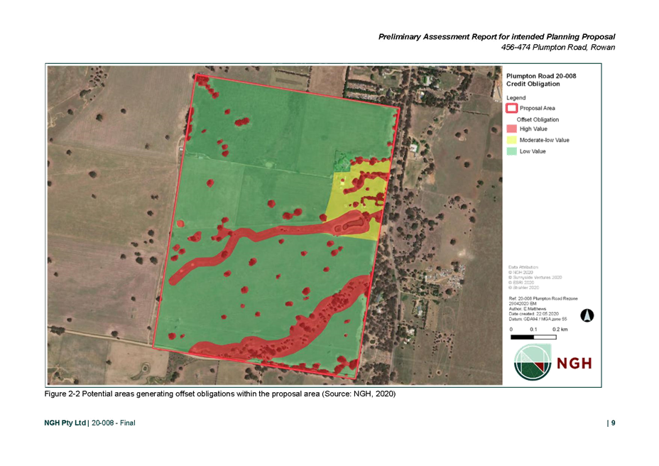
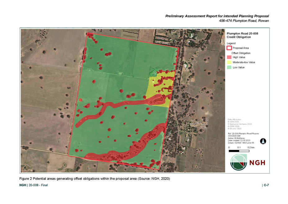
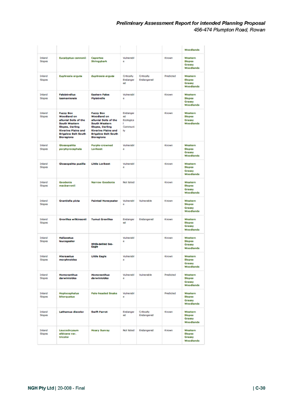
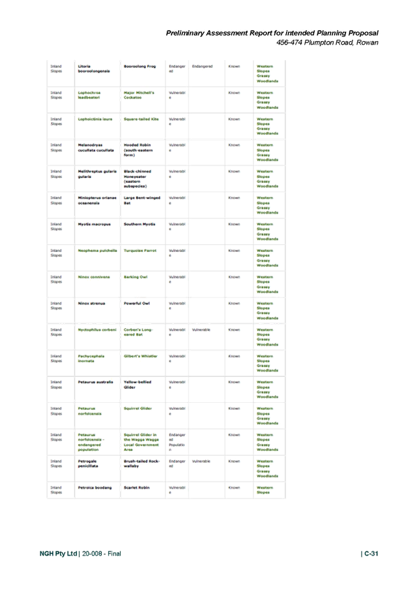
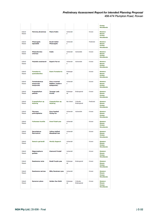
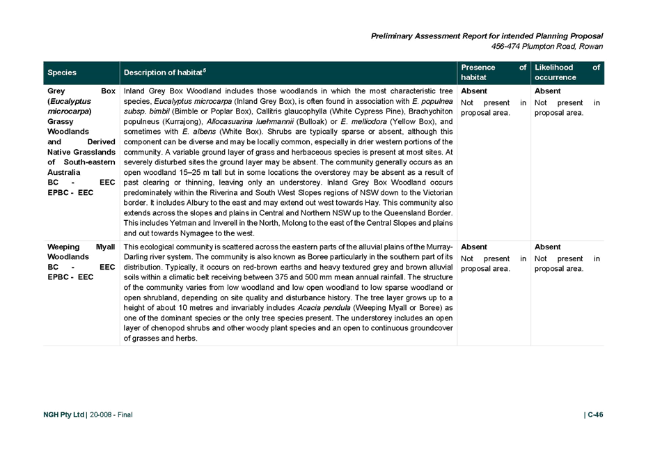
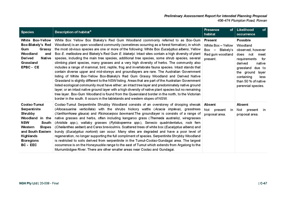
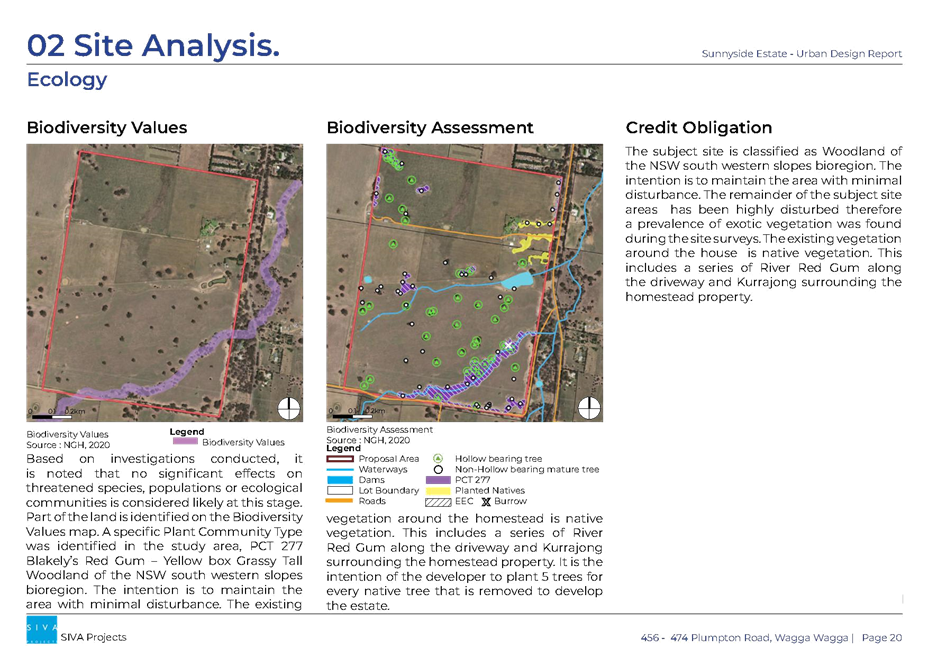
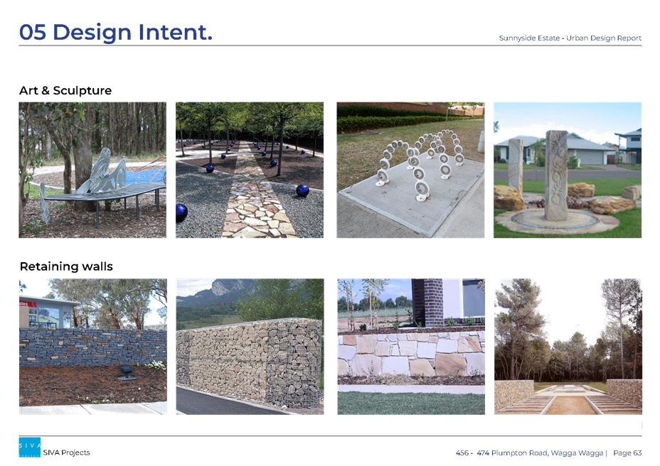
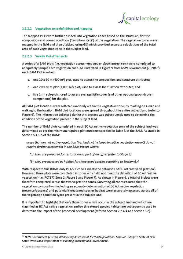
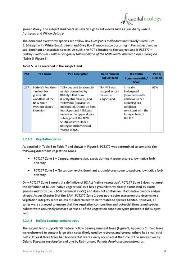
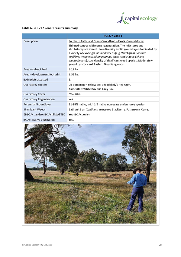
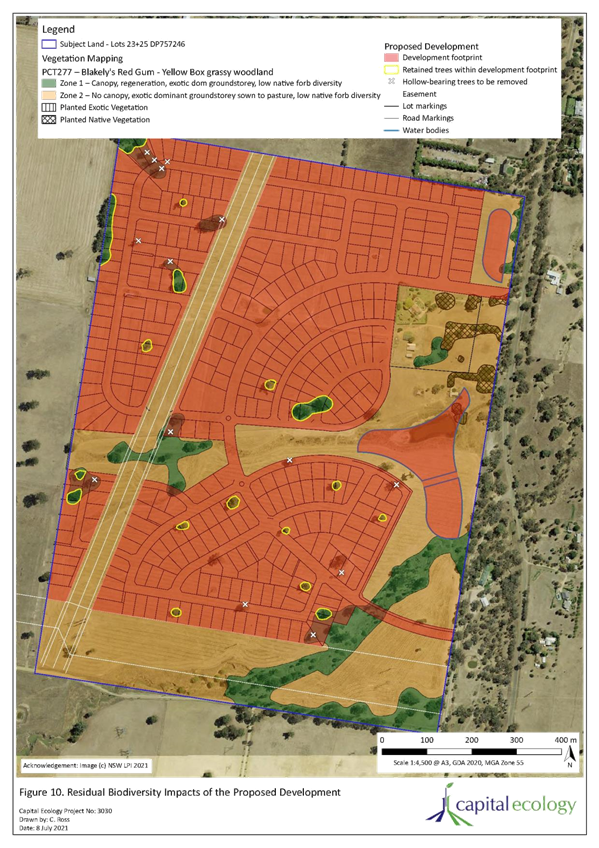
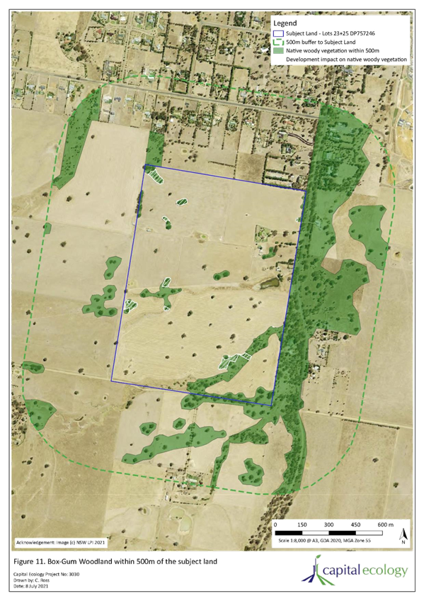
The Planning Proposal states that the site contains biodiversity corridors and seeks to apply an RE1 zone over those parts of the land which contain waterways, environmentally sensitive land, and high concentrations of vegetation. The Planning Proposal states that there will be offset obligations and the urban design report outlines an intent to plant five trees for every native tree that is removed. A draft BDAR has been prepared to provide preliminary findings with targeted surveys to occur in October / November 2021 to finalise the BDAR. The proponent has identified that the proposal enacts a number of principles to avoid and minimise impacts to Box-Gum Woodland with details provided within the draft BDAR.
Principle 3: Manage growth sustainably
The LSPS requires that infrastructure provision and capacity is managed and prioritised in decision making for infill development and includes broader considerations and precinct wide planning rather than site specific Planning Proposals in isolation or ad-hoc planning that results in unsustainable outcomes.
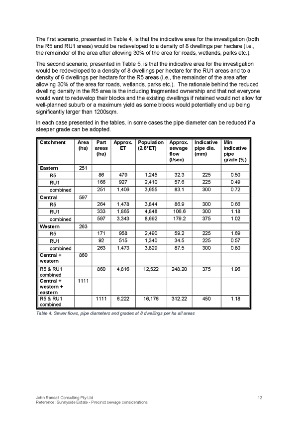
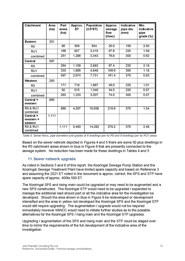
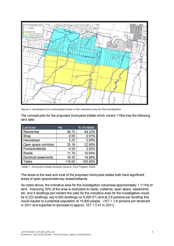
The Planning Proposal was accompanied by a precinct wide infrastructure plan, encompassing the site, the developed land to the north and undeveloped / RU1 Primary Production land to the east and west of the site. It assumes that all land within the catchment area would be developed for residential purposes, at a density of 8 dwellings per hectare and 2.6 persons per dwelling (total projected population of 15,600 people).
The precinct wide infrastructure plan states that the site is capable of being connected into the broader infrastructure network and services can be made available to the site. Substantial upgrades will be required to sewer, water, and road infrastructure to support the estimated population. Servicing is further addressed under ‘2. Infrastructure’ below.
Principle 7: Growth is supported by sustainable infrastructure
The LSPS provides opportunities for consideration of areas not identified for growth in the LSPS, on the basis that the Planning Proposal addresses the principles of the LSPS including service provision, accessibility, and connectivity.
The Planning Proposal has provided studies to demonstrate adequately service provision, accessibility, and connectivity solutions. Being an urban release area, Clause 6.2 of the WWLEP 2010 will apply to development applications and consent cannot be given unless the consent authority is satisfied that adequate arrangements have been made to make infrastructure available when required. For the purposes of the planning proposal, it is considered that the site can be adequately serviced. Servicing is further addressed under ‘2. Infrastructure’ below.
2. Infrastructure
One of the key issues to consider in the rezoning and future urban development of the site is the impact on existing infrastructure and the ability of existing networks to service the future projected population.
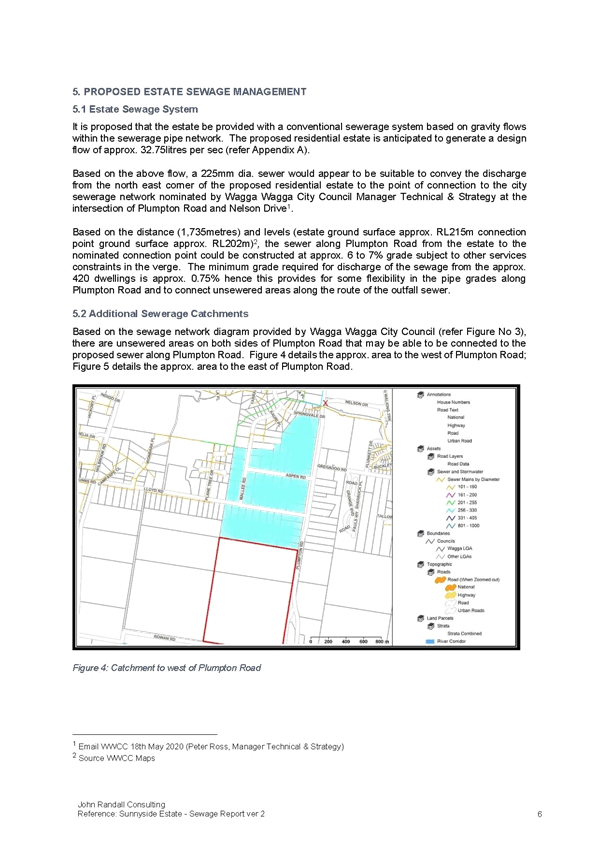
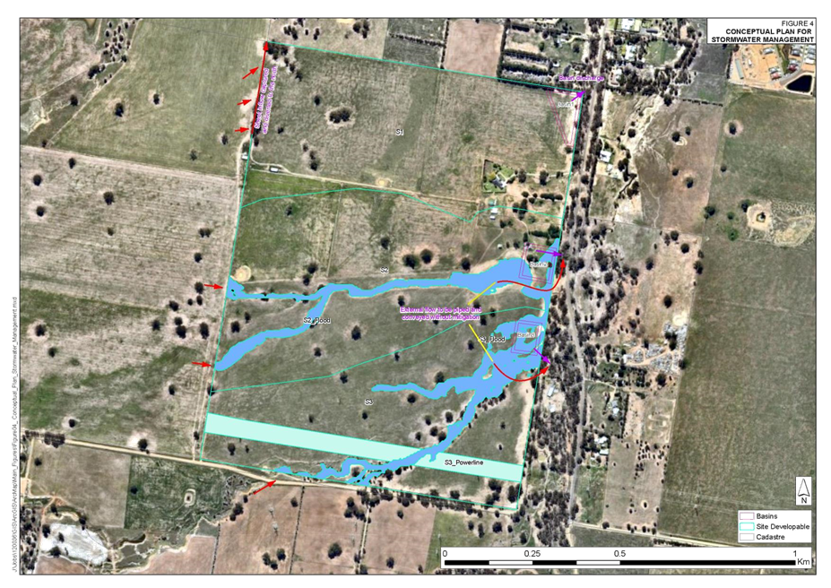
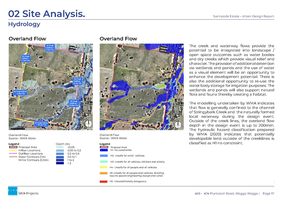
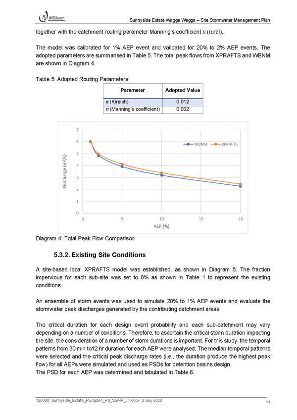
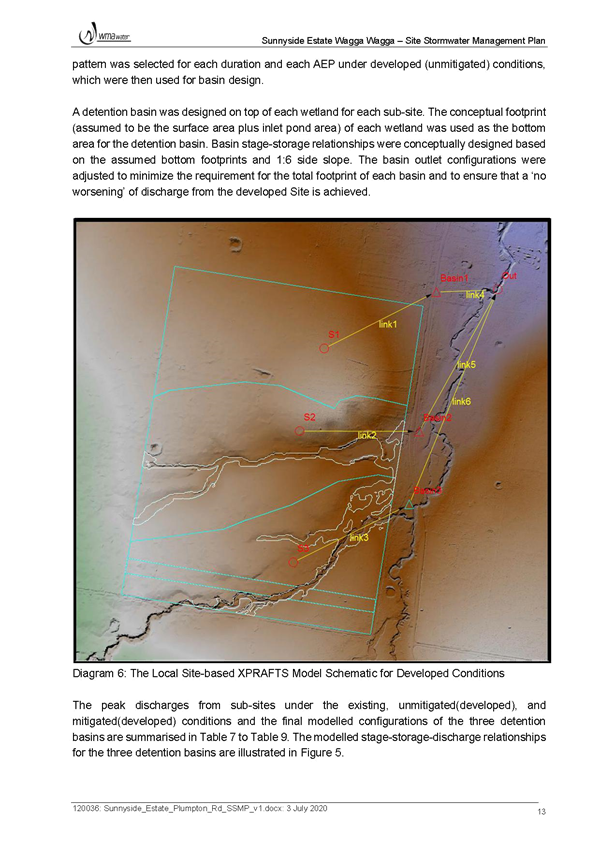
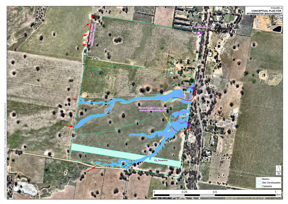
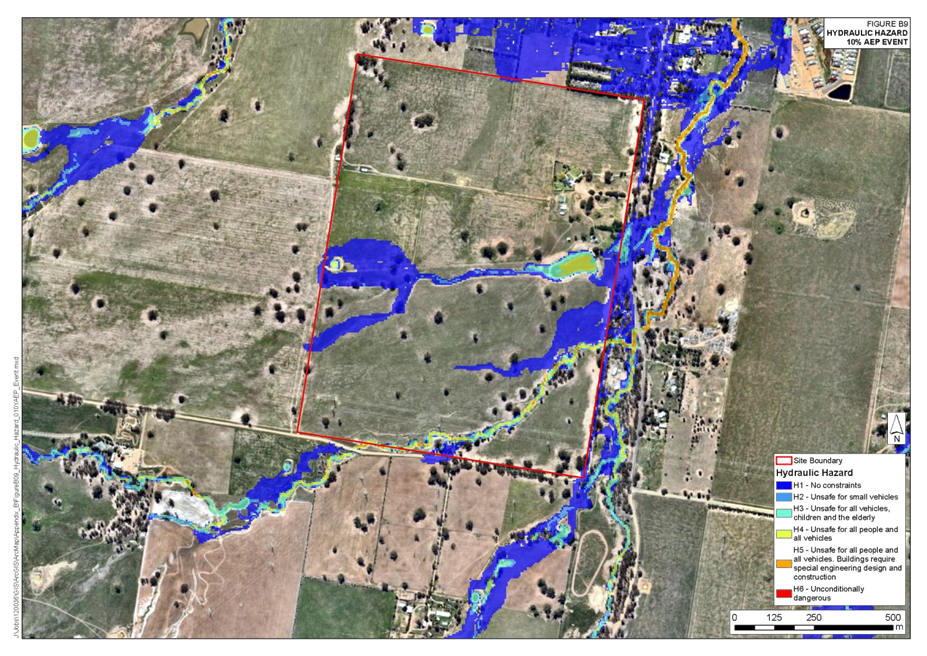
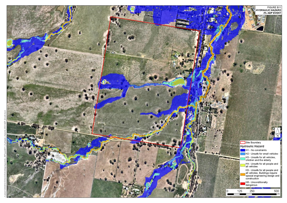
Stormwater
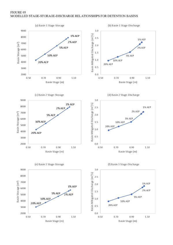
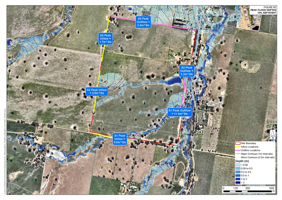
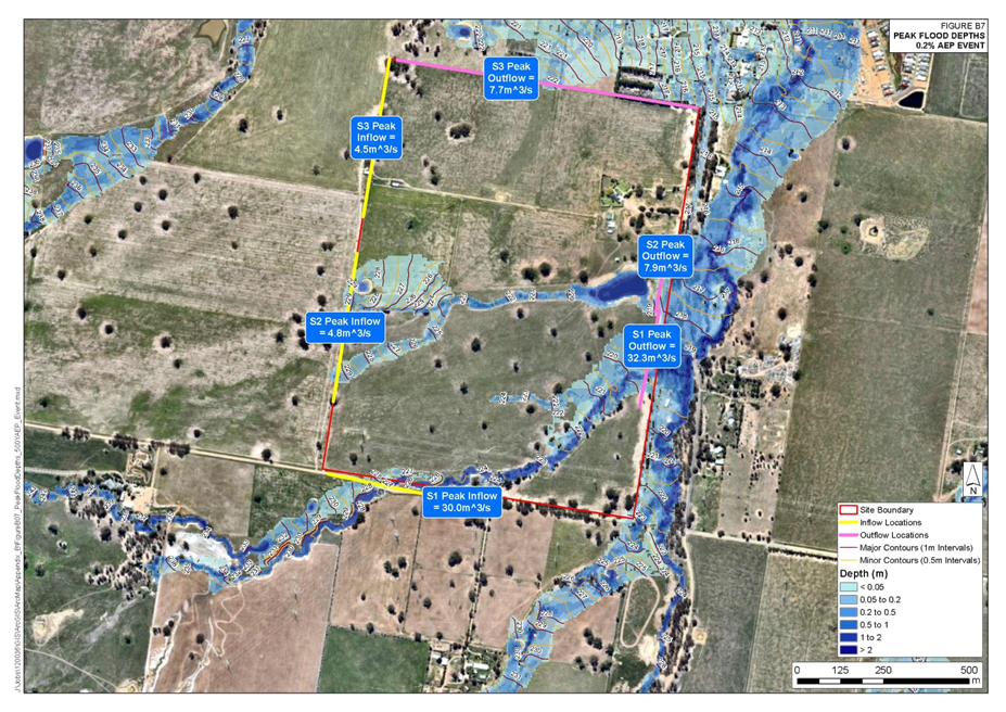
The applicant has submitted two stormwater reports, one covering the subject site and the other covering the broader precinct. The estate report focuses on a strategy for the management of stormwater based on an initial concept layout. The proponent indicates these are best practice principles and techniques that are consistent with stormwater management requirements within Council’s Development Control Plan and Engineering Guidelines. The report demonstrates there are acceptable solutions to manage stormwater.
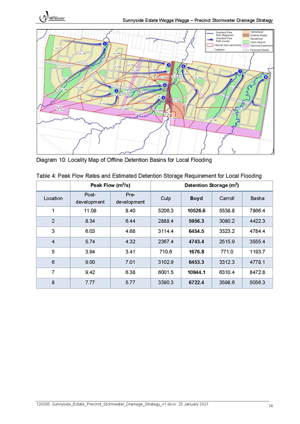
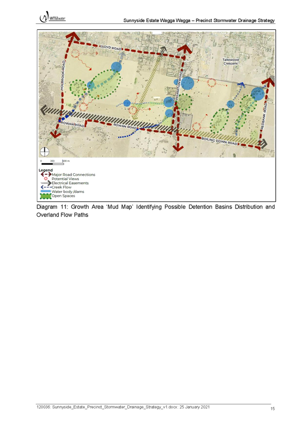
The precinct report looks at the broader precinct to determine the requirements and impacts if the broader precinct was to be developed at a similar scale to the subject site. The report indicates offline detention basins can provide required detention to achieve ‘no worsening’ stormwater objectives.
The plans are conceptual only and will need to be further tested at design stage as part of any future development application.
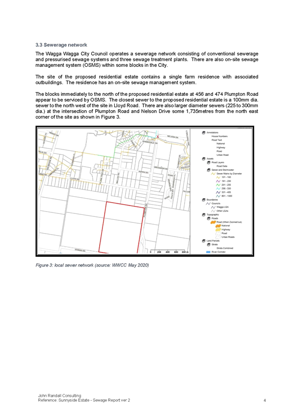
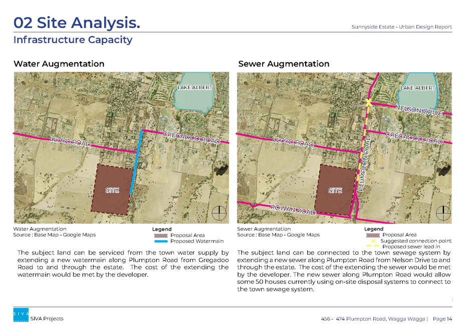
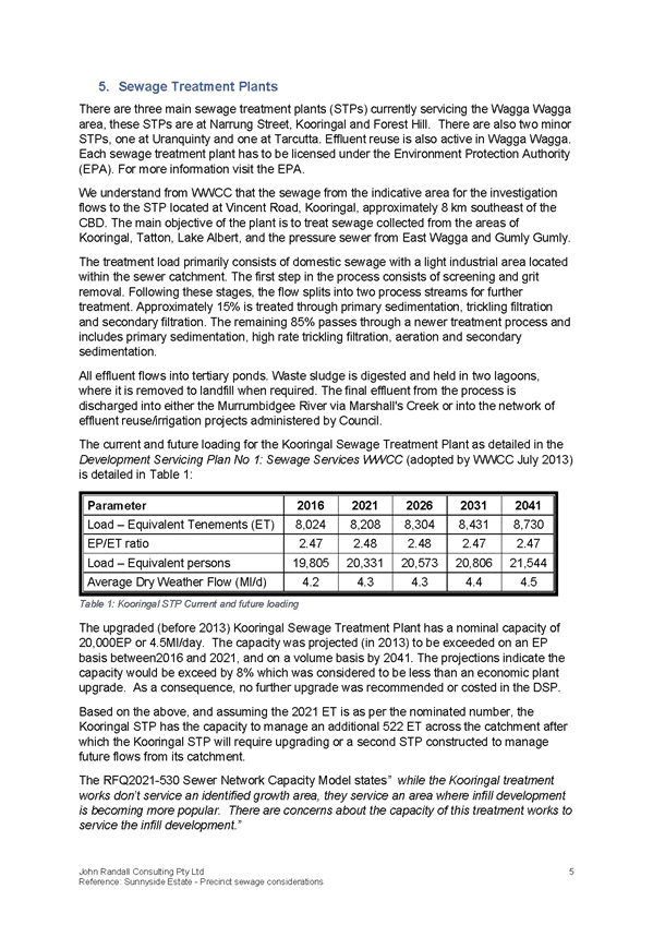
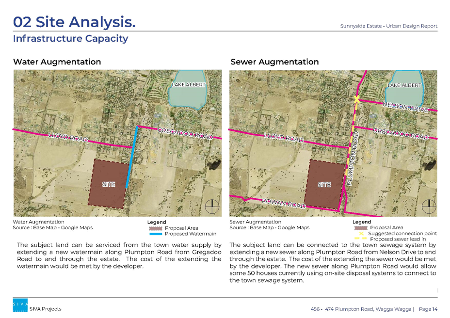
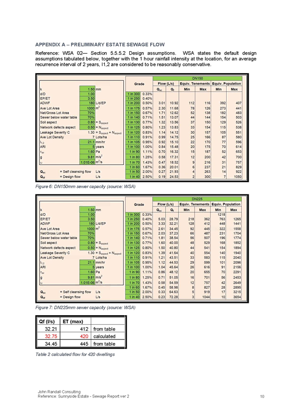
Sewer
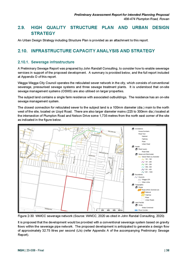
The LSPS requires infrastructure provision and capacity to be managed on a broader precinct wide scale rather than assessing site-specific Planning Proposals.
The applicant has submitted a Precinct Considerations Sewerage Plan. The following comments are provided in the context of the broader catchment:
· The Kooringal Sewer Treatment Plan (STP) and Kooringal Sewer Pumping Station (SPS) have limited spare capacity (approximately 400 to 500 ET).
· If only the Sunnyside Estate was to be developed (staged delivery over approximately 8-10 years), the full development would absorb all existing capacity in the Kooringal SPS.
· If development was to only be intensified within the “existing development” catchment area, being the existing R5 Large Lot Residential land to the north, the Kooringal SPS would still require upgrading, although not immediately.
· Irrespective of development as presented under the Planning Proposal, the sewerage connection north of Plumpton Road and Nelson Drive would require upgrading.
· Given the demand for housing within the Wagga Wagga LGA, any required sewerage upgrades to service the Sunnyside Estate should be considered on a Precinct wide scale. This would likely require:
o Upgrading the Kooringal Sewer Pumping Station
o Upgrading and augmentation of the sewer pipe north of the intersection of Plumpton Road and Nelson Road
o A new sewer connection from the site, connecting into the existing network at Plumpton Road and Nelson Road. This would require a 375mm dia. sewerage pipe (note: this is greater than the 225mm diameter required if only the site was to be developed).
Subject to infrastructure upgrades to the pipe network and the SPS, the site can connect into and be serviced by Council’s sewer network.
Council has engaged a consultant to undertake modelling of the sewer network. As the subject site falls outside of the area included to be modelled, the proponent is proposing to engage the same consultant to extend the modelling to include the subject site. The modelling extension will be done in consultation with Council.
Water supply
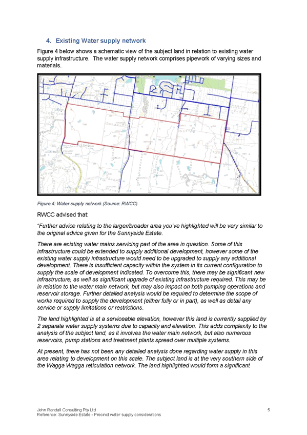
The Sunnyside Estate is currently serviced by an existing water main. The land is at an elevation that is capable of being serviced by the Riverina Water County Council (RWCC).
However, as part of the preliminary discussions, RWCC advised the Proponent that significant assessment and analysis of the capacity of the two separate water supply systems would need to occur to determine the serviceability of the land. Currently, there is insufficient capacity within the system in its current configuration to supply the scale of development presented in the Planning Proposal.
The Planning Proposal identifies that the following upgrades to the water infrastructure would need to occur and the timing and funding of the work:
· New infrastructure would be required to increase the supply capacity south of the Plumpton Rd and Gregadoo Rd intersection.
· Upgrades to water main network
· Upgrades to water pump stations
· Increase in reservoir storage capacity.
Given there is insufficient capacity for the development of the subject site, capacity would also be limited if a similar scale of development was to be undertaken within the broader precinct.
The Planning Proposal states that further analysis would be required to determine the exact scope (and associated cost) of works required, including any potential impacts on supply to surrounding areas.
The proponent relies on the application of the Urban Release Area overlay and clause 6.2 of the LEP to enable the rezoning of the land, acknowledging that development would not occur until satisfactory infrastructure arrangements have been agreed.
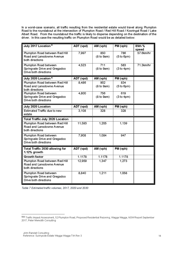
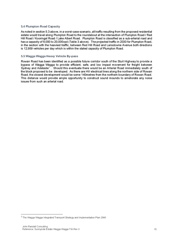
Traffic
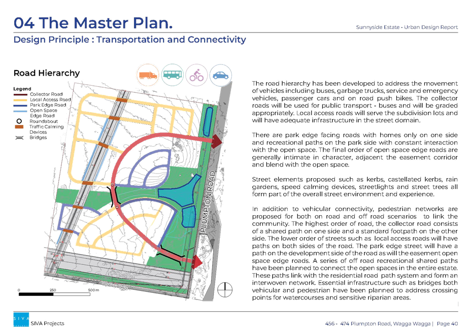
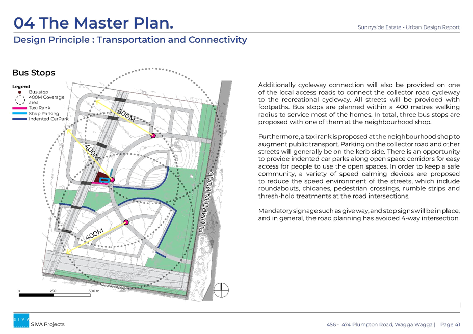
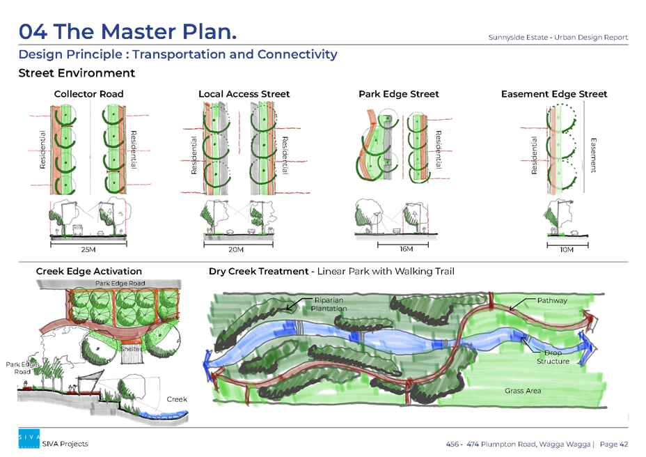
The site has frontage to Plumpton Road in the east and Rowan Road in the south. As Rowan Road is an unsealed rural road, currently not designed for urban traffic, the Planning Proposal relies on future connections to Plumpton Road.
Two traffic reports were provided with the proposal, one a Preliminary Traffic Assessment Report and the other a Traffic Considerations for Indicative Area for the Investigation.
Insufficient information has been submitted to adequately assess the impacts of the proposed traffic on the road network, including the road infrastructure upgrades required to support the future development of the site. The proponent indicates that these reports provide a reasonable assessment of the likely impact of the proposed traffic from the subject site on the network. Council provided the proponent with traffic volumes for several key roads and these were used to identify indicative traffic impacts.
The traffic assessment will be refined as part of a future development application.
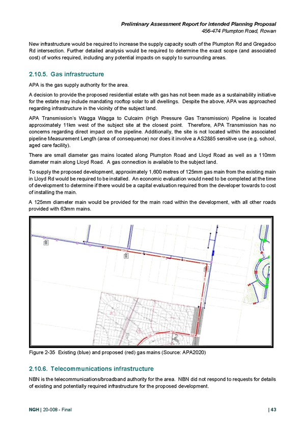
Utilities
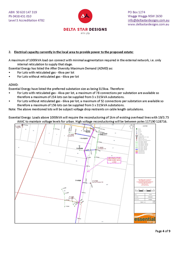
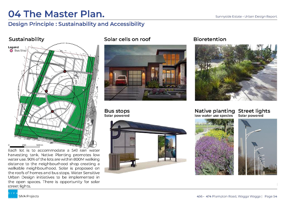
Other infrastructure networks and services, including electricity, public transport, waste management/recycling, health, education, emergency, mail, and other community services are established in the local area and accessible to the subject site. The applicant may elect not to implement gas infrastructure as part of sustainability measures; however connection of the site is possible if required.
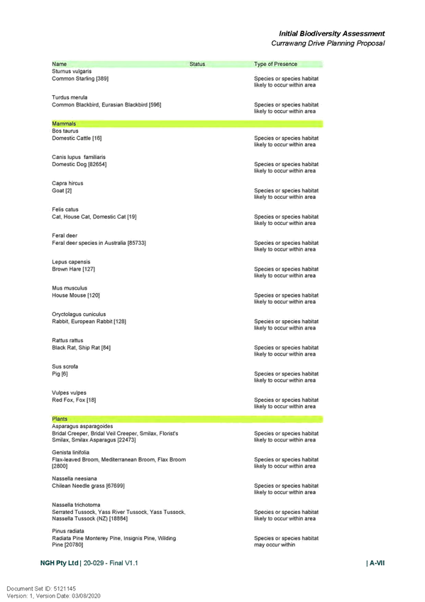
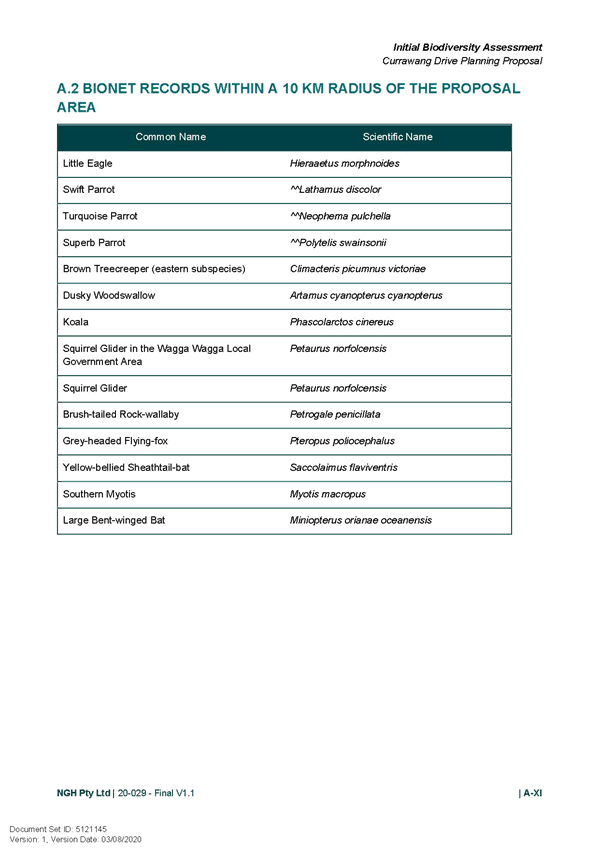
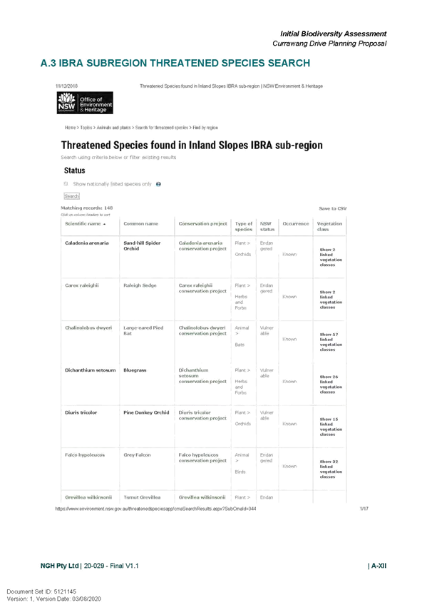
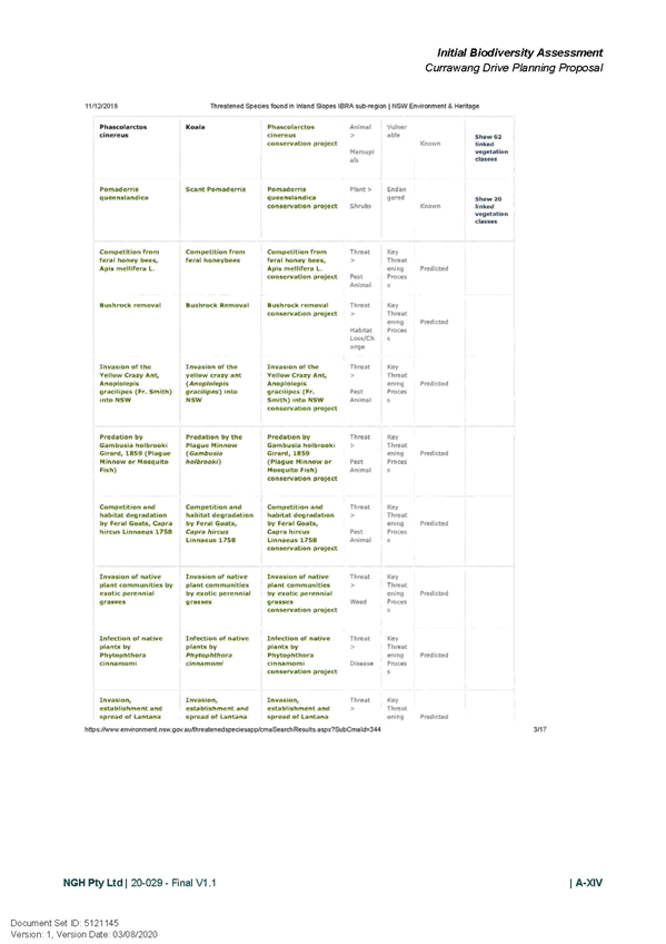
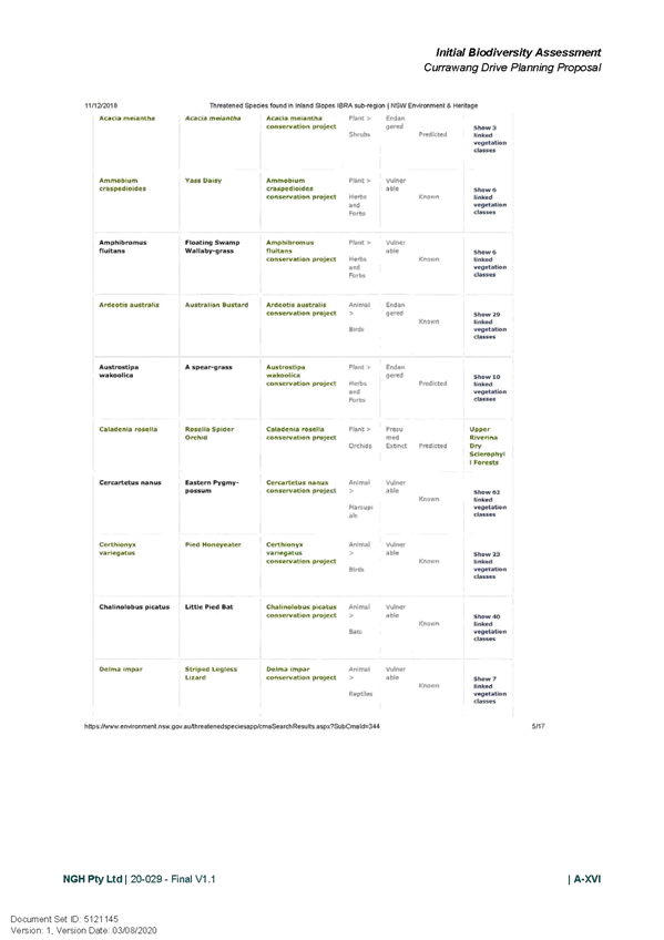
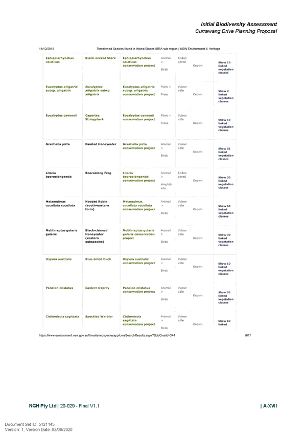
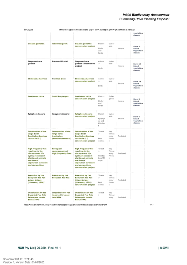
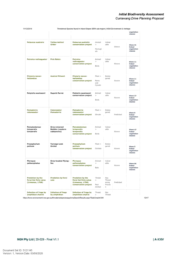
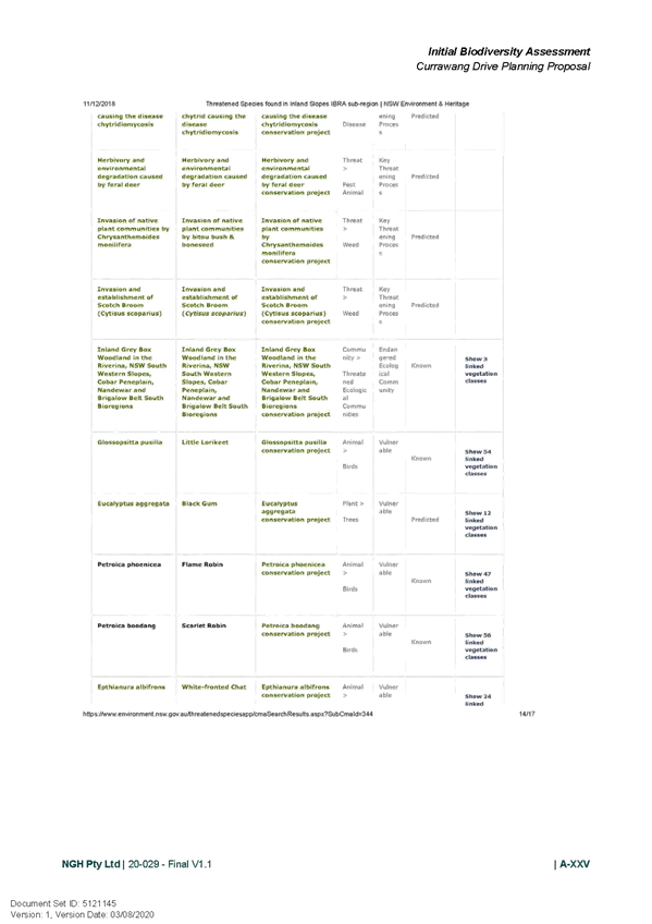
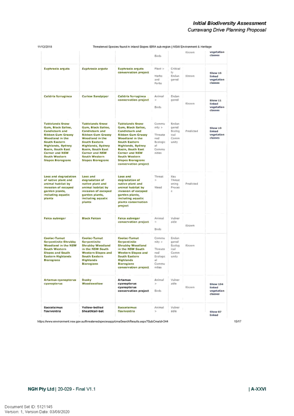
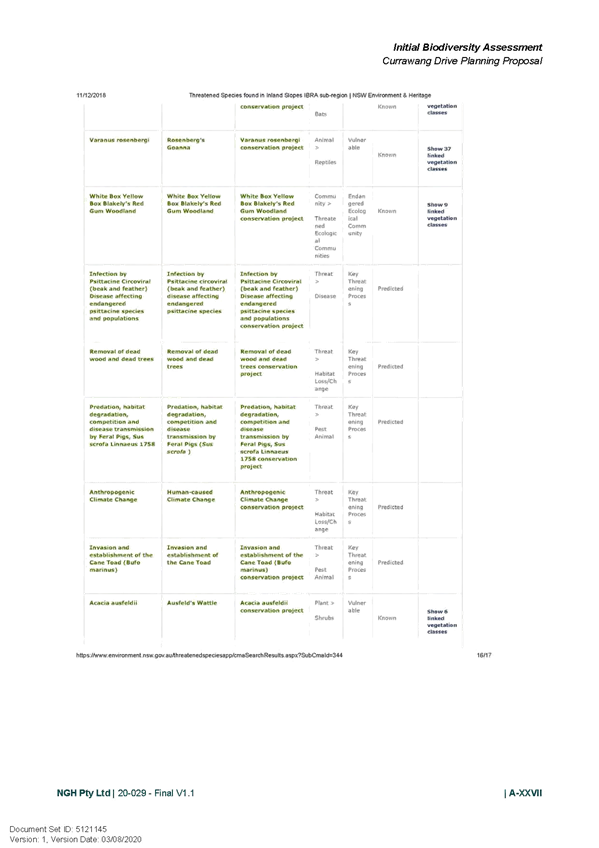
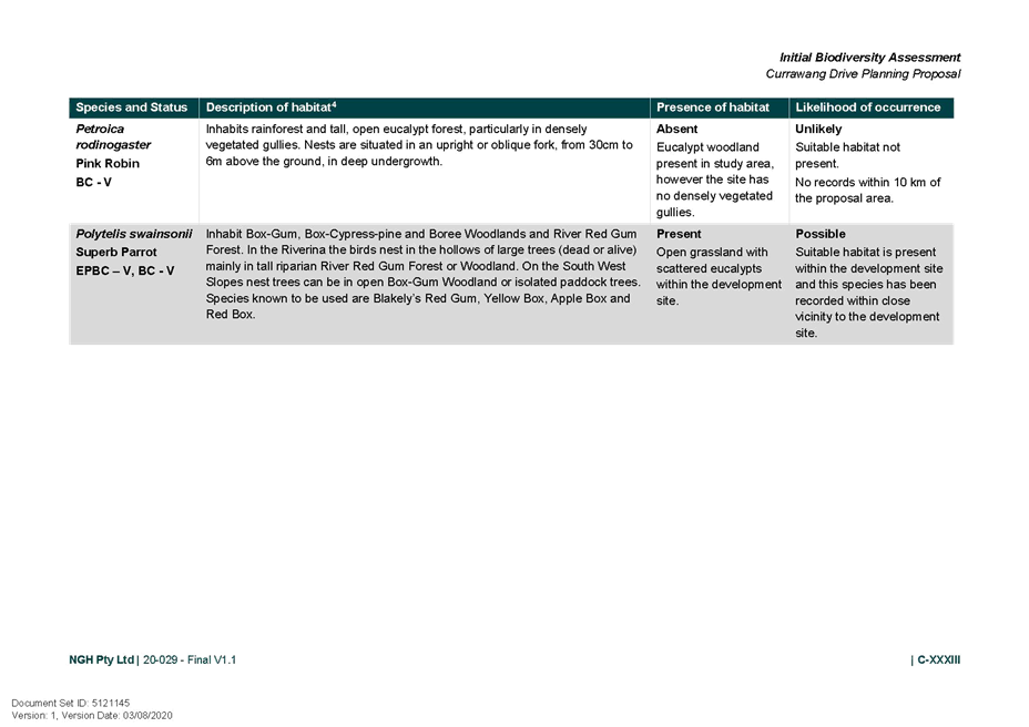
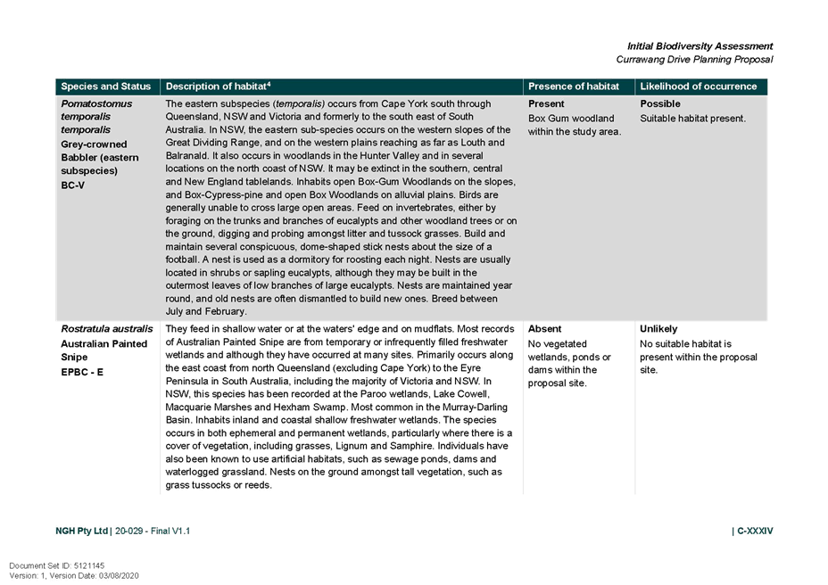
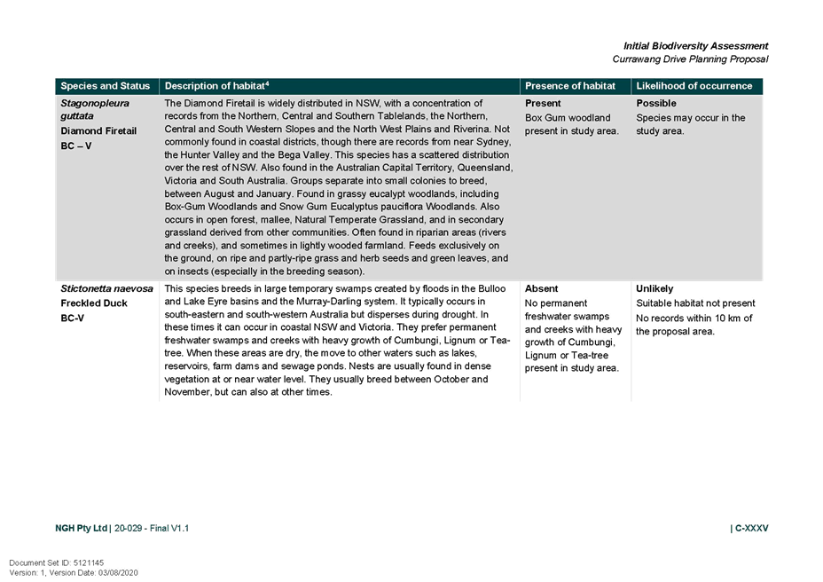
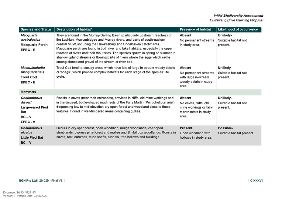
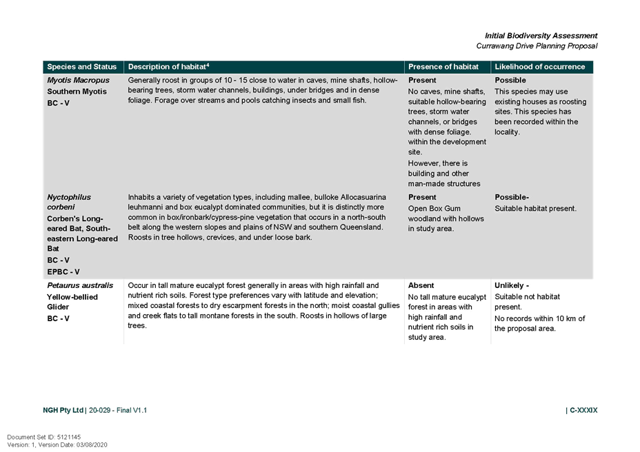
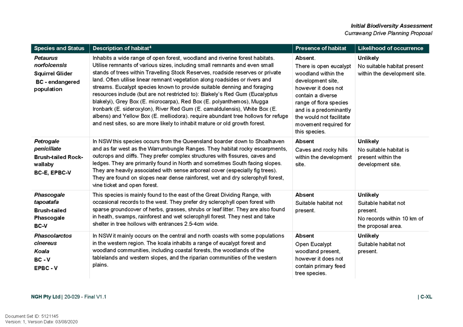
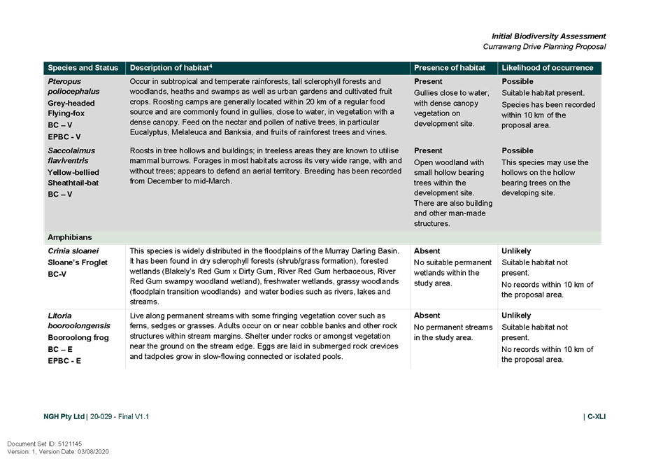
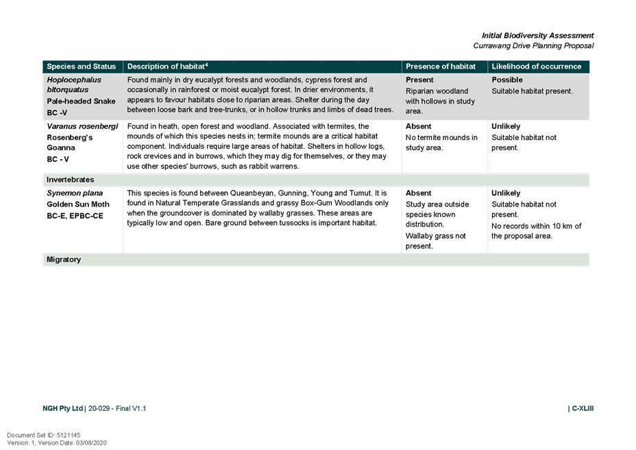
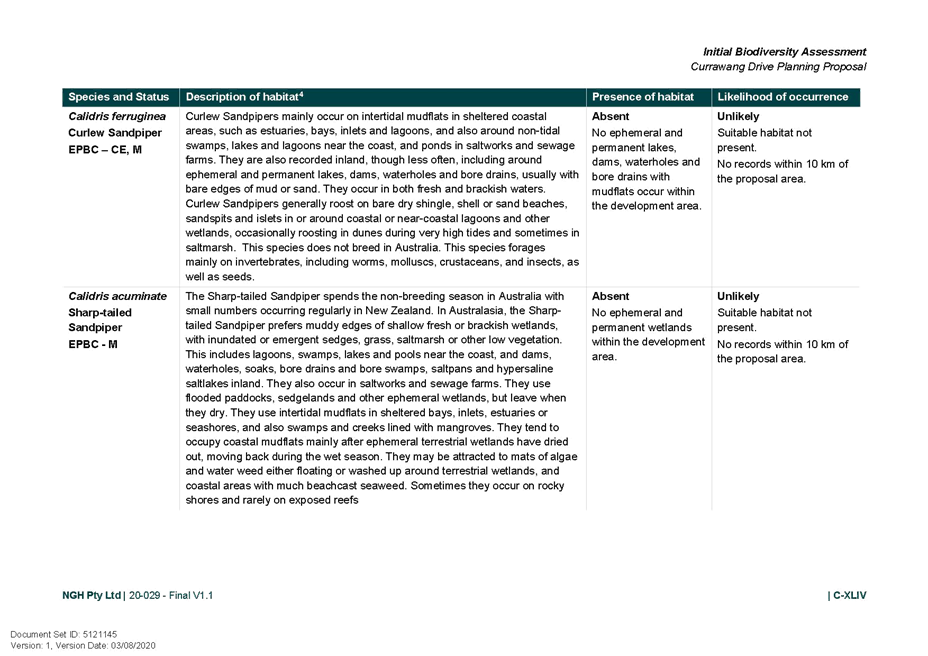
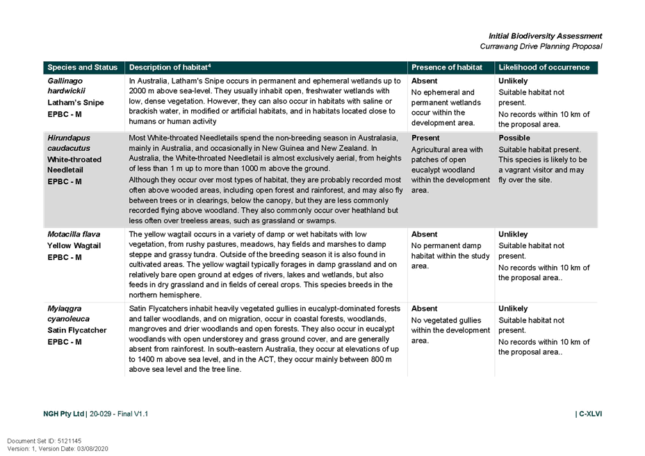
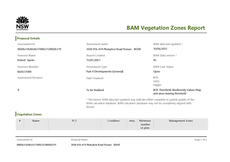
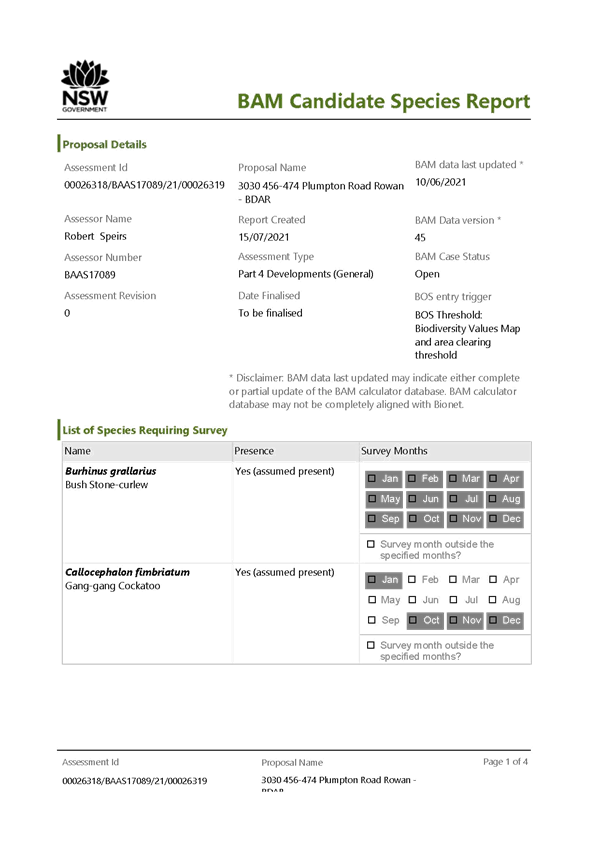
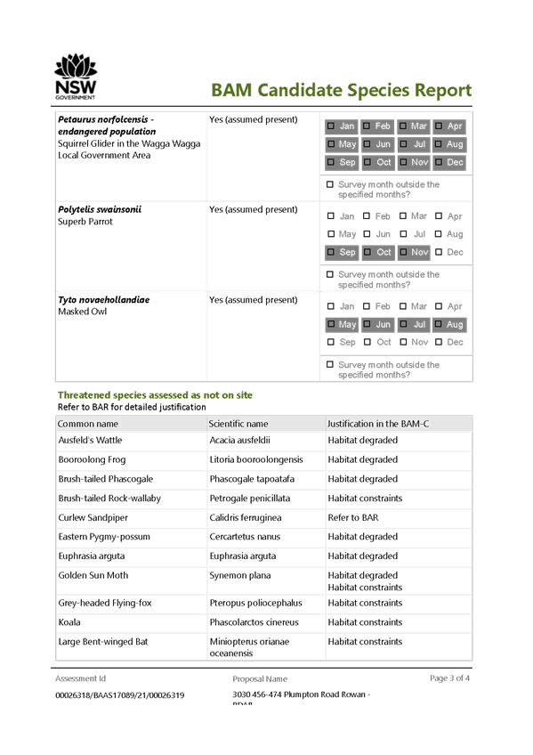
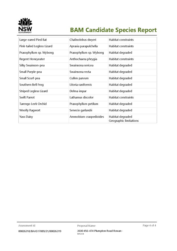
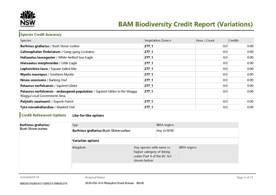
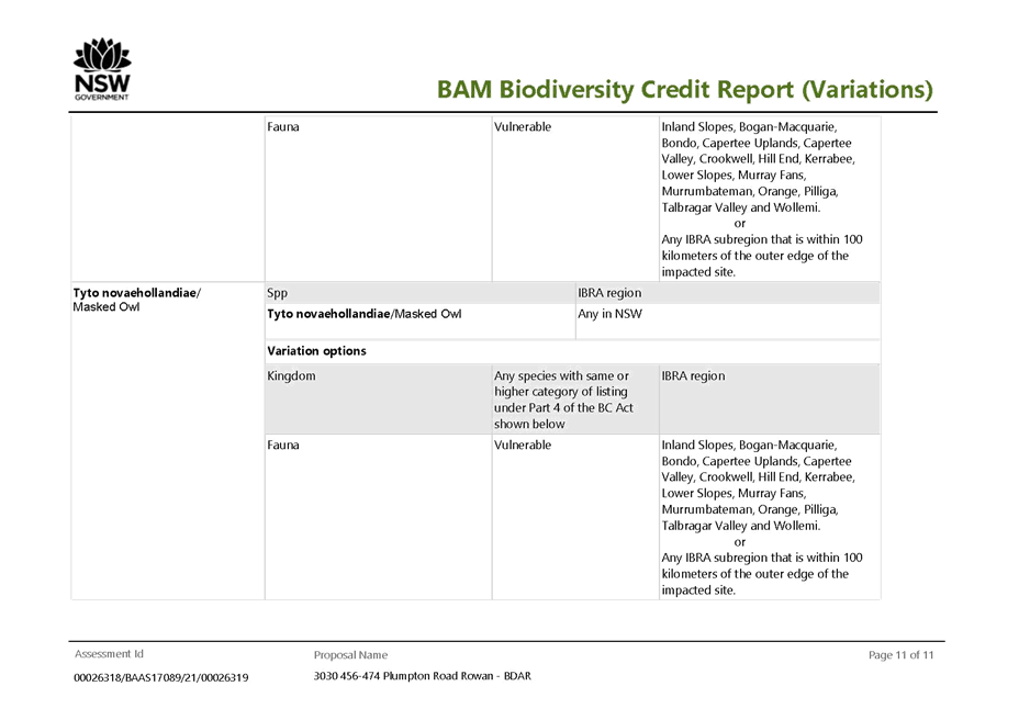
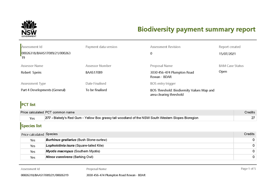
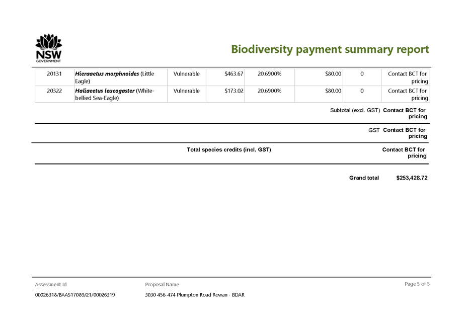
3. Biodiversity
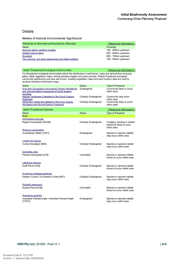
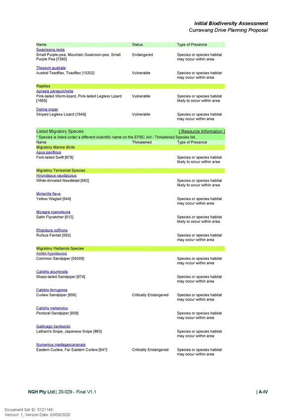
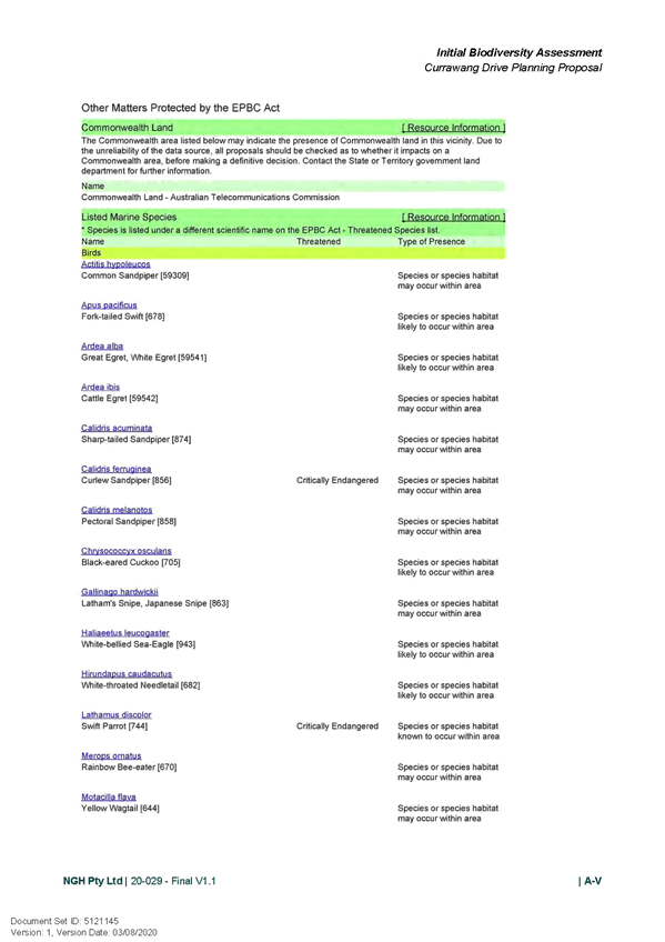
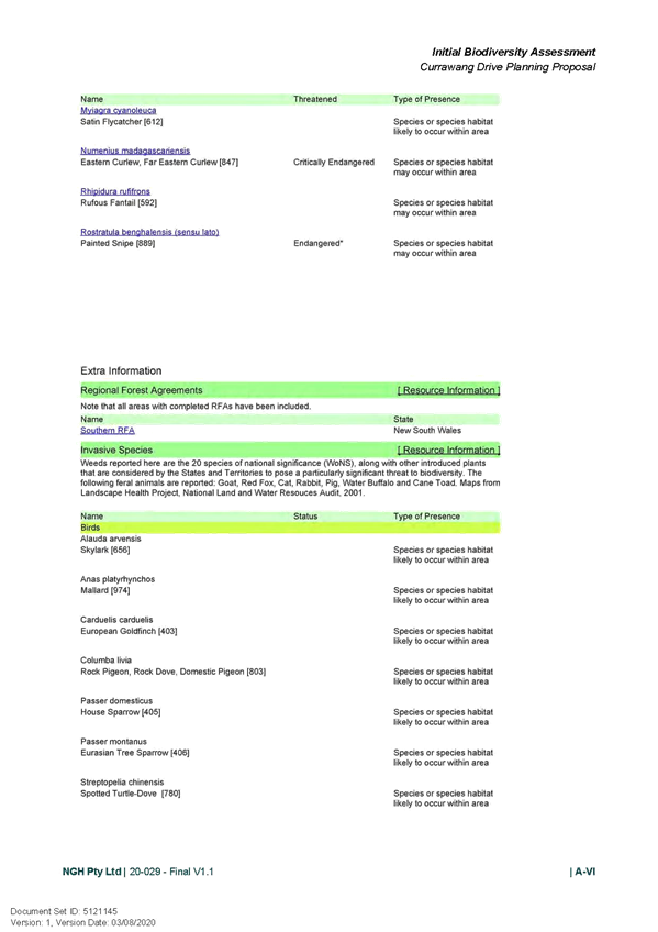
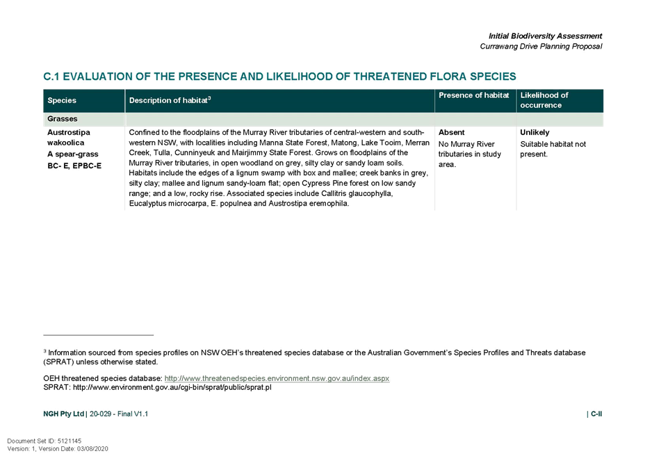
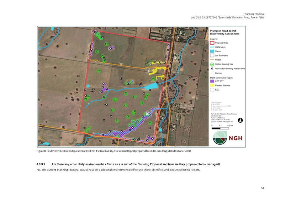
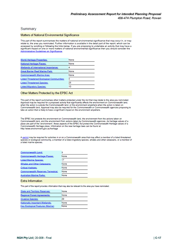
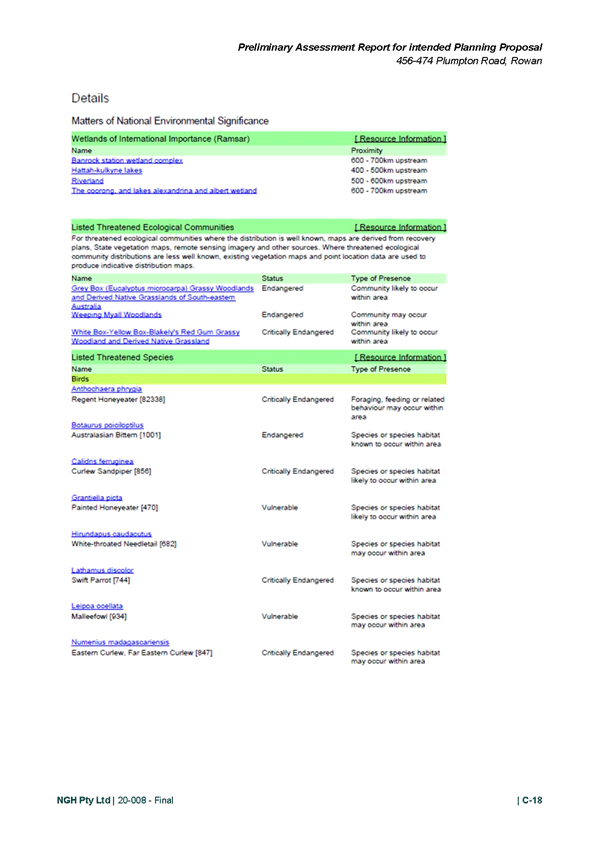
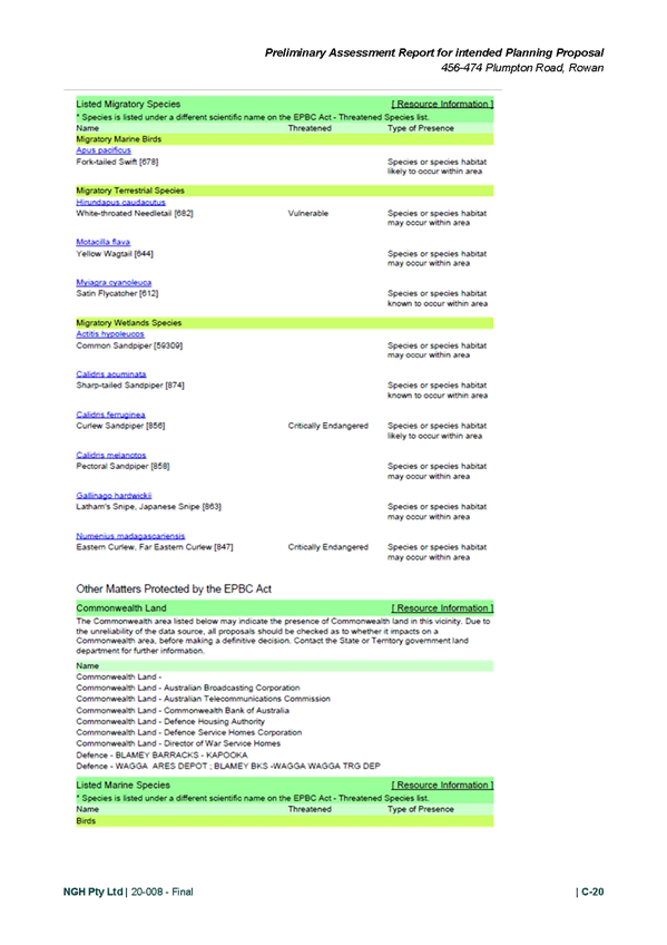
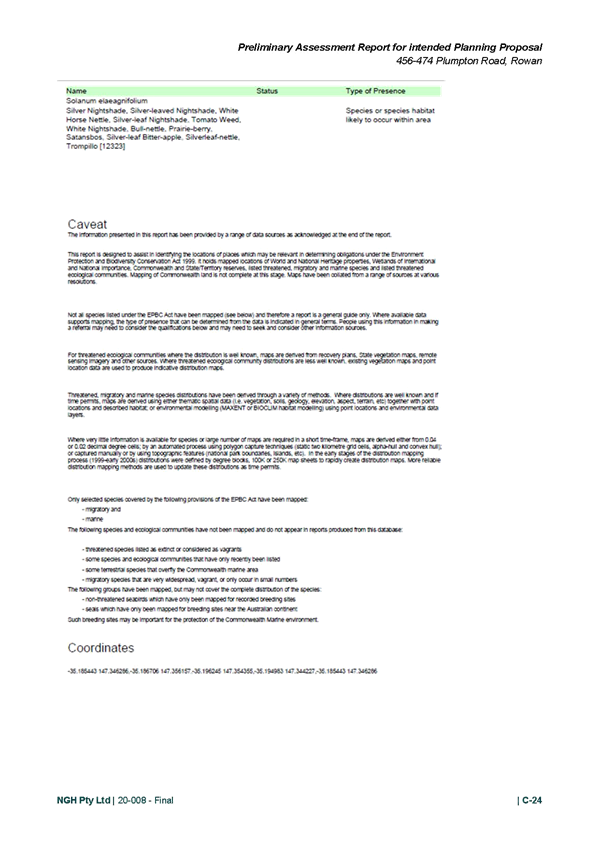
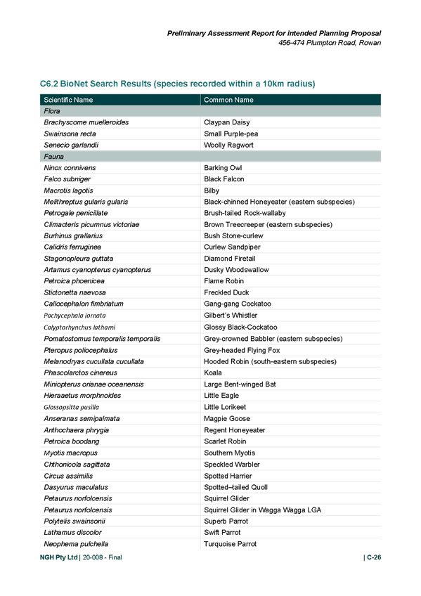
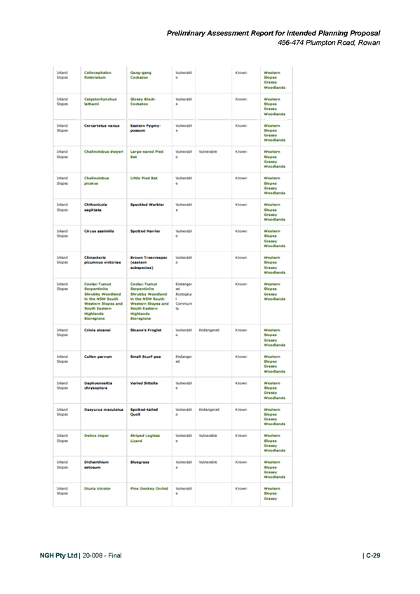
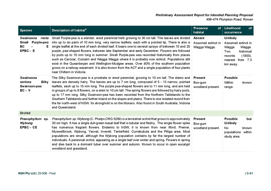
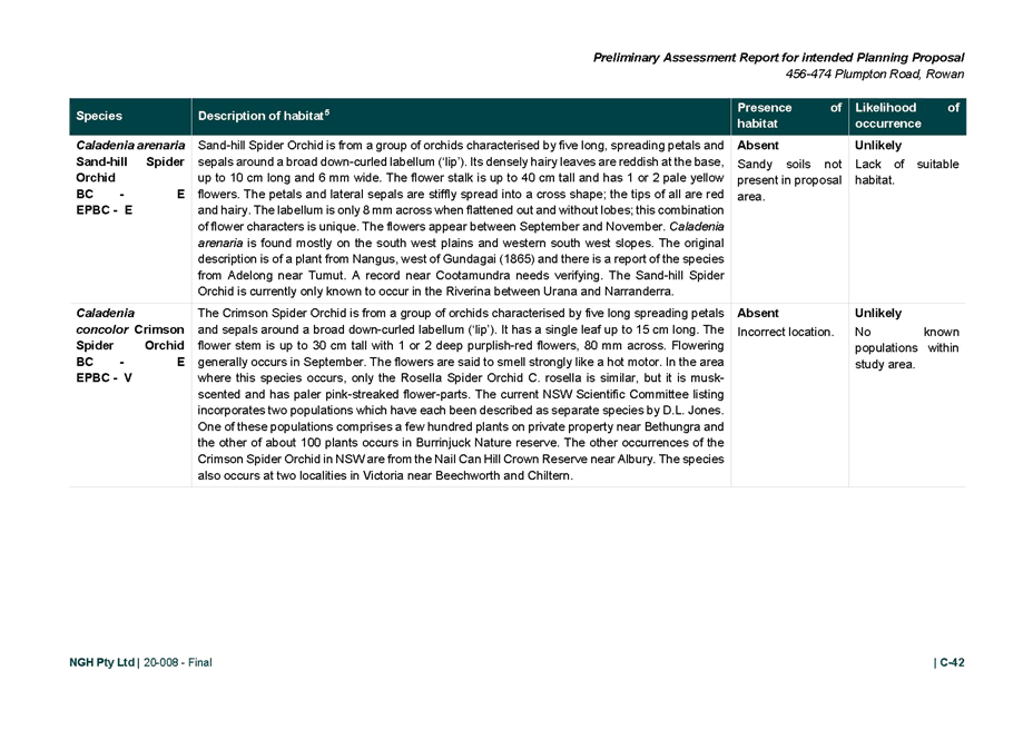
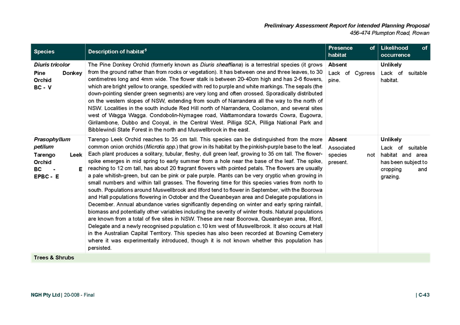
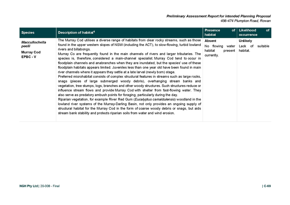
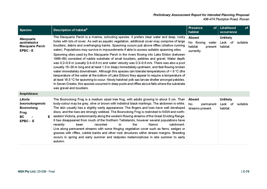
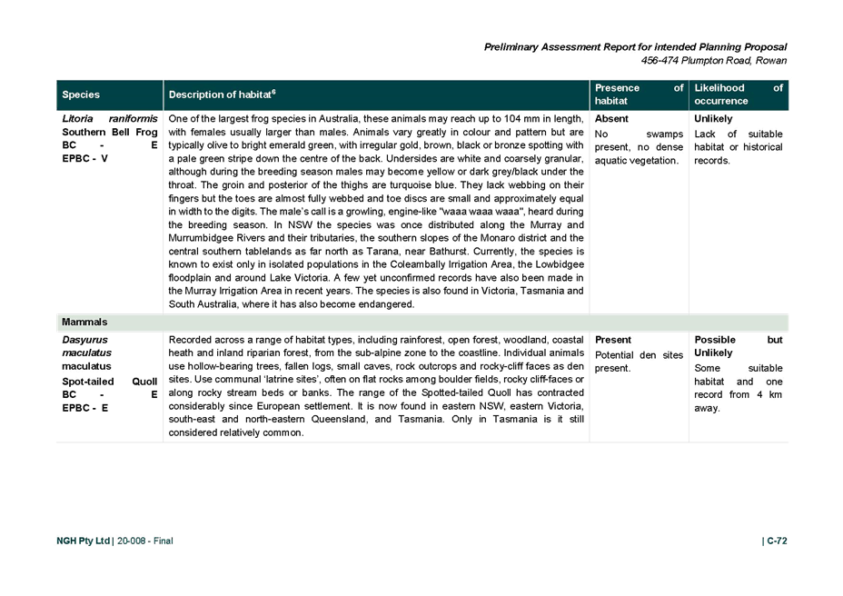
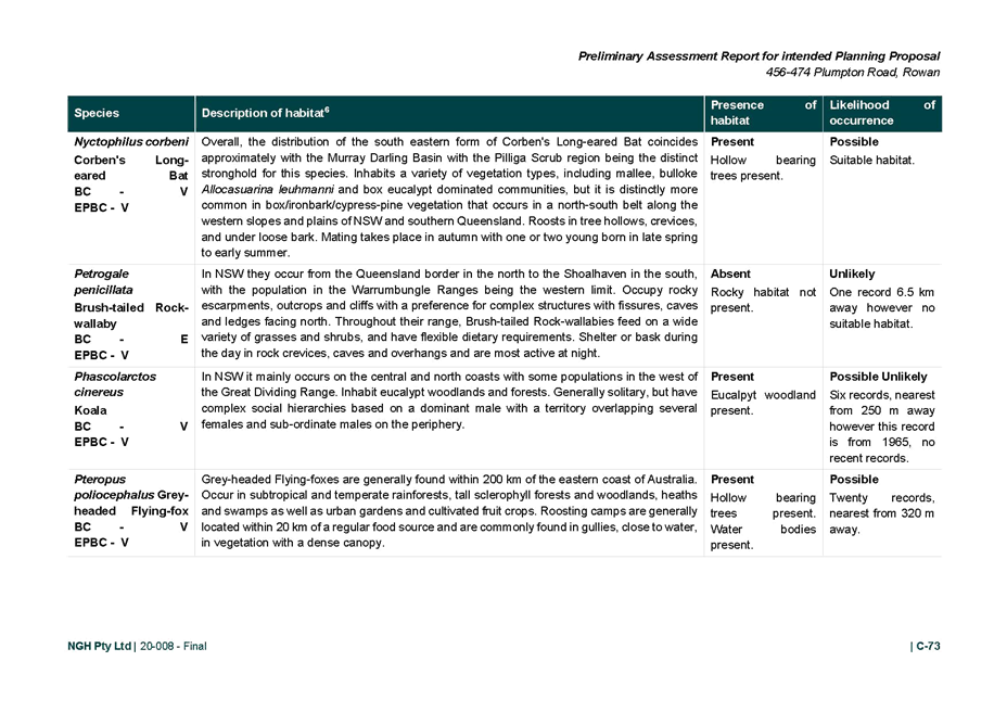
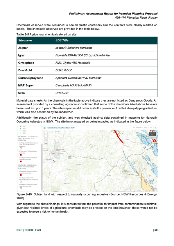
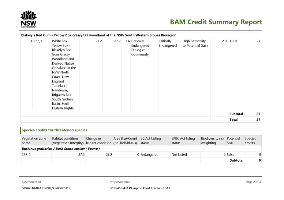
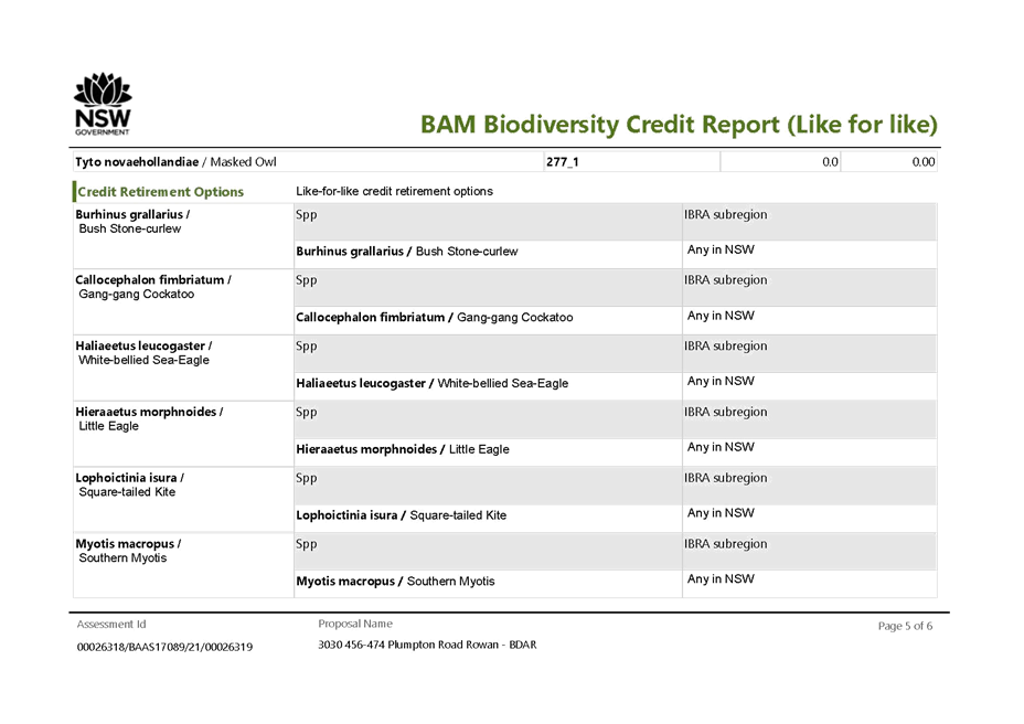
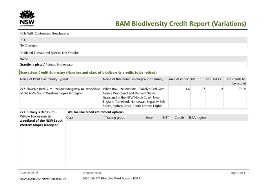
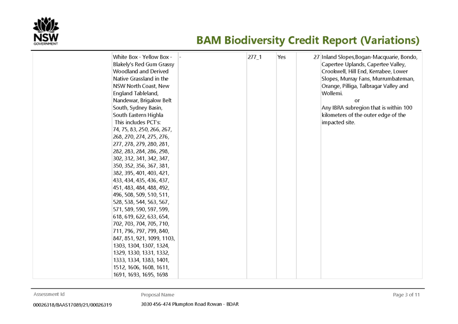
The Planning Proposal was accompanied by a preliminary Biodiversity Assessment and on request, a draft Biodiversity Development Assessment Report (BDAR) has been provided. The draft BDAR presents the results of the NSW Biodiversity Assessment Method 2020 (BAM) to assess the significance of the impacts on biota listed as threatened under the NSW Biodiversity Conservation Act 2016 (BC Act). It also includes assessment of potential impacts on Matters of National Environmental Significance (MNES) listed pursuant to the Commonwealth Environment Protection and Biodiversity Conservation Act 1999 (EPBC Act).
From the draft BDAR the following conclusions were made:
· The subject land was assessed as supporting 9.11 hectares of Biodiversity Conservation Act Box-Gum Woodland in highly modified condition. Of that, the proposed rezoning will impact 17% (1.56 hectares).
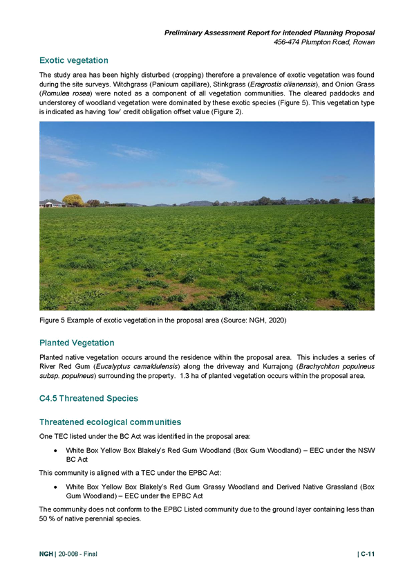
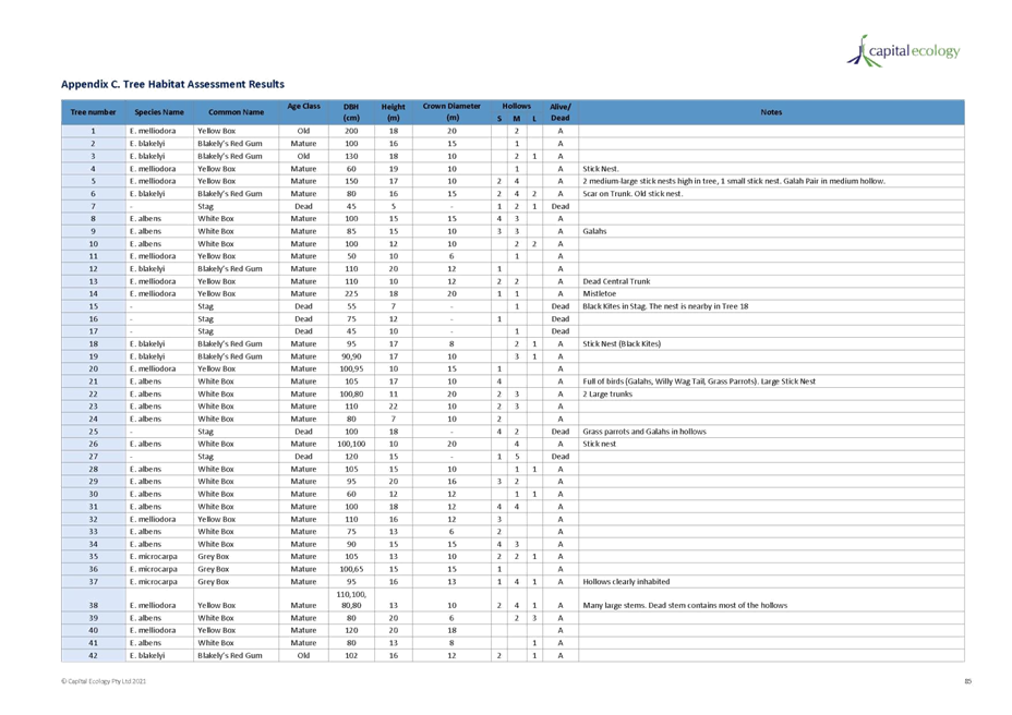
· The threatened flora credit species flagged by the (BAM) are considered unlikely to occur on the subject land given that the ground-storey and shrub-storey vegetation across the entire subject site is moderately to highly disturbed, shows signs of historic cultivation and/or pasture improvement, supports a variety of weeds, has been heavily grazed, and is currently moderately to heavily grazed by stock and Eastern Grey Kangaroos.
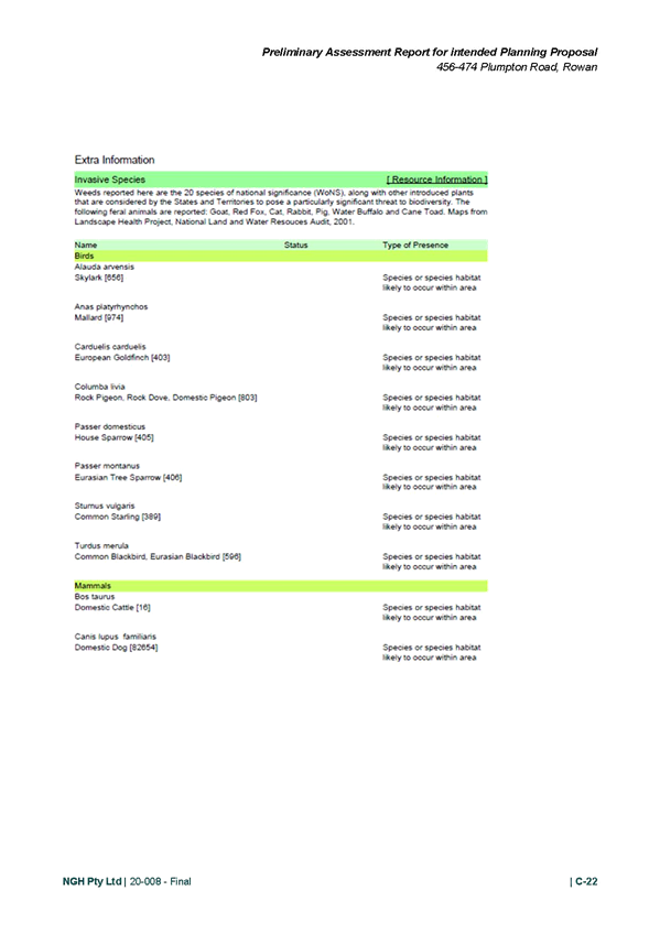
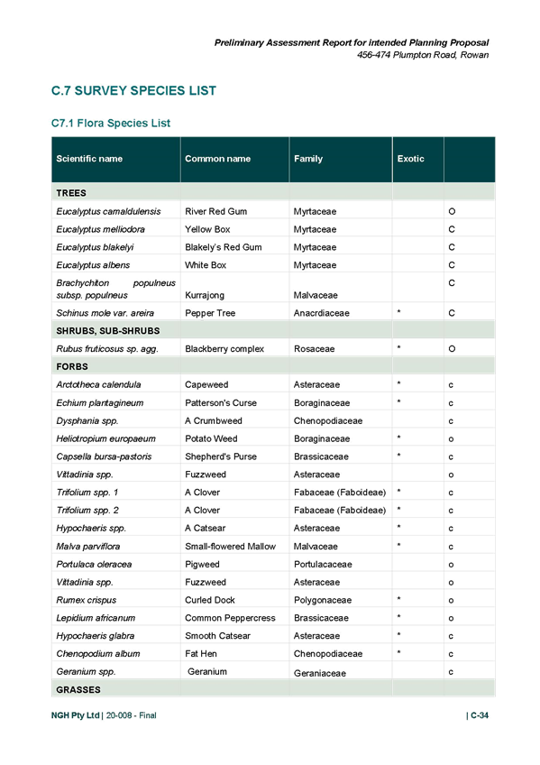
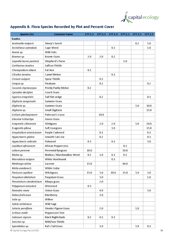
· A total of 72 flora species were recorded during field surveys, comprising 27 native species and 45 exotic species. None of the EPBC or BC Act threatened flora credit species identified in the draft BDAR were recorded on the subject land or are likely to occur.
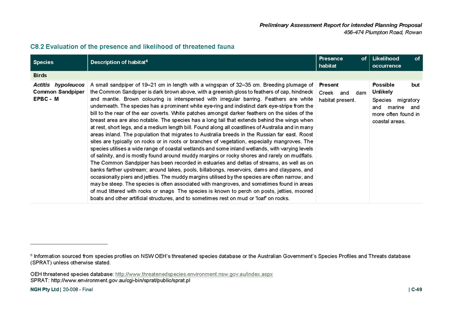
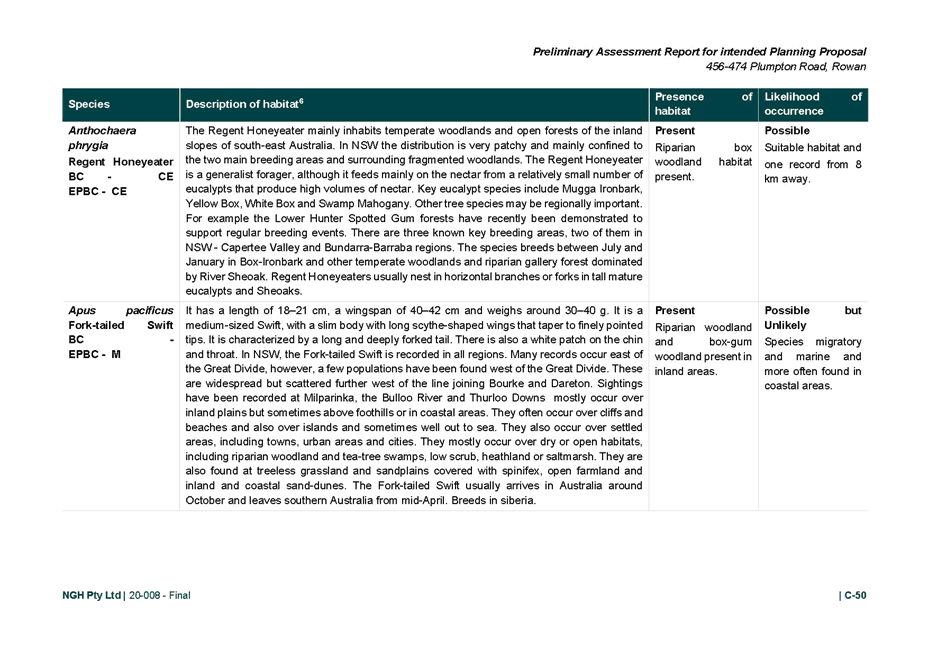
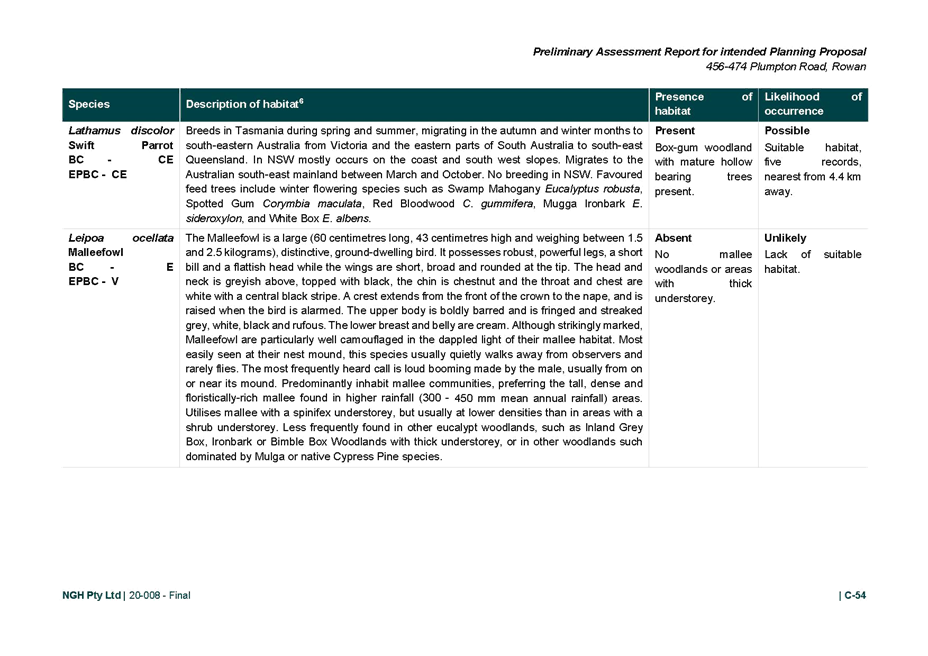
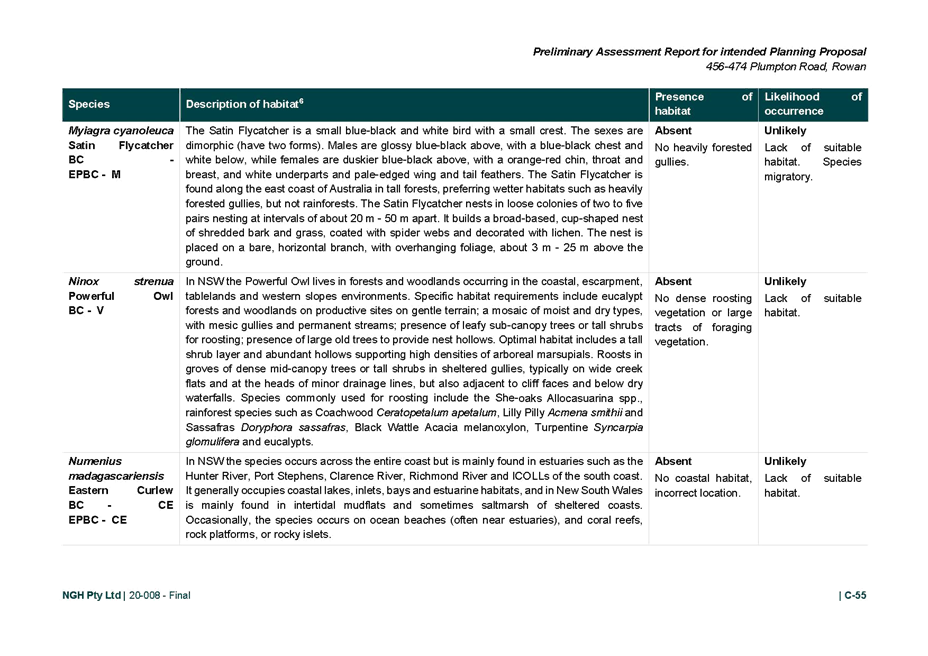
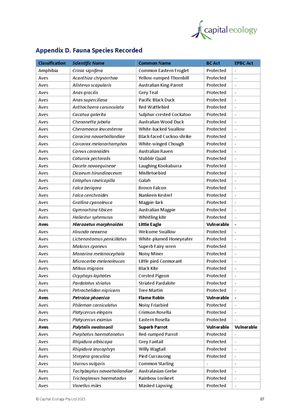
· A total of 44 native fauna species were recorded during field surveys, comprising 42 bird species, one amphibian species, and one mammal species. Two exotic fauna species were recorded, comprising on bird and one mammal.
· One ecosystem credit species have been considered in the draft BDAR. Due to seasonal constraints, targeted surveys to confirm the presence/absence for the relevant credit species were not possible for the draft BDAR. Targeted surveys will be undertaken in October / November.
· The proposed rezoning / development enacts a number of principles to avoid and minimise the impacts to Box-Gum Woodland.
· Potential indirect impacts, including indirect impacts to Box-Gum Woodland, will be minimised and mitigated by a number of techniques.
· The rezoning / development will generate ecosystem credit obligations.
· The subject site is considered unlikely to constitute important or occupied koala habitat now or in the future.
The final BDAR will be completed prior to the planning proposal being finalised.
4. Planning Agreement
The Planning Proposal Report identifies a variety of development contributions that could be considered by the Proponent to provide for a range of infrastructure to meet the needs of the future population.
To better understand the public benefits associated with the Planning Proposal, beyond the development requirements necessary to support the development of the site, a formal public benefit offer should be submitted which clearly outlines what monetary contributions and / or works in kind the Proponent is proposing and at what stage of the development these contributions or works would occur.
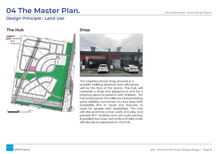
6. Local Centre
The master plan indicates the intention for a local centre to be established. A B2 Local Centre zone provides a range of retail, business, entertainment, and community uses that serve the needs of people who live, work in and visit the local areas.
A local centre zone will be the only way to achieve the intended local centre and the land zoning should reflect the intent of the master plan. The land zoning mapping will be updated in consultation with the applicant to reflect the intent of the master plan.
7. LEP Provisions
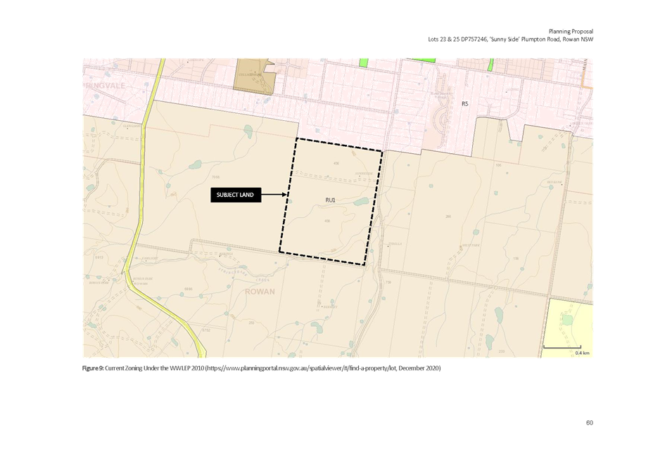
· Exiting provisions
The land is currently zoned RU1 Primary Production with a 200-hectare minimum lot size.
· Proposed provisions
The planning proposal seeks to rezone land from RU1 Primary Production to R5 Large Lot Residential and RE1 Public Recreation with a 1,000m² minimum lot size across R5 Large Lot Residential zoned land and remove the minimum lot size provisions for RE1 Public Recreation zoned land.
The planning proposal also seeks to identify the site as an Urban Release Area.
8. Development Control Plan
· Existing controls
Development of the site is subject to the rural provisions of the Wagga Wagga Development Control Plan 2010 (DCP).
· Master plan / site specific controls?
As the planning proposal intends to rezone the site to a large lot residential area, the residential provisions of the DCP would apply. Further site specific controls will be developed for exhibition alongside the planning proposal to manage relevant matters.
COMPLIANCE TEST
The following matters pursuant to the provisions of Section 3.33 of the Environmental Planning and Assessment Act 1979 and the Department of Planning, Industry and Environment’s Guide to Preparing Planning Proposal, have been taken into consideration in the assessment of the proposal.
|
Riverina Murray Regional Plan 2036 |
|
|
Direction |
Compliance |
|
Protect the region’s diverse and productive agricultural land |
The proposal is inconsistent with this direction as it proposes to rezone land from RU1 Primary Production to R5 Large Lot Residential and RE1 Public Recreation.
|
|
Protect and manage the region’s many environmental assets |
A draft Biodiversity Development Assessment Report has been prepared and will be finalised prior to the planning proposal being finalised. This will direct development away from environmental values. |
|
Align and protect utility infrastructure investment |
Transgrid easement |
|
Promote the growth of regional cities and local centres |
The planning proposal is proposing an urban release area. The area will provide approximately 490 residential lots and accommodating a population of around 15,000 people. Additional residential land will ensure the city can continue to accommodate growth and encourage future investment. |
|
Build housing capacity to meet demand. |
The proposal intends to provide approximately 490 residential lots to assist with building housing capacity. |
|
Provide greater housing choice. |
The proposal intends to increase availability of lifestyle lots on the fringe of the city. |
|
Manage rural residential development. |
The minimum lot size proposed for this area is not a size typically seen in rural residential areas and will maximise utilisation of infrastructure that will be constructed for the development. |
|
Deliver healthy built environments and improved urban design |
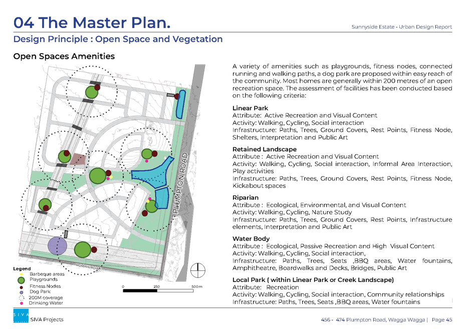
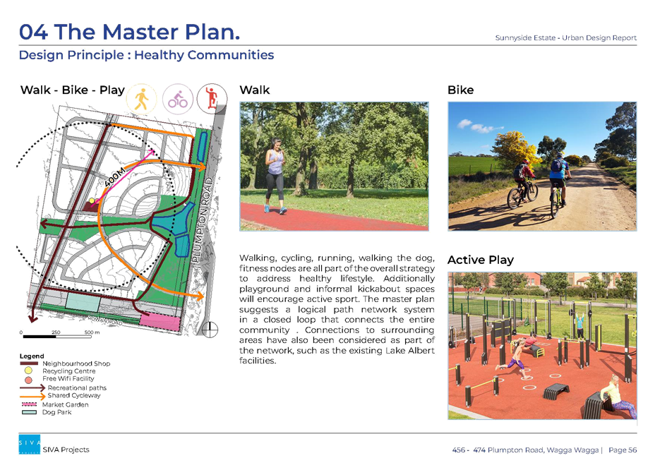
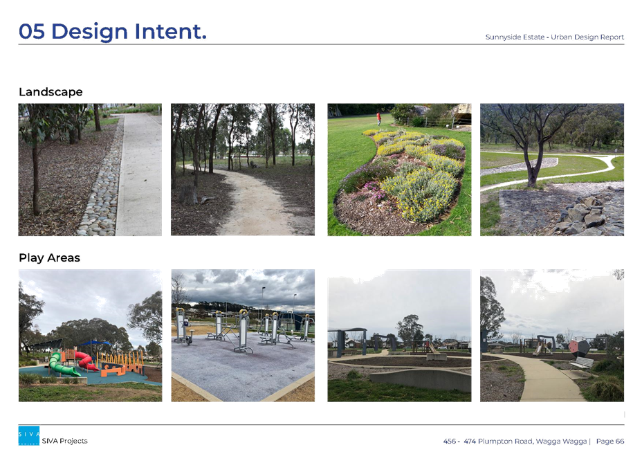
Opportunities are identified in the master plan to provide passive and active open spaces throughout the development. |
|
Wagga Wagga CSP |
|
|
Direction |
Compliance |
|
Recreation is a part of everyday life. |
The master plan identified opportunities for passive and active open space opportunities to allow recreation opportunities. |
|
We have sustainable urban development. |
The proposal is intending to introduce a smaller lot size within a large lot lifestyle area to maximise utilisation of new infrastructure required for the development. |
|
We minimise our impact on the environment. |
A biodiversity development assessment report will be finalised as part of the planning proposal process to direct development away from sensitive areas. |
|
|
|
|
Wagga Wagga Local Strategic Planning Statements |
|
|
Direction |
Compliance |
|
Principle 1 – Protect and enhance natural areas |
Complies. The proposed rezoning / development enacts several principles to avoid and minimise the impacts to Box-Gum Woodland. Potential indirect impacts, including indirect impacts to Box-Gum Woodland, will be minimised, and mitigated by several techniques. The rezoning / development will generate ecosystem credit obligations. |
|
Principle 2 – Increase resilience to natural hazards and land constraints |
Complies. The site has an overland flow path with the risk being able to be managed through subdivision design. |
|
Principle 3 – Manage growth sustainably |
Complies. The draft Biodiversity Development Assessment Report which identifies impacts on biodiversity. |
|
Principle 6 – A connected and accessible city |
Complies. Connectivity across the city supports an attractive lifestyle through reduced travel time and congestion. In the LSPS the objective is to direct greenfield development to identified growth areas integrated into transport networks and enabling infill development near key locations of the city. Whilst development in this location is not an identified greenfield development area or infill within proximity to key services, it is a direct extension of an existing large lot residential area and within a 15-minute drive of the CBD. |
|
Principle 7 – Growth is supported by sustainable infrastructure |
Complies. Development in this location, whilst requiring sewerage treatment plant and sewer pump station upgrades, it will utilise this existing infrastructure rather than requiring new. |
|
Principle 10 – Provide for a diversity of housing that meets our needs |
Complies. Large lot residential development is to be restricted to the fringe to support future investigation of expansion reliant on infrastructure capacity. The southern fringe of the city is an expansive area of large lot residential development desirable for many residents. Development of additional large lot residential lots in this location is a direct extension of an existing large lot residential precinct and will increase supply of this type of housing in a location that is not restricting future growth potential. |
|
|
|
|
Section 9.1 Ministerial Directions |
|
|
Direction |
Compliance |
|
1.2 Rural zones |
The planning proposal is inconsistent with this direction as it intends to rezone land from RU1 Primary Production to R5 Large Lot Residential and RE1 Public Recreation with a minimum lot size of 1,000m². Whilst the planning proposal is inconsistent, the land is low agricultural grade. |
|
1.5 Rural Lands |
The planning proposal is inconsistent with this direction as it intends to rezone land from RU1 Primary Production to R5 Large Lot Residential and RE1 Public Recreation. Whist the proposal is inconsistent, the land is low agricultural grade. |
|
3.1 Residential zones |
The planning proposal intends to introduce a residential urban release area with a minimum lot size of 1,000m². The planning proposal is consistent with this direction as it will apply the urban release area provisions requiring the site to be adequately serviced prior to development being approved.
|
|
3.4 Integrating Land Use and Transport |
The planning proposal is inconsistent with this direction; however, it is consistent with the Riverina Murray Regional Plan objective of increasing housing supply. The proposal identifies the need to adequately design future roads and ensure active pedestrian and cycle routes are integrated within the development. |
|
5.10 Implementation of Regional Plans |
The planning proposal is consistent with this direction as it is promoting growth and residential accommodation within Wagga Wagga. |
|
|
|
|
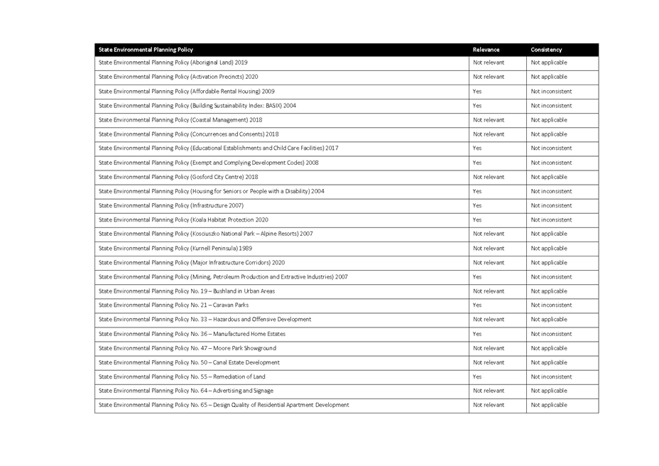
State Environmental Planning Policies |
|
|
Policy |
Compliance |
|
State Environmental Planning Policy No 55 – Remediation of Land |
The subject area is currently zoned and used for agricultural purposes. Agricultural activities have potential to cause contamination. There is no known contamination, however, if contamination is found, it can be remediated prior to development consent. Given the previous land use of the site, it is considered that the potential impacts of land contamination are low. |
|
|
|
|
Other |
|
|
Nil |
|
Internal / External Consultation
Internal: A cross-directorate internal referral occurred.
A councillor workshop is scheduled for 20 September 2021 where officers presented the planning proposal to councillors.
External: The proposal will be referred to relevant state agencies as required by the Gateway Determination.
Community consultation: Community consultation will be undertaken as required by the Gateway Determination.
FINANCIAL IMPLICATIONS
In accordance with Council’s 2020/2021 Fees and Charges, a Major LEP Amendment has a total application fee of $44,000.00. The proponent has paid these fees.
As the planning proposal intends to introduce an urban release area, funding of infrastructure is a key consideration and will require an addendum to Council’s servicing plans. Addendums to Council’s servicing plan will be exhibited alongside the planning proposal.
CONCLUSION
The planning has demonstrated strategic planning merit and is consistent with eh vision and outcomes provided in the LSPS.
The proposal is supported for the following reasons:
· It is consistent with relevant S9.1 Ministerial Directions.
· The investigation of the subject land provided with the application is enough to support the planning proposal and forward to the Department of Planning, Industry and Environment seeking Gateway Determination.
To comply with the NSW Department of Planning, Industry and Environment guidelines and to support the planning proposal, council staff will prepare an addendum to the proposal prior to submitting for Gateway Determination to address timeframes, mapping and other relevant matters relevant to the site.